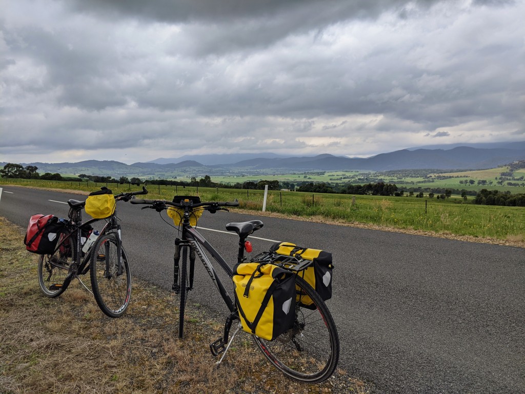
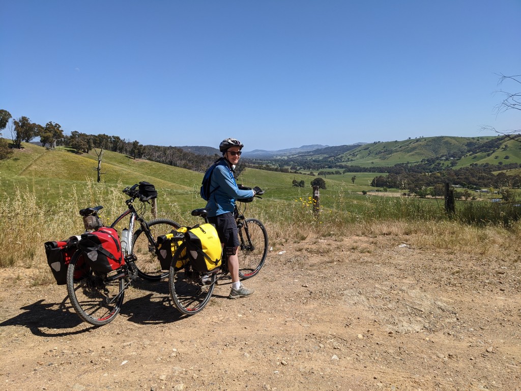
Day 1 Yackandandah to Rutherglen
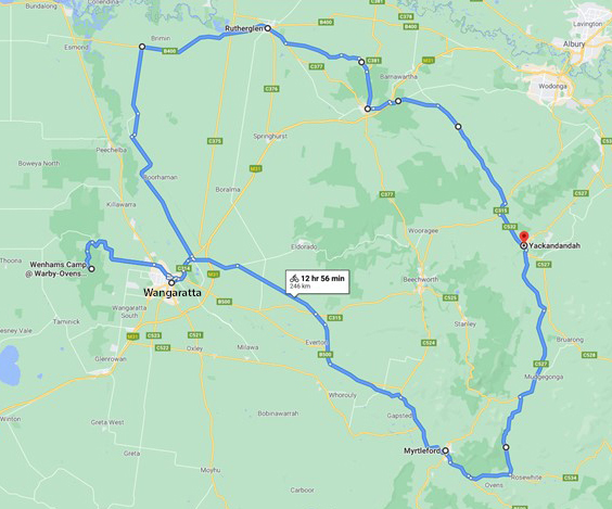
In 2019 we were cycling in Morocco, Portugal and Wales and hiking in the Pyrenees. This year, 2020, the coronavirus pandemic has kept us close to home. On Sunday 8 November, taking advantage of the freedom granted us a few weeks ago to travel anywhere in country Victoria, we rode down our driveway on a five day circuit taking in a small corner of north-east Victoria: Rutherglen, Wangaratta, the Warby Ranges and Myrtleford. Day 1 was wonderful for a number of reasons: there had been nine consecutive days of zero new cases of Covid-19 in Victoria, Joe Biden and Kamala Harris were declared the next president and vice president of the USA, it was a beautiful blue sky spring day and we felt fit enough to ride 60 kilometres beginning with a four kilometre uphill stretch out of Yackandandah. This was the busiest stretch of road for the day – by next year we should be able to ride this section on the new rail trail.
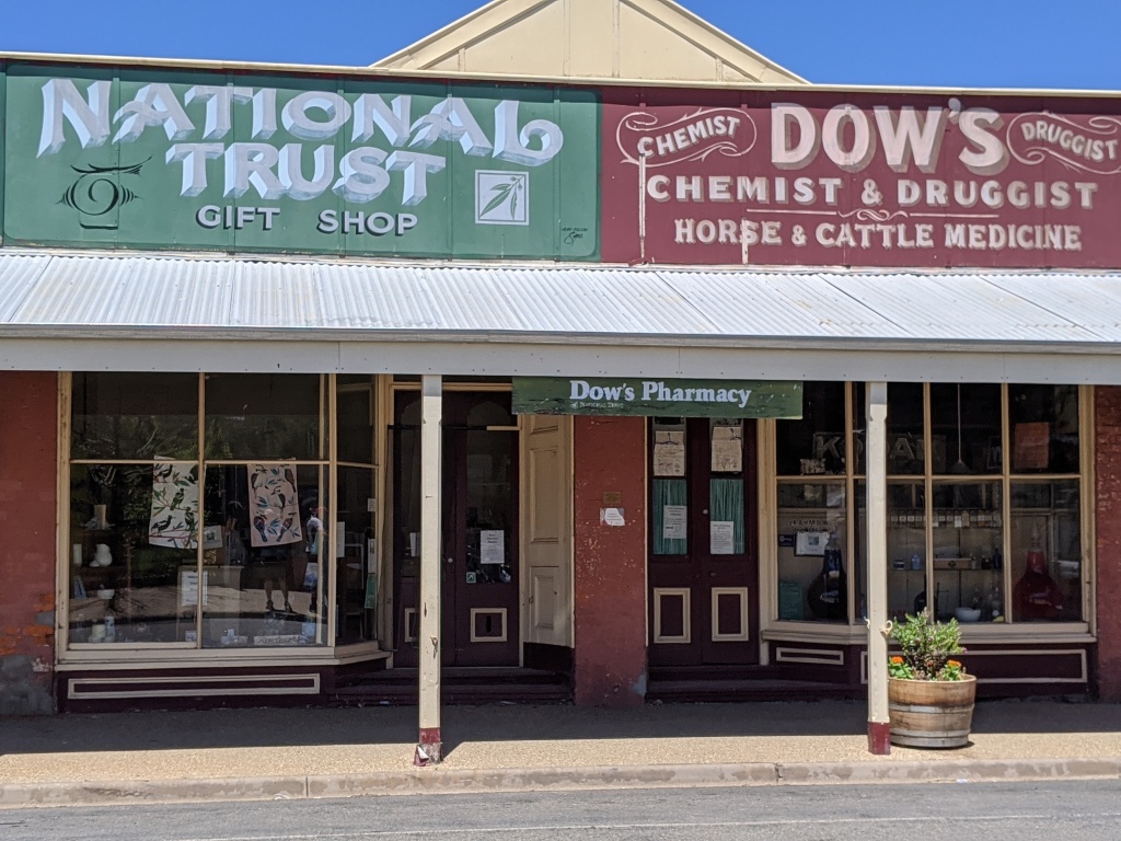
The view, looking down the Indigo Valley from the Beechworth/Wodonga Road was stunning – green as far as the eye could see. Rolling down the valley to Chiltern was pure pleasure. We met an old teaching friend at the Chiltern Bakery. Mick suggested a quiet route to Rutherglen along the Howlong Road, then Old Howlong Road, Indigo Post Office Road and then Cornish Town Road. It was definitely quiet, apart from the squawk of cockatoos in the roadside trees. Magpies flitted between the trees, fortunately minding their own business. No swooping. And the sweet smell of harvested hay. Finally, Rutherglen, our motel and dinner at the Poachers Paradise Hotel.


Day 2 Rutherglen to Wangaratta
Another blue sky day. We rode out of Rutherglen on the main road to Yarrawonga (the Murray Valley Highway). We were on this for 17 kilometres before turning off just before Warrabilla Wines onto Jones Swamp Road. (No wine tasting on this trip even though the area around Rutherglen has great wines and numerous wineries). The road was sealed but mainly traffic free. At times, we were riding along a tree lined avenue with flat wheat fields stretching either side. We had hoped to access the Ovens River but side roads, marked on the map, turned out to be non-existent or blocked by farmhouses. Our one attempt, via a cemetery, took us to a swampy mosquito infested pool. Not the highlight of the day or the relaxing lunch spot we’d hoped for. The day became warmer. Wheat coloured sheep dotted the fields, black cows congregated in clusters under available trees. Onward for another 20 kilometres and into Wangaratta, a bit saddle sore and hot, but happy to be on the rail trail for the last few kilometres. Every town seems to have a Thai restaurant, Wangaratta is no exception. Generous serves, a bottle of wine. Nice.


Day 3 Out and back to Warby – Ovens National Park
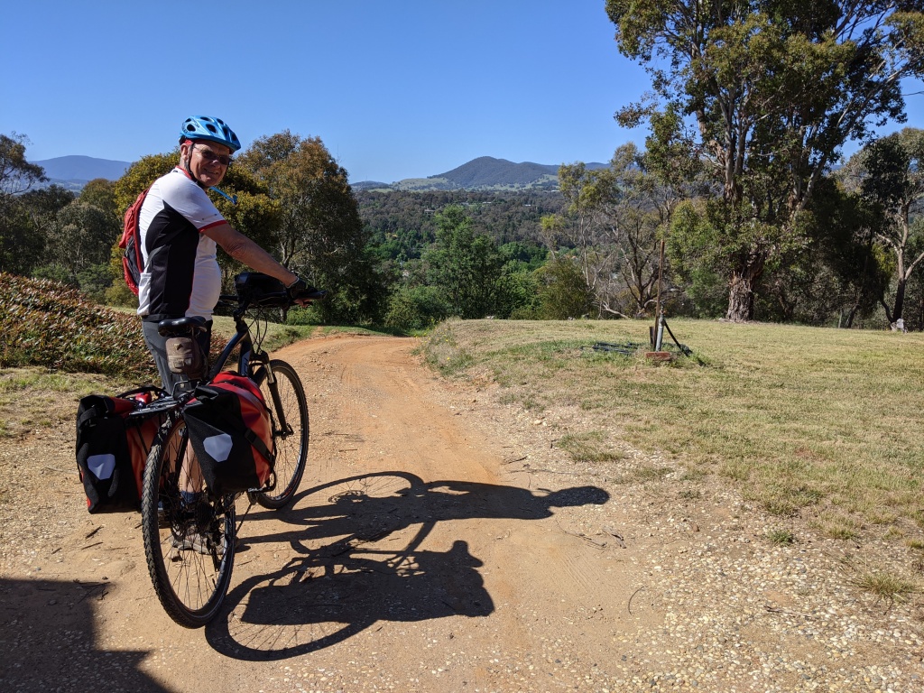
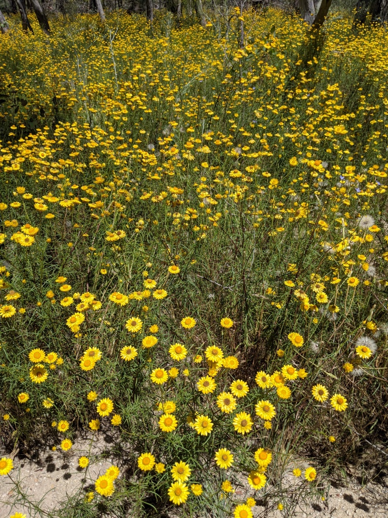
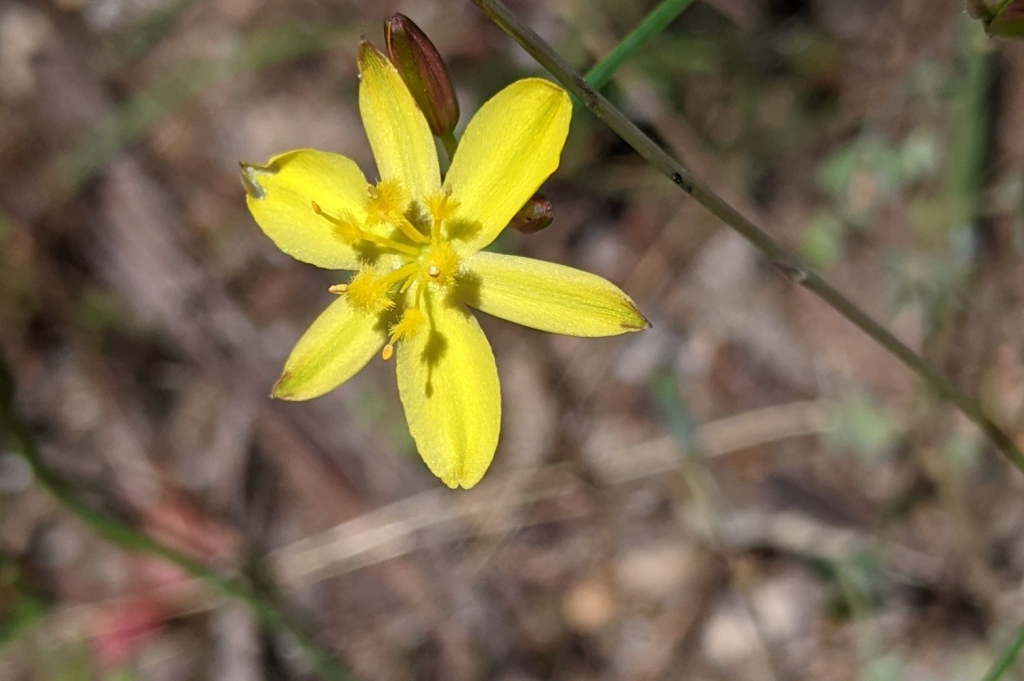
A day’s riding without panniers. After a raisin toast and coffee breakfast at a restaurant on the Ovens River, we rode out on another dead straight road to Warby – Ovens National Park. Even though this national park is close to home we haven’t visited it for many years. Wildflowers, at this time of the year, are the main attraction and they were out in abundance particularly everlasting daisies and bluebells. After the flat stretch, it was a steady climb up to Ryan’s Lookout – from there we could see Mt Buffalo to the east and Tabletop to the north. More uphill on the gravel road to Wenhams Camp and the start of Friends Track. We locked up the bikes and walked – all the better to see the wildflowers. The photos show some of the flowers we saw in the park. It was an enjoyable descent back down and along the flat to Wangaratta. We finished the day with a swim in the motel pool then wandered across the road to have a delicious meal at Watermarc Restaurant – a great gnocchi and pizza and a delectable dessert.


Day 4 Wangaratta to Myrtleford
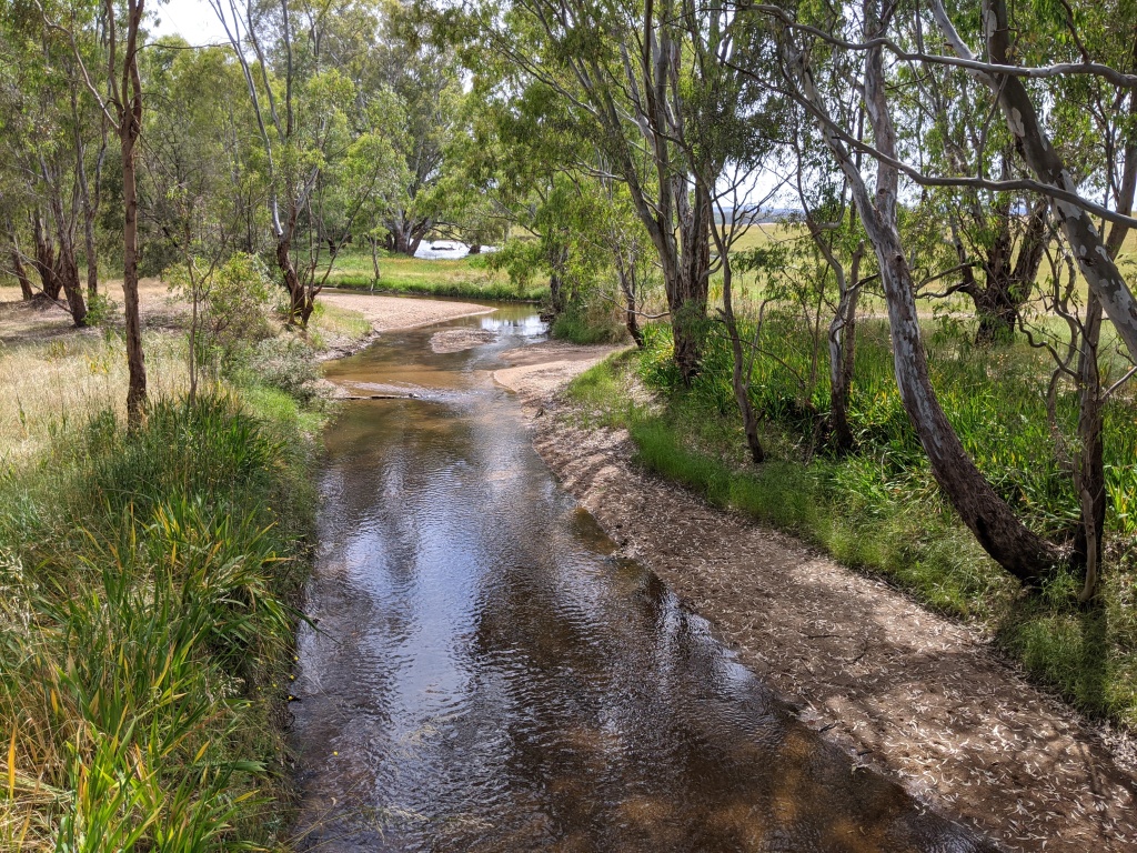
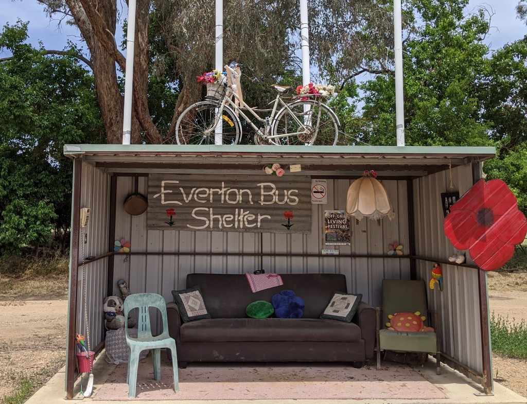
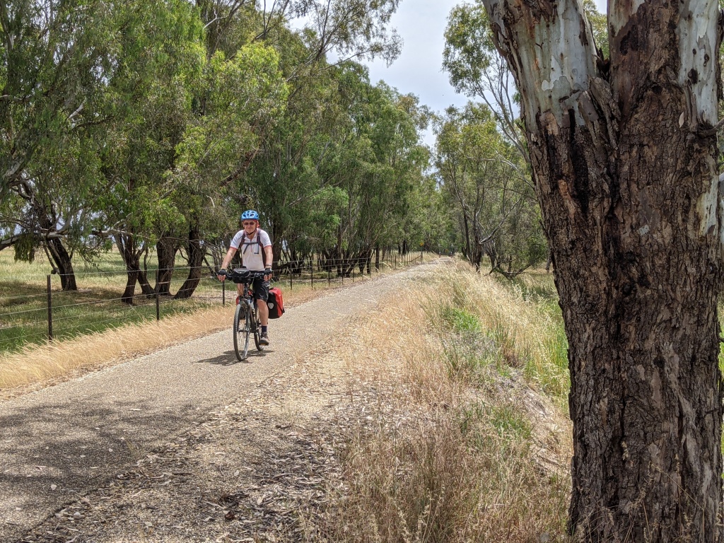
The Murray to Mountains Rail Trail links Wangaratta and Myrtleford, a distance of 52 kilometres. As you leave Wangaratta the trail winds along the Ovens River past giant gnarled river red gums before following the highway to the old railway station site of Bowser. The rail trail cuts through farmland and it was pleasant flat riding. There are a few a scenic highlights: the shady banks of Reedy Creek; Everton, with it’s unique bus shelter; a junk yard for cars; views of Mt Buffalo in the distance; Taylor’s Gap after a climb up from the flats; Gapsted Winery as you whizz down the other side to Myrtleford. After three days of clear blue skies, the weather had been very warm, humid and mostly overcast. A cabin in the Myrtleford Caravan Park was our resting place at the end of the day and. We enjoyed a beer at the pub before a meal at Tu Vietnamese in the main Street. Gourmet travelling is possible in Victoria.


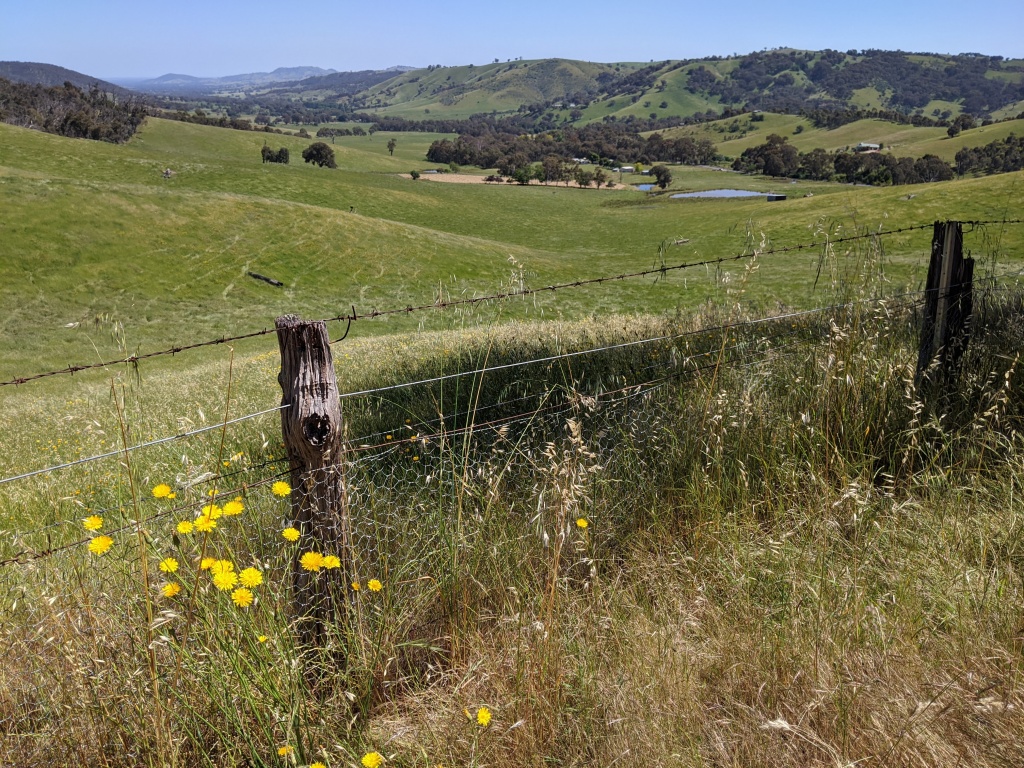
Day 5 Myrtleford to Yackandandah
There is the short way between Myrtleford and Yackandandah – the main road – but we opted for a more scenic and quieter route first along the rail trail towards Bright then up the Happy Valley Road before turning left onto Carrolls Road, up and over to connect with the road into Yackandandah. Rain threatened. The skies we’re stormy. We got a bit wet, then it cleared as we struggled up Carrolls Road, past Rosewhite – where we had contemplated staying the previous night – and down the other side. The panoramas of valleys and hills with dark brooding clouds was as stunning as the first few sunny days. There was nowhere to buy lunch, and we hadn’t stocked up in Myrtleford, so we were sustained on nuts and water. This wasn’t enough to get me up the hill into Yackandandah although I’d managed a sustained climb at 10 percent on the Rosewhite stretch earlier in the day. We eventually trudged up our own driveway, energised by a cup of tea and a slice of cake when we called on friends on our way through town. Good to be home and happy to have managed 250 kilometres with panniers over the five days. We weren’t in Europe, but the spring countryside in north-east Victoria offers great scenery, quiet roads and plenty of places to stay. And you don’t need a passport or hours in airports and on planes.