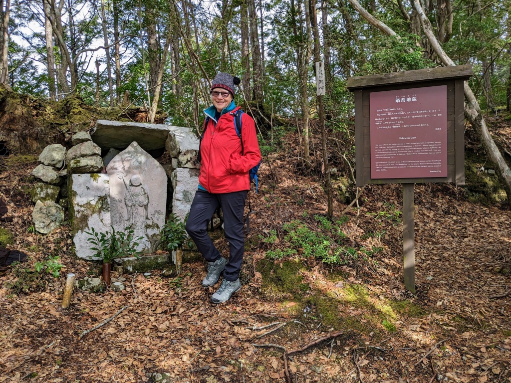
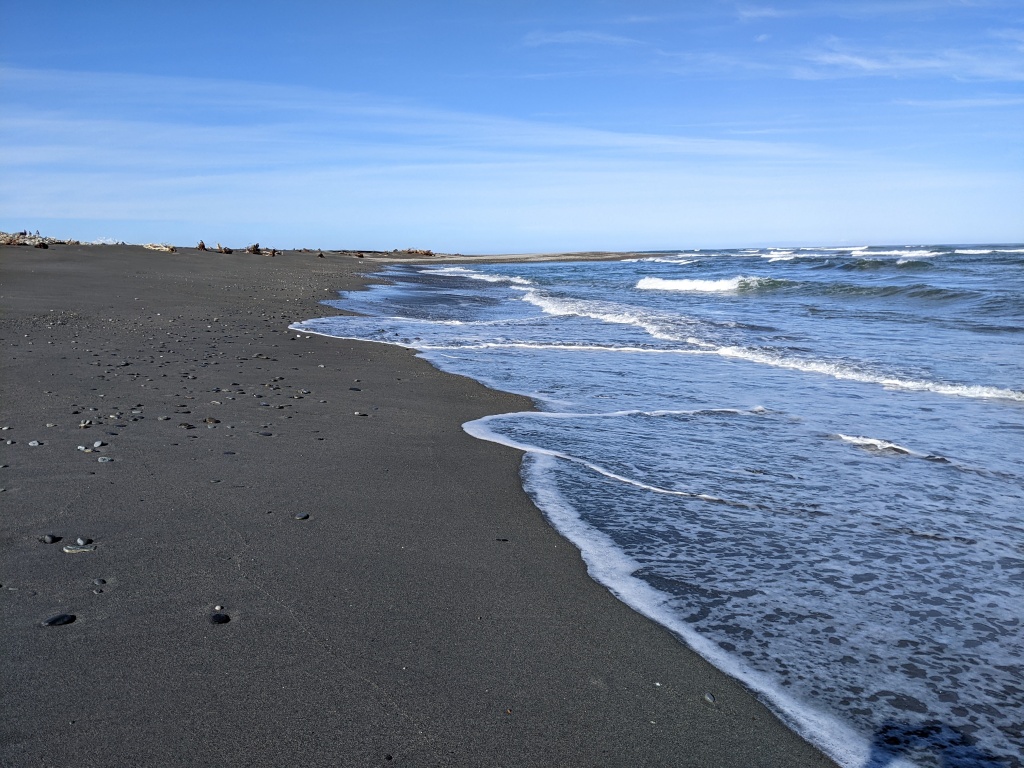
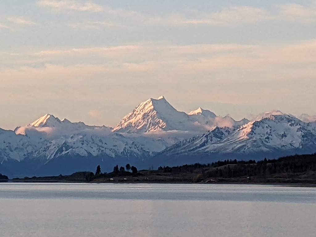
After leaving Shark Bay we drove to a camping spot at Milligan’s Island, south of Geraldton. It was hot and windy, not very pleasant, and that was before the arrival of the bees! We enjoyed a long walk on the beach, beautiful shades of colour in the water, white sand, the cry of seabirds and, on our second evening, a magic sunset framed in a gap on Milligan’s Island.
Milligan’s Island Beach Sunset – Milligan’s Island
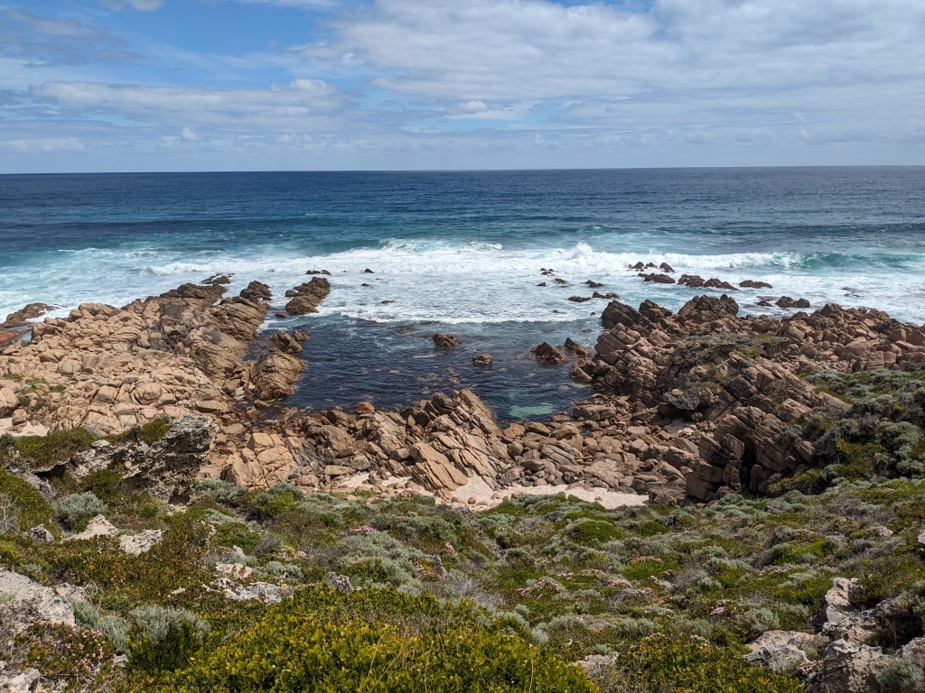
Then inland with a short stopover to do the three bay coastal walk at Greenhead. The sea just keeps on being stunning. Sea grass creates dark patches that contrast with the lighter aquamarine over sand then the scalloped edge of the white sand.
Leseur National Park
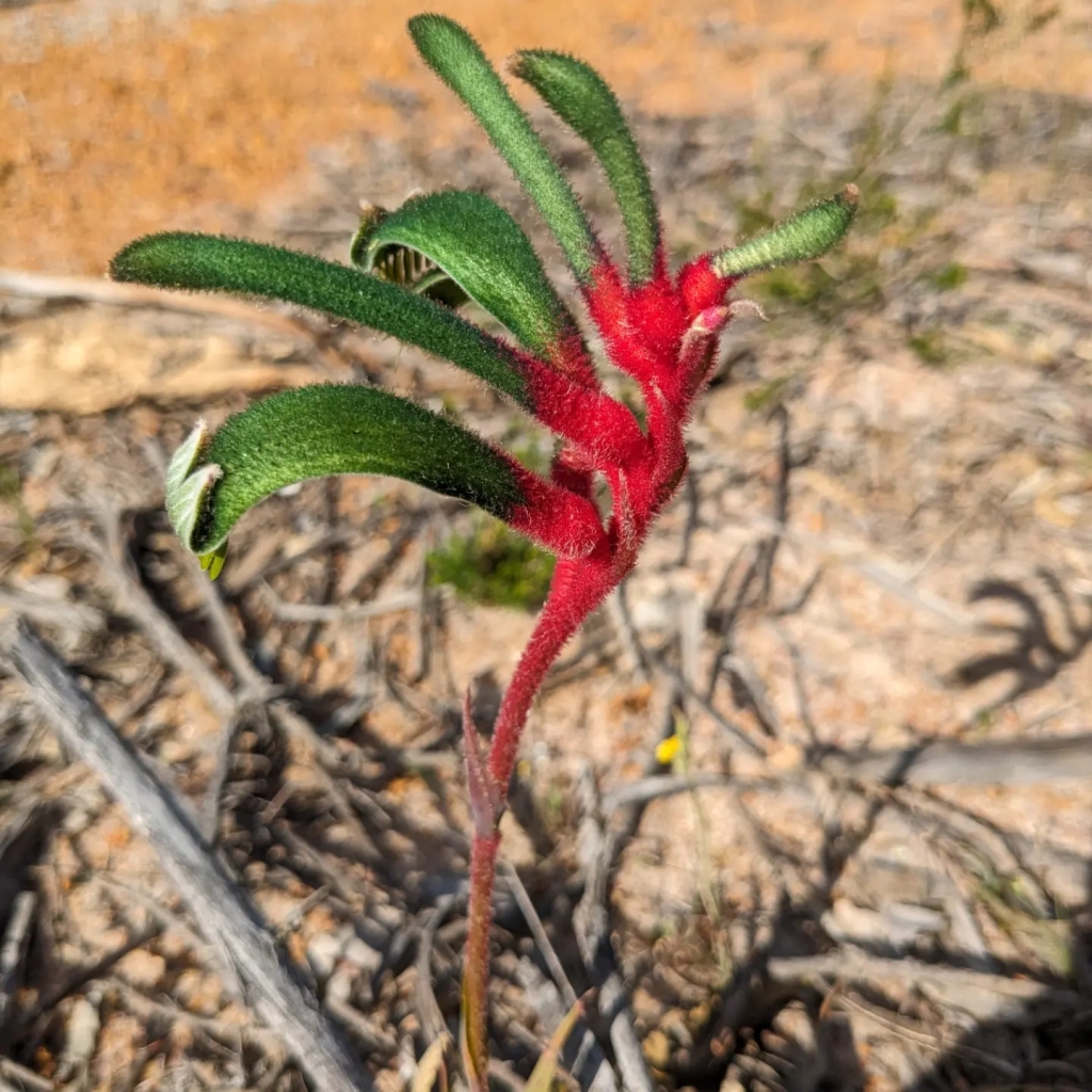
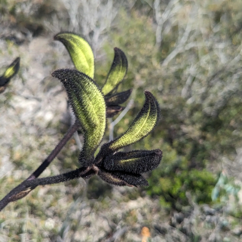
After almost three weeks on the coast we decided to go inland. Lesueur NP offered the prospect of more wildflowers. Karda Campground is next to the national park and was a real treat; gum trees and shady sites, open grass with grazing kangaroos and emus and only a few other campers. The down side: flies and heat (38 degrees by early afternoon). We stayed three nights with a day trip into Lesueur NP and an easy but hot walk up Mt Lesueur. Lots of wildflowers on the driving loop and then the walk with a single sighting of the rare black kangaroo paw.
Karda Campground Karda Campground Mt Lesueur On the summit with the flies
The Pinnacles
On another day we got up early (not hard to do when it’s light at 5.30 am) and drove south to The Pinnacles. By being early we beat the influx of tourist buses and had an unimpeded desert wander amongst these amazing rock extrusions.
The Wheel Incident
A swim at Jurien Bay was an after desert treat before heading back to our campground and sweltering through a hot afternoon. Then disaster! The wheel came off our van at 100 kph near the coastal town of Lancelin, 100 kms north of Perth. The van stayed upright and Chris managed to slow down and pull over into a side turning lane. People stopped but our main saviour was a young man, Kim, living nearby who had heard the brake drum grinding on the road. Chris managed to drive the van around the corner onto his house block. We left it there overnight and drove to Perth, picked up a new brake drum and returned to Kim’s place in the morning. Apart from issues with the wheel nuts, we managed to get a wheel back on and the spare tyre – the original wheel was lost in the bush – and drive to Freemantle. We bought two new tyres from a mobile tyre service who came to our campsite in Freemantle and replaced the dodgy spare and fitted a new tyre on our replacement rim. Phew! Not a nice experience but it could have been worse.
With our rescuer, Kim, putting the spare wheel onThe new hubMobile tyre service
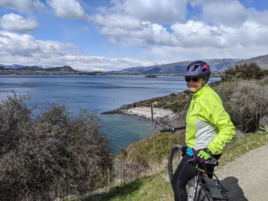
Rottnest Island (Wadjemup)
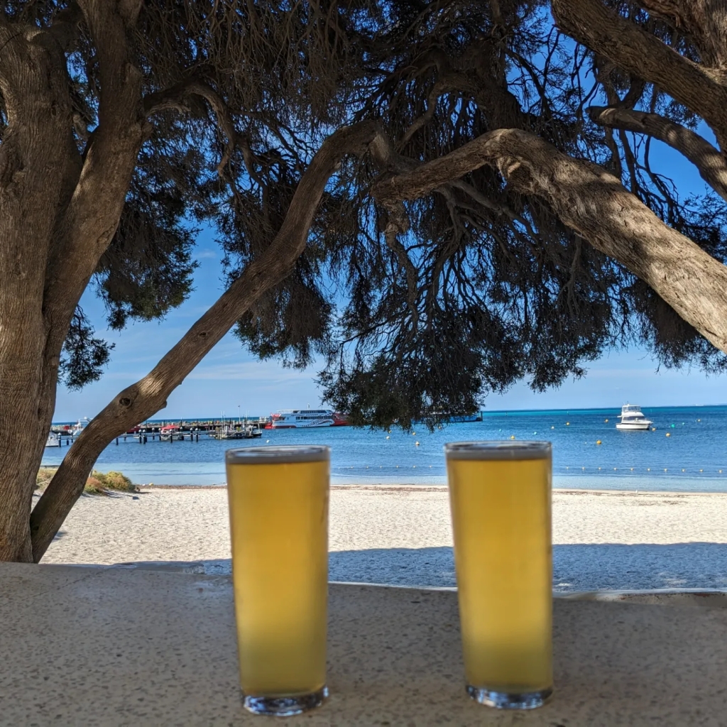
We had time to enjoy other attractions of Perth and Freemantle with time spent amongst the flowers in the Perth botanical gardens and an amazing day cycling – on hired bikes – around Rottnest Island (Wadjemup). The weather was perfect and the road around the island and in and out to the bays along the way, was easily managed. No cars either, just an occasional tour bus. There was so much more to Wadjemup than we had thought, not just a beach or two and quokkas! We were lucky enough to see a whale breeching out to sea and a colony of seals on the rocks at the end of the island.The bikes we’d hired were good and we finished the circuit with a beer before returning to the mainland on the ferry.
Margaret River
With our wheel disaster behind us, new tyres on the van and the memory of the enjoyable experience of Wadjemup and cycling, we drove to Gracetown near Margaret River to be in place for the Cape to Cape Track. Our walking experience has been given, a separate post so no more on that here. The Margaret River area, however, had other attractions being a wine and gourmet dining region. Over a hundred wineries, many of them with restaurants made it difficult to decide what to taste and where to taste it, but we managed, and with some beautiful string music provided at one of the wineries as a bonus. By the time we left, our car now had a modest cellar in the canopy for future drinking.
Skigh WinerySkigh Winery Mikis Restaurant – 3 of 28 tasting dishesLunch at Amelia Park Entree at Amelia Park
A PS to this post to showcase some of the beautiful natives in the Perth Botanical Gardens.
Onwards to the karri forest, cycling, kayaking and coastal walking.
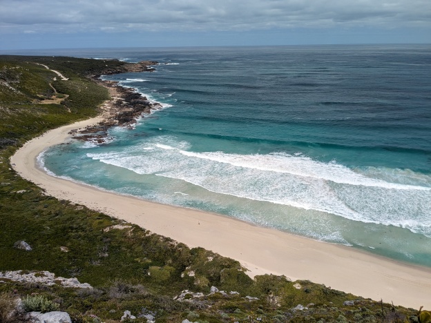
The Cape to Cape Track has existed since 2001. It follows the coastline from Cape Naturaliste to Cape Leeuwen. The official length of the track is 135 kilometres and is a mix of disused sandy 4WD tracks, narrow rocky paths and soft sandy beaches. We hiked south from Cape Naturaliste with the ocean on our right and the vegetated ridges of Leeuwen – Naturaliste National Park on our left. When the sun shone, the sky and sea were a brilliant blue contrasting in a stunning way with the green of the vegetation and patches of mainly pink wildflowers. The edge of this coast is also scalloped with sandy beaches defined by rocky outcrops and rugged headlands. Wildflowers in abundance and humpback whales out to sea. Gorgeous!
Kennedia Scarleta
Our version of the Cape to Cape Track was completed over six days with two rest days. We skipped a few sections towards the end where long beach trudges on soft sand seemed to dominate but we were satisfied with our 90 kilometres. Our base was in our van at Gracetown Caravan Park. Each walking day we used a shuttle service. We drove to the end point for the day where we met our driver, Jye. He then drove us to our starting point and we walked back to our car. This flexible arrangement meant we could take a couple of days out for a winery lunch, a gourmet dinner in Margaret River and a whale watching boat trip from Busselton.
Day 1 Cape Naturaliste to Torpedo Rock (Yallingup) 21.5 kms
After our driver dropped us off we had some time before the lighthouse opened so we completed a 5 kilometre circuit around Cape Naturaliste.This seemed like a good idea at the time, not such a good idea when we were trudging the last 5 kilometres of the day to our car at Torpedo Rocks. However, that loop was a great introduction to the wildflowers in the area. Many of them we would see in abundance as we made our way south. At one point we stopped to watch several whales, mothers with calves about to begin their journey to Antarctica. After a coffee and a warm choc-chip muffin at the lighthouse cafe we started on the track, well graded, wide and firm for the first few kilometres to Sugarloaf Rock with panoramic blue sky, blue sea views all the way. The walking was varied, ups and downs, sometimes on the old 4WD tracks, sometimes on narrower pathways through the vegetation and several soft sand stretches on the beach. The constant was the ocean, the crash of the waves as a backdrop to its vastness.
Starting out at Cape Naturaliste Lighthouse Cutleaf HibbertiaDiplolaena dampieri – Southern diplolaena Looking back northSugarloaf RockSandy track and Pimelea An ocean viewA seat to enjoy the view
Day 2 Torpedo Rocks to Moses Rocks 18.5 kms
Still a bit weary and footsore from our long day yesterday, we were on Smith’s Beach trudging south by 8.30 am. After the beach came a climb up a rocky slope. The track meandered through boulders to a rocky outcrop and a stunning view of the coastline heading south. The day had been grey to start with but the sun was now shining and the sea a deep cerulean blue. The map has names for all the beaches and cliffs. They’re a mixture of English and French – Smith Beach, Mitchell Rocks, Cape Clairault and indigenous. Many of the names in the local indigenous language end in ‘up’ meaning place in the Noongar dialect: Wyadup, Quininup, Injidup. We concentrated on the views and the track, the names too numerous to remember. Our 18 kilometre day began to seem neverending but we did manage a short side trip to Quininup Falls a couple of kilometres before our destination end, Moses Rocks. Looking back, we thought this was one of the most stunning days of the walk.
Early morning, Smith’s Beach Climbing upRocky outcrop The view A secluded bayPimelea roseaBristly cottonheadsQuininup FallsEnjoying the wildflowers
Day 3 Moses Rocks to Gracetown 15 kilometres
Our base was the Gracetown Caravan Park which is about 3 kilometres inland from Gracetown Beach, our end point for day three. A sunny day that became quite hot by early afternoon and made the walking harder. It was a great day for the wildflowers and more of those stunning ocean and coastline panoramas. Towards the end, we negotiated a difficult rock scramble around North Point before eventually reaching Gracetown Beach and a refreshing swim in clear cold water. Another fabulous day, equal to day two.
Heading down to walk on the beach On the beach 4WD track – very sandy Red and green kangaroo paw Into the treesCoastal path with a view Sky, ocean and pink Pimelea On the beach Lunch with a view A rock climbing cliff
It was time for a treat. Anticipating an earlier finish, we had booked into one of Margaret River’s top rated restaurants, Mikis. Showered and dressed up, we fronted for the late sitting of a Japanese fusion degustation of 23 delicious morsels with matching wines. A reward for our efforts so far.
Duck, beef and fish, three of the twenty three at Mikis in Margaret River
Day 4 Ellensbrook to Prevelly and the Margaret River mouth – 15 kilometres
We cut out a section from this day. We were weary and thought a shorter day was in order. Our starting point was Ellensbrook Homestead. This restored, historical site provided some variety, particularly as the track wandered away from the coast through scrubby forest. Much of the walking after that was along a path carved into the tall heath, rather like walking along a closed in corridor. The skies were greyer and the day cooler, something of a relief after yesterday’s heat. The downside, grey ocean and duller light for photos. We had expected to wade the River mouth at the end of our long morning but managed to cross the sandbar between the river and the ocean. Ate lunch at a cafe overlooking the mouth.
Ellensbrook Homestead View from the path through the heathThe path through the vegetation Flame peaTwining fringed lilyOn the beach on a grey dayCape Mentelle
Day 5 Redgate Beach to Hooley Road Junction 12 kilometres
This was another shortened day. It’s great when you can manage your own timetable – our driver, Jye, was happy to do whatever we wanted. We’d declared the day before to be completely free of walking and opted instead for a late start and a winery lunch at Amelia Park winery. The lamb shoulder was delicious! Excellent wine too in a beautiful restaurant. Anyway, we were once again back on the track and spent some time watching the surfers ride the waves at Redgate Beach. Then away from the beach and along a 4WD track with some different wildflowers. After about 7 kilometres the track passed through a bush camping ground, Contos. We had originally intended to move to Contos but decided to stay at Gracetown because a hot shower at the end of a long day walking is so good. Beyond Contos was a long stretch of track through forest that had been burnt some years ago. The regrowth was abundant, both greenery and wildflowers, particularly the Kennedia Coccinea vine with its clusters of bright orange pea flowers. The last kilometre to the car was into unburnt karri forest.
Redgate Beach Burnt vegetation Coral vine Grass trees with a view Another beautiful beachChris in a treeGrass tree and Pimelea
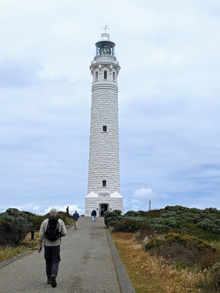
Day 6 Hillview Road to Cape Leeuwen Lighthouse – 11.5 kilometres
It is a 70 kilometre drive south from Gracetown to the lighthouse. We parked our car in the lighthouse carpark and a different driver, Cy, drove us and a party of six from Perth, to Hillview Road. We had all decided on this short option to avoid a very long walk along a soft sandy beach. We had stopped on the track and talked briefly to different people on previous days, but we actually walked with this group, three older couples, for about an hour. Nice to talk to someone else apart from each other for a change! Another grey day so not so much temptation to take photos but the views were good and those wildflowers just keep on blooming. At last the lighthouse and the end of our journey. Today’s treat, a lovely lunch in a restaurant in Augusta.
A distant Cape Leeuwen Lighthouse Walking with others Sand dunes Sand dunes Hardenbergia On the beach again Almost there Cape Leeuwen Lighthouse and the end of the track
The days roll on when you travel. Sometimes it’s hard to remember what you did a few days ago. The photos help though and we have seen some beautiful sights in the area between Perth and Shark Bay. We sought wildflowers from Kalgoorlie west, then north, travelling up through towns of assorted sizes many of them starting with the letter M: Mukinbudin, Koorda, Moora, Coorow, Three Springs, Carnamah, Mingenew and Mullewa. Along the way we stopped to take short walks and overnighted in some free or excellent council run camping grounds with fellow nomads, not all of them grey. Sadly, lack of winter rain meant a poorer display of wildflowers than other years. No carpets of everlastings. We were also a bit late for this area they call the Everlastings Trail. Despite this, we saw a few gems, especially on a wildflower loop near Koorda. The standout bush was the Koorda Rose and later a rare pinkish red flowering gum ((Rose Mallee – Eucalyptus Rhodantha) at Three Springs.
Rose MalleeKoorda Rose Pincushion Hakea
Coalseam Conservation Park
The nicest place we stayed in this inland stretch was Breakaway campground at Coalseam Conservation Park. This is stark, red soil country seeped in the history of unprofitable coalseam mining. You can see the black coal bands in sections where the Irwin River has carved a striking cliff face into the Victoria Plateau. Only a few hardy flowers but a remarkable number of birds including the singing honeyeater which we saw and heard many times. Wind and flies were occasional drawbacks. Fly nets do work though!
Breakaway campground at Coalseam Conservation Park Coalseam Conservation Park Coalseam Conservation Park
Cape Burney
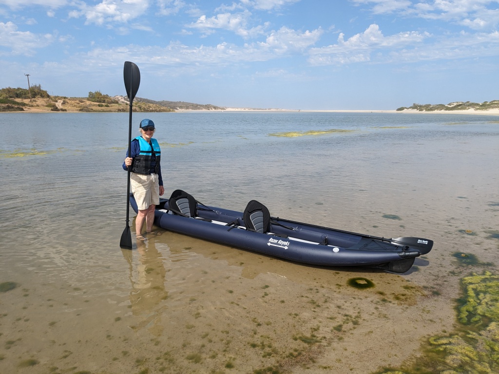
Our intention was to go further north to Kennedy Range National Park but the weather forecast was dire, very hot (42 degrees) on the days we would be there. It was an easy decision to turn west after Mullewa and drive to Geraldton and a camping ground a few kilometres south at Cape Burney near the Greenough River. This was a chance to launch the new inflatable Razor Kayak as the estuary waters of the river are shallow and sheltered. The launch was successful and we were soon kayaking with the pelicans.
Inflating the kayakLaunching at Greenough River
Geraldton
Geraldton is a large centre. They have an excellent museum which features detailed information about the wreck of the Batavia and subsequent mutiny in 1629 and the sinking of HMAS Sydney II in WW2. A well designed memorial on a high point commemorates the significant loss of life, 645 crew members, when the Sydney was sunk by a German boat laying mines off the WA coast in November 1941. A big centre such as Geraldton is also an opportunity to stock up on supplies and use the library for a strong WiFi connection.
HMAS Sydney II Memorial Part of the memorial
Kalbarri
We headed to Kalbarri next – sea cliffs and inland gorges. The sea cliffs can be viewed from a number of lookouts on the coastal drive. First we stopped at Hutt Lagoon or Pink Lake. The lake is given its pink hue by carotenoid-producing algae. A popular place for selfies. The coastal cliffs are impressive and stretches of boardwalk have been built so you can walk along the cliff tops. My favourite was Pot Alley. We visited this small cove and cliff area in the late afternoon. The sea surged onto the beach and swirled into a blow hole with great force sending spray arching up and catching the sun. Ideal for photography.
Pink Lake (Hutt Lagoon)Kalbarri Coastline Kalbarri BeachFeeding the pelicans Pot Alley Beach Small blow hole at Pot Alley Beach Sooty oyster catchers
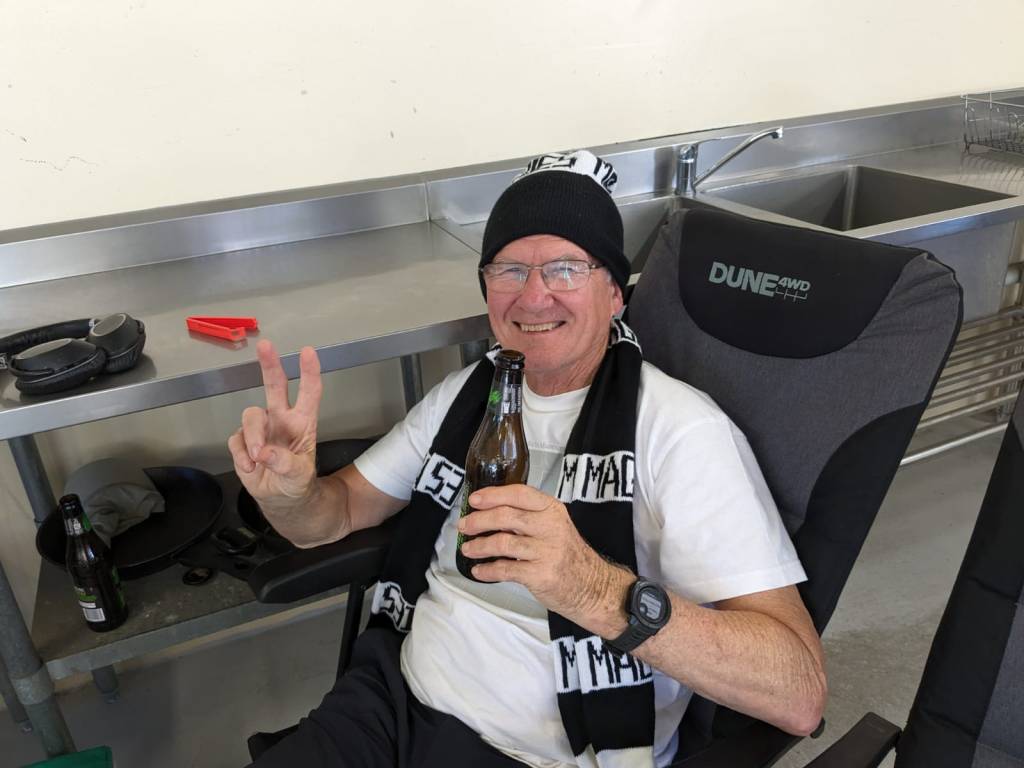
The highlight for Chris at Kalbarri will be Collingwood winning the AFL Grand Final. We watched this in the camp kitchen of the Kalbarri Caravan Park with about twenty other people. Only a few wanted Collingwood to win but the atmosphere was friendly.
A happy fan – Collingwood wins the 2023 AFL Grand Final
Kalbarri National Park
Kalbarri National Park is inland from the coast. This is the country of the Nanda people where the Murchison River has carved steep sided gorges over 400 million years. A skywalk has been constructed that hangs in mid-air 100 metres above the gorge. This engineering marvel has been constructed in consultation with the Nanda people. It’s weathered steel blends with the sandstone landscape. Numerous paths are designed so that the gorges and cliffs can be viewed from different locations. Another popular photography point was Nature’s Window; the tourists were lined up here for a compulsory photo.
View from Kalbarri Skywalk Kalbarri Skywalk Nature’s Window Lining up at Nature’s Window View down the Murchison River
Shark Bay
Some months ago, we had made a booking in Denham at Shark Bay Caravan Park aware that we would be there in school holidays. Denham was a busy place and we arrived on a very windy day. Fortunately the next six days were calmer. The sun shone, the breezes were mild and the temperature hovered in the high twenties. This made for ideal conditions for the kayak which had two outings, the first on the inlet to Little Lagoon and the lagoon itself, and the second on Big Lagoon. These lagoons were once land-locked salt pans (birridas) that were inundated by the sea thousands of years ago. White sand, pale green water on the shallow edge, darker deeper water where the sea grass grows. Our paddle across Big Lagoon brought us closer to red rock sea cliffs; the contrast with the different coloured water was stunning. Getting to Big Lagoon, located in Frances Peron National Park (he was here in 1801) involved a 20 kilometre sandy 4-wheel drive track. To tackle this we had to deflate our tyres to avoid getting bogged. We gave a lift to a hitch-hiking couple, Jules (French) and Connie (Austrian). Memories of our own hitch-hiking days probably prompted this offer. They were good company.
Inlet to Little Lagoon – Shark BayKayaking on the inlet The sandy road into Big LagoonBig Lagoon – Francois Peron National Park Big Lagoon Kayaking on Big LagoonView from the lagoon Jules and Connie – our hitchhikers
Day out on Shark Bay
The next day, we’d booked a big day out on the bay with Shark Bay Dive and Marine Safaris. The weather was perfect, the group small and the activities manageable for two in their early to mid- seventies. The boat took us to Steep Point the western most point of Australia. We experienced several humpback whale sightings, a dugong, eagle rays, dolphins, a cormorant colony and a 400 year-old osprey nest. The snorkeling in clear sheltered water was good: some colourful coral, star fish and small fish, particularly around a small rocky island. We also snorkelled from the boat onto Dirk Hartog Island, the site of the first recorded European landing on Australian soil in 1616. The Dutch were definitely here first! Both the island and Francois Peron National Park have benefitted from Project Eden an attempt to reverse ecological destruction and the extermination of native mammals. Livestock, foxes, rabbits and cats have been eliminated on Dirk Hartog Island and, at this stage, five mammals successfully reintroduced. Heartening. We didn’t see any sharks on this day out on the water but had good views of the nervous shark swimming in the shallow water below Eagle Bluff as we left the bay.
Day out on Shark Bay Small island Steep Point Humpback sighting Snorkeling Osprey Colony and 400 year old osprey nest Our boat for the day
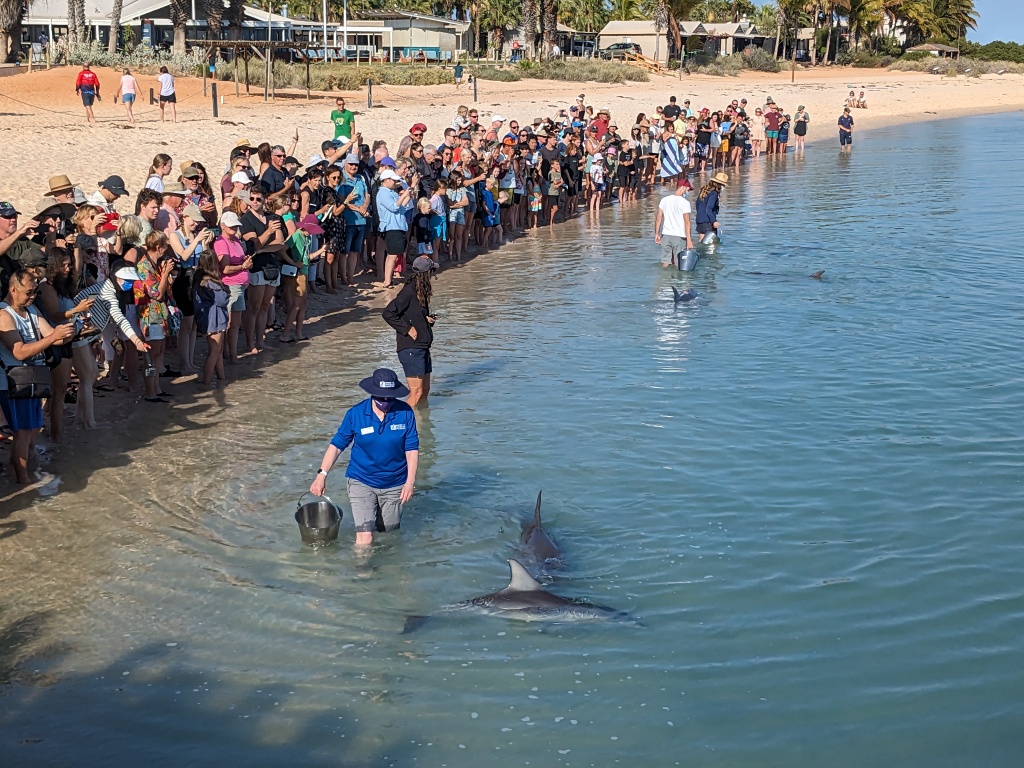
Monkey Mia
Of course a visit to Shark Bay wouldn’t be complete without seeing the dolphins at Monkey Mia Resort. I was sceptical about this, but the dolphins are fed only a small portion of what they need to survive each day and the crowd is kept under tight control. It was great to see these sleek creatures up close and personal. So the journey so far has been a history lesson, a geology lesson and a lesson in projects that are aiming to reclaim what has been lost.
Feeding the dolphins at Monkey Mia Indo-Pacific bottlenose dolphin Pelicans at Monkey Mia Shark Bay A beach formed entirely of cockleshellsTiny cockleshells
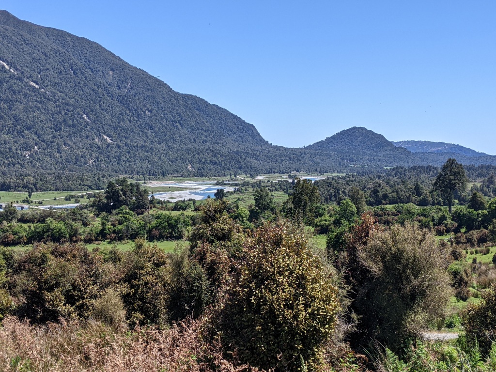
Milligan’s Island
We had one more stay on the coast at Milligan’s Island. A great camping ground but oh the wind. It was time to head inland to Lesueur NP in search of more wildflowers and some shady trees.
Near Cape LouiseMilligan’s Island Sunset – Milligan’s Island
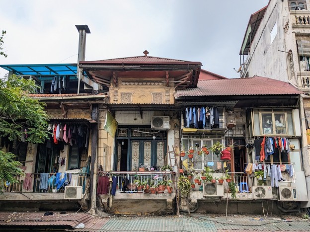
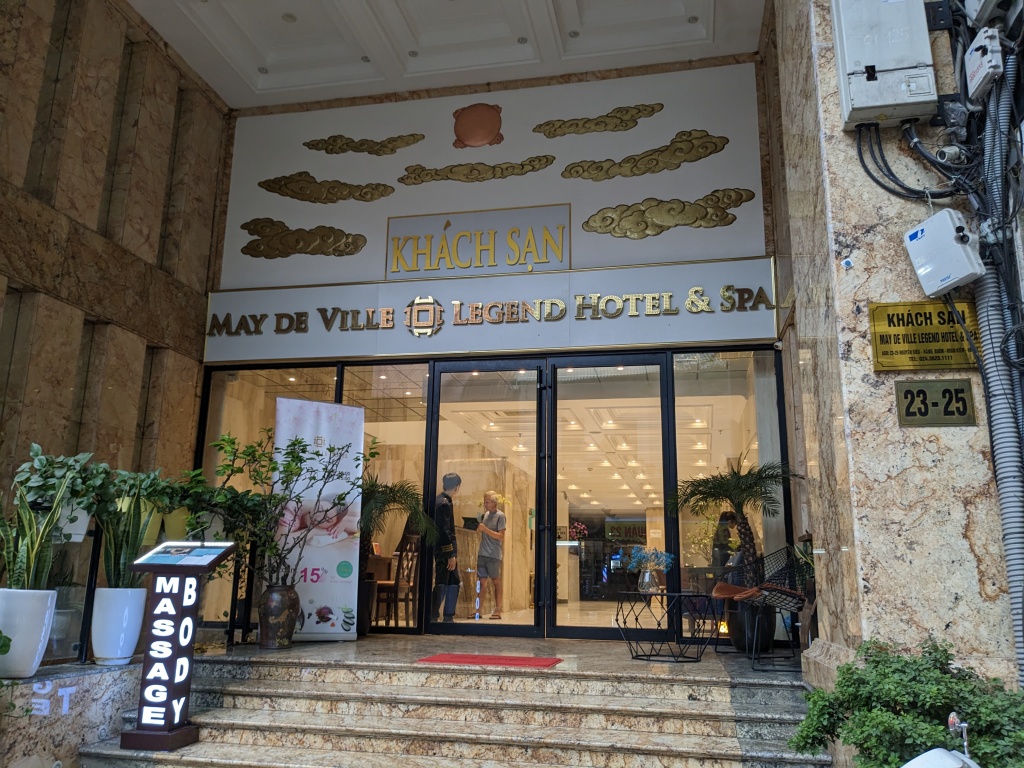
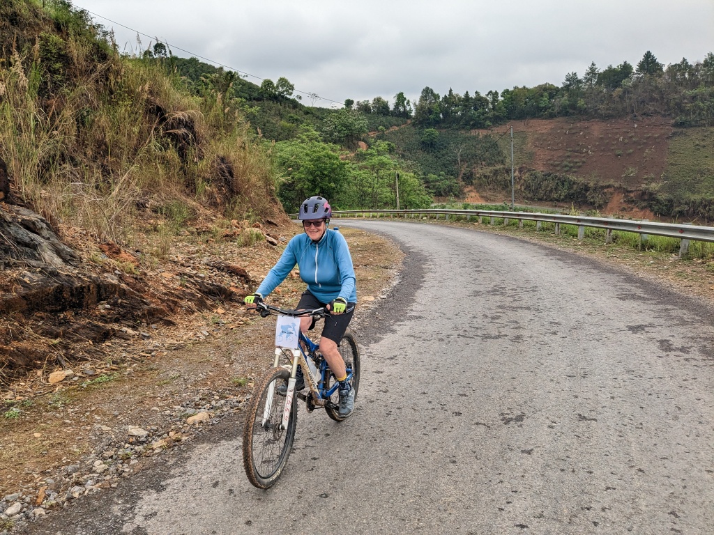
A starting point to our sixteen day cycling trip in Northern Vietnam was a few days in Hanoi. This was an opportunity to revisit a city first experienced in 1999 soon after the country was opened up to tourism. Was the young woman riding the bicycle laden with plastic souvenirs the daughter of the woman riding the streets then with similar wares for sale? Some things didn’t seem to have changed. There were many more motor scooters weaving and dodging and clogging the narrow roads of the Old Quarter and more night life, but the impression is that the lives of people has changed very little. They still cook meals on the street and crouch on small plastic chairs to eat them, peddle mass produced goods, fruit, vegetables and flowers from carts and bicycles and ferry enormous and unwieldy loads on ancient bicycles.
May De Ville Hotel & SpaA laden bicycle Constant traffic A rare quiet moment in the Old Quarter Dining out Sunday night market Sunday night market
A Taste of History and Culture
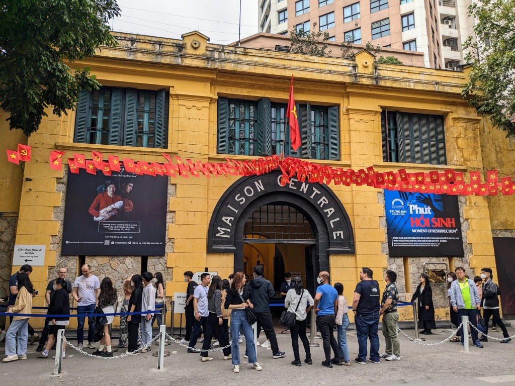
A self-guided walking tour of the Old Quarter of Hanoi and beyond gave us a superficial glimpse of the history and culture. Maison Centrale was a French prison built to incarcerate Vietnamese political prisoners. Conditions were brutal: prisoners shackled to hard wooden benches or kept in dark isolation cells. Later it was used by the Viet Cong as a prison for captured American pilots. Their treatment was better. They could move about more freely and were given more comforts. We later visited Son La Prison in Son La Province where the French also imprisoned Vietnamese Communists. Cruel treatment didn’t stop the inmates from disseminating Communist philosophy.
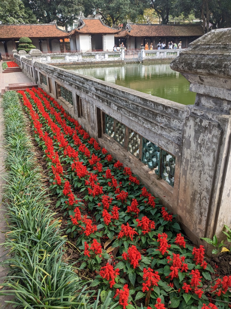
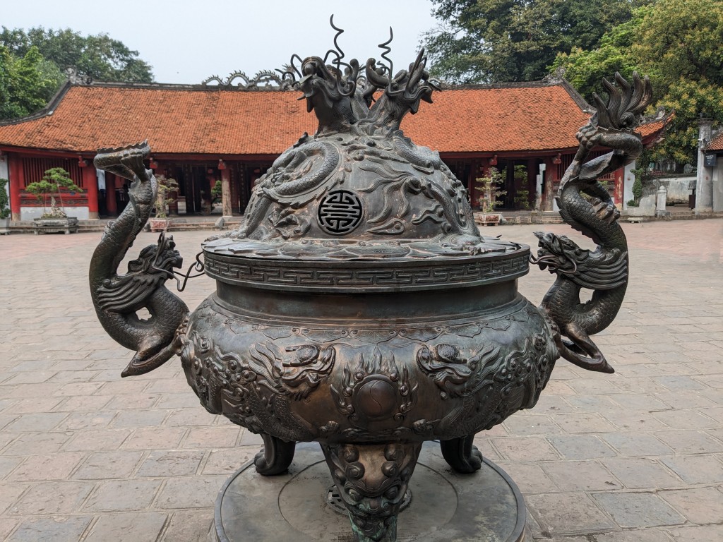
We also visited the Temple of Literature built in 1070 at the time of Emperor Ly Thanh Tong. This place of peace and contemplation is in stark contrast to The purpose of Maison Centrale. It is one of several temples in Vietnam dedicated to Confucius, sages and scholars. Other places in Hanoi also offer peaceful retreats from the chaos of the city streets: small temples, museums, galleries and a stroll around the central lake.
The French Prison The Vietnamese prisoners were shackled to the benches Temple and flower vendor Statue in history museum Beside the lakeChildren like to practise their English Street scene in the Old Quarter A gallery inside a restored house – Old Quarter Garden in Temple of Literature – HanoiTemple of Literature Confucius and packaged offerings
Dining out
Culinary adventures are part of the travel experience. ‘Do you like frog?’ asked the Vietnamese waitress after we’d boldly ordered the set banquet written, unlike other parts of the menu, completely in Vietnamese. I remembered frogs’ legs as an entree at a long ago French restaurant in Melbourne and said, ‘Yes.’ The others nodded. We were fine with a bite of frog. When the multiple dishes arrived, we got what we’d asked for: deep fried frog, frog in chilli sauce, raw frog to be cooked in the hot pot simmering on the table, frog in the vermicelli salad and deep fried battered frog. It was an extravaganza of frog and we devoured it all! (Unfortunately, no photo).
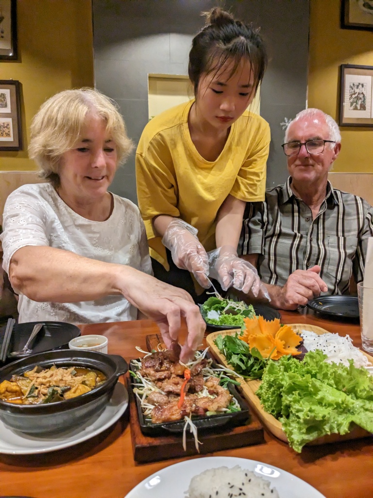
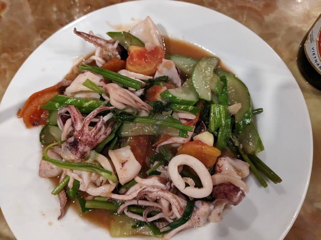
Other meals were tasty and varied. We particularly enjoyed making our own rice paper rolls with a Vietnamese omelette as the main ingredient. Salads, seafood, stir fried tofu, noodles and, of course, rice, so much rice.
Getting help with the rice paper rollsCucumber and mango saladBaked fish Stir fried seafoodNoodle SaladStreet food
Wandering the streets, dodging the traffic, strolling around the lake were all enjoyable ways to experience Hanoi. Our time in the city, after our bike ride, was brief. A final meal and a drink in a rooftop bar and it was goodbye to Hanoi and Vietnam.
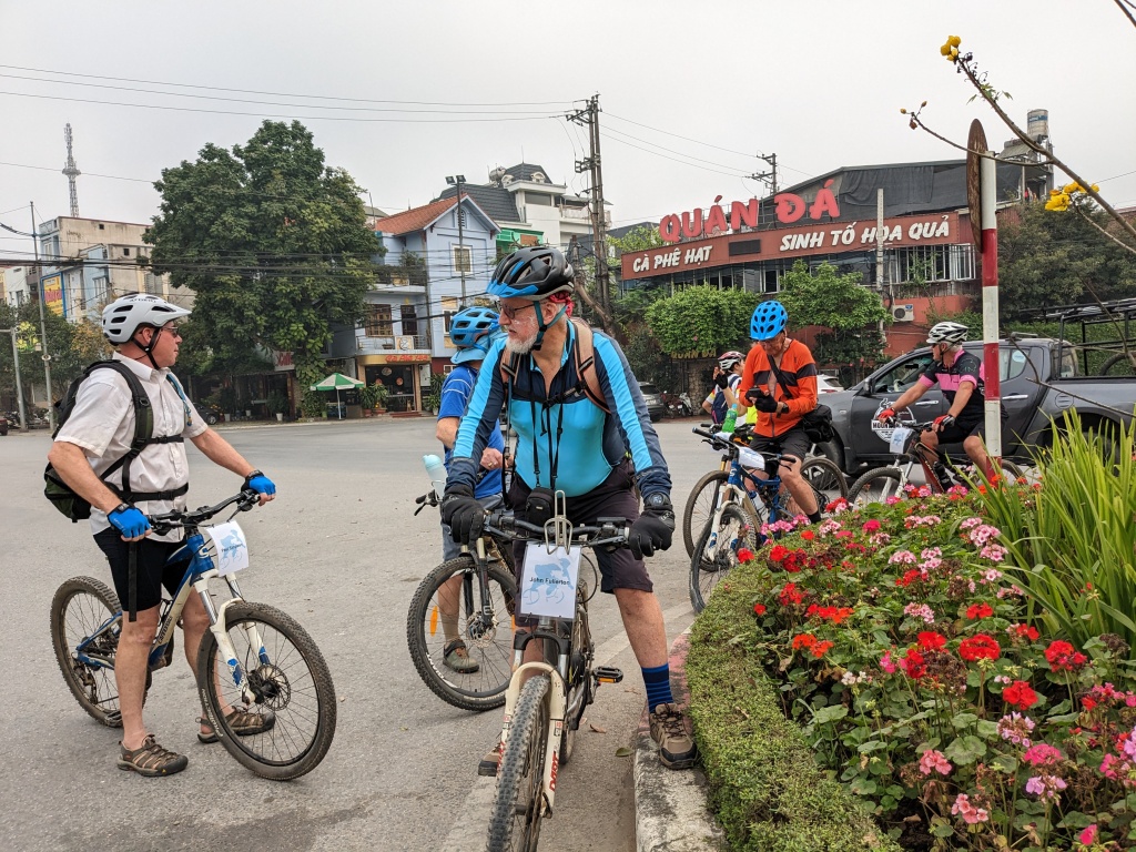
We were a group of twelve, average age early 70s, nine men and three women. Our route from Hanoi followed the Red River in a northwesterly direction to the Chinese Border then up to Sapa and over a range of mountains to Muong Lay and back down in a south-easterly direction to Ninh Binh. Eleven days of mainly back road cycling. Joe and his team in Vietnam, Biking Vietnam, organised our transport, guides, support team, accommodation, bikes, meals and planned our route. There was a mixture of e-bikes and non e-bikes. All good. This is a good place for a roll call of names: Bev (me), Chris, Allan, Mary-Ann, Hamish, John, David, Paul, Jennie, Graeme, Robert and Chris R.
Unfortunately the team had no control over the weather and the first few days had temperatures in the mid thirties with high humidity. There was a constant fog or smog trapping in the heat.
Near our hotel in Hanoi – no cycling here
The drive out of Hanoi took us beyond the traffic chaos of the city and into semi-rural countryside. The first hour was spent sorting the bikes, adjusting seats, pumping up tyres and getting hotter even before we started peddling. Finally we were off, riding on smooth bitumen to start then a rough track around a lake, where people were camping, and then up and over an even rougher track into a forest of shrubby trees. It was dusty and hot and the roadside rubbish strewn, not the most beautiful introduction to cycling in Vietnam although the lake and hills were scenic. The day was not without mishap with two women down through a combination of unexpected rough surface and faulty brakes and gears. Also one near collision with a car. Riding unfamiliar bikes in a foreign country requires some getting used to. Lunch was a picnic beside the vehicles with a hamburger, juicy pineapple and cold drinks. We were sufficiently revived to ride a ten kilometre stretch of bitumen to the day’s pick up point. The air conditioned bus ride to Yen Bai was bliss.
Sorting the bikesScenic riding around a rather parched lakeSeeking shadeOur first night’s accommodation
Day 2 – Yen Bai to Lao Kai
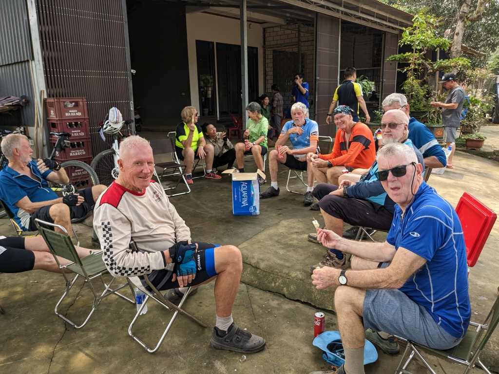
Another hot and humid day although the 8.30 am start meant it was cool riding through the city of Yen Bai and out into the countryside. We became quite strung out along the road but with our guide, Ann, in the lead and Joe mostly on our tail, no one got lost. The locals in the villages were friendly, smiling, greeting us, waving, even riding alongside and chatting. Chris was given the reception of a celebrity when he stopped at a school gate! It was soothing on the eyes when the houses gave way to rice paddies, such a brilliant green. The area is known for producing cinnamon bark and this was laid out to dry by the side of the road. Morning tea was a highlight with icecreams, fruit, cold drinks and filtered coffee. An hour and a half later we were eating a full restaurant meal. Fortunately we only rode another 12 kilometres after lunch. In the morning, we’d done 50 kilometres of easy up and down along the fertile Red River Valley. After that it was a two hour drive to the Chinese Border for a photo opportunity before being delivered to our hotel in Lao Kai.
Negotiating the traffic in Yen BaiHappy ridersRice paddiesCemeteryMorning teaBonsai and rice paddiesChris and school childrenCinnamonBikes and scootersThe group near the Chinese Border
Day 3 – Lao Kai to Sapa Farmstay
The day began with an hour long drive. There was much talk of two options and much discussion and indecision about who would do which option. Option two sounded very steep and in the end Joe decided for us. ‘Everyone back in the van,’ he said decisively. We all did the easy option! This involved quite a bit of hot climbing and wasn’t easy at all. Lunch was delicious: grilled pork on sticks, grilled vegetables, a dessert of watermelon and filtered coffee Vietnamese style and enjoyed on the balcony of a house with a view across to the smog covered mountains. After lunch, we were again offered two options. I opted for option one which was going uphill until I didn’t want to go up anymore. Jennie, Graeme and Mary-Ann joined me, the rest set off to ride further and higher. Our group lasted another 4 kilometres before collecting Chris and Hamish in the next village. The others rode on and up and were not seen again until we were reunited in our homestay much later in the afternoon. We were in the hills all day with amazing views looking down to a huge dam and terraced rice paddies.
Our homestay – Sapa Homestay – was also amazing. High on the side of a hill, great views, an infinity pool, accommodation in huts, the best meal so far, friendly hosts and an excellent full body massage. Our host, Lang, told us she had helped her mother sell souvenirs in Sapa when she was seven, close to the time Chris and I were there in 1999! We found a photo of Owen with the souvenir sellers and she recognised her cousin in the photo as a young girl.
The road ahead Riding upLooking downJoe at the barbecueCoffee brewing Vietnamese styleA village up highRice terraces near SapaSapa FarmstayOur roomThe boys enjoying the poolThe infinity poolDinner at Sapa Farmstay Lang, our host, and Moon
Day 4 – Sapa to SinHo
We left the luxurious Sapa Farmstay reluctantly and drove 10 km up to Sapa. What a shock. The sleepy village of 24 years ago is no more. It’s now glitzy hotels and restaurants. The only aspect we recognised from the past was the women selling traditional bags, hats and cloth. Joe kept us moving (he thought five minutes in Sapa was enough) so we were on our bikes and peddling upwards by 10 am. I accepted a lift in the truck when the pitch increased and my legs and gearing could no longer cope. Everyone else made it to the highest point at Tram Tom (Heaven’s Gate) Pass at 2000 metres. This was another group photo opportunity, wearing our team t-shirts against a back drop of steep, mist shrouded mountains and the statue of a hand representing the vital life force within all things. After the photo we dropped 1300 metres over 25 kilometres fortunately on a smooth two-laned road. It was an easy, breezy descent with some truck and bus traffic to contend with. Enjoyable. After a cafe lunch we had a hot ride up a boring hill through a town and its outskirts. Most of us bailed out after six kilometres leaving a few of the e-bike riders to do another ten. Then we were all in the bus for the long mountainous drive to the unremarkable town of Sin Ho.
Sapa – all glitz and glamour The souvenir sellers were very friendlyLittle girls dressed up for photosGroup photo at the highest point on our tour – Heaven’s GateThe prana mudra is the vital life force within all living thingsResting after a long descent
Day 5 – Sin Ho to Muong Lay
It was much cooler for the ride from Sin Ho to Muong Lay. Unfortunately the haze persisted so the mountains were lost in the mist. The early riding for the day was up and down before another 25 kilometre descent. The road was rougher than yesterday’s descent but more scenic. We stopped mid-way for a roadside morning tea, a repair job on Jennie’s derailleur and a chance to regroup (we do get spread out) before continuing down to a larger town and a cafe lunch.
The afternoon ride was another 23 kilometres along the lake-like Nam Lay River to our hotel on the river. Despite a few short sharp sections, I managed not to succumb to the offer of the van and felt quite pleased, when the riding day was over, with my 62 kilometre effort and over 600 metres of climbing. Unfortunately the lake was shrouded in smog.
Chris being pursued by a truckMechanics at work Morning teaDave’s photo of friendly girlsOur guide Ann with Paul and a passing motor scooter riderSharing the road with water buffalo Nam Lay River
Day 6 – Muong Lay to Tuan Giao
We drove fifteen kilometres uphill and started the day’s riding from a high point. Each day is different. An enjoyable feature of this day, apart from the misty mountain scenery, were the farms and villages we passed through and the friendly greetings particularly from school children as it was Monday and a school day. I think we were all growing weary after six quite hard days of riding so it was a relief, soon after lunch, to retire to the van and be taken to our hotel in Tuan Giao. Three on e-bikes kept going!!
Fence construction Weary water buffalo Rural road riding A farming villageChris R and the boys More rice paddies Chris with the school children Typical housing
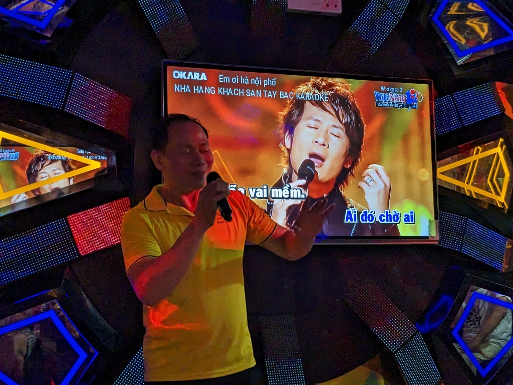
Our hotel in Tuan Giao provided some unexpected evening entertainment with karaoke and dancing.
Our hotel manager singing a Vietnamese love songJoe on the mikeHamish and Chris
Day 7 – Tuan Giao to Son La: no cycling
Our day of no cycling was pleasantly cool. More scenic driving then a visit a huge cave where weapons were hidden during the Vietnam War and also during the oppressive French colonial rule. A rough road went through the cave to a village on the other side and some traffic passed us as we stood in the cave. Later, we toured the notorious Son La Prison where the French imprisoned Vietnamese Communists. This was similar to the French prison in Hanoi. The conditions in both prisons were cruel but despite this they became places where communist ideals were honed.
Son La city has many French colonial buildings and many glitzy new hotels. We stayed in a four star hotel, our best hotel so far, and enjoyed the relatively peaceful pace of the streets. It’s hard to reconcile this with the barbarity of French occupation and the American/Vietnam War.
Street scene – Tuan GiaoView from the cave near Son LaEntrance to the caveTraffic coming throughSon La Prison after it was partially reconstructedA painting depicting the prison during French Colonial ruleCoffee and ice-cream in Son La (French influence)
This is the end of Part 1 of Cycling in Vietnam. We still have five more days of riding and some sightseeing ahead.
At the end of our first quite short day, we enjoyed a wood fire in the main dining room of our accommodation after a not so hot onsen immersion. This is a February hike so warmth at night is essential. We were self-guided, having done all our own planning and booking and, by the end, we were experts in the local bus timetables as they seem to form part of the trek. The towns are also accessible by road so the experience only occasionally felt remote.
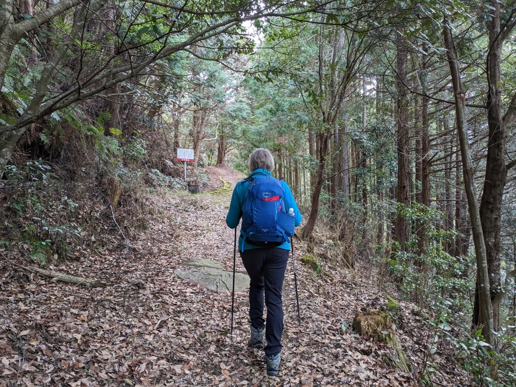
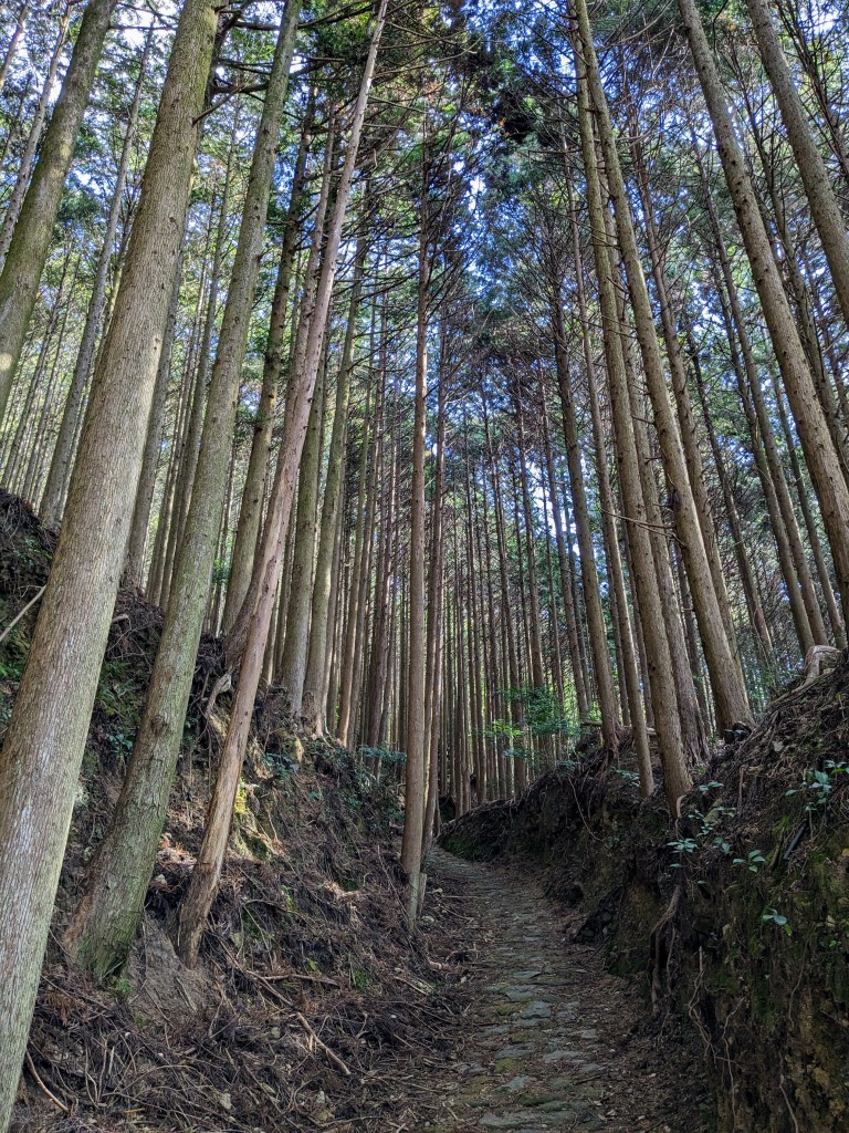
Our first day began with a bus trip from the town of Tanabe on the coast to Takijiri the start of the Nachahechu Route of the Kumano Kodo. The route begins at Takijiri-oji. Oji are subsidiary shrines of the Kumano Grand Shrines that line the Kumano Kodo to protect and guide pilgrims. These shrines house the “child deities” of Kumano and serve as a place of both worship and rest.
It was a strenuous uphill climb through forest, tree roots for steps and leaves and pine needles making a soft carpet underfoot. Signposts abound – it would be hard to lose the way – and pilgrims have been following the well worn path for a thousand years.
Takijiri-oji: entrance to the Kumano Kodo A directional signpost. We had 3.7 to walk.Path near the start“Not” trail markers stopped you from going astrayDescending A fellow hiker (we met very few)Typical scenery on our first dayOjiTakahara Our first night’s accommodation – Kiro-no-Sato Takahara Lodge “Organic Hotel”Our room with a view Hatenachi Mountains from Takahara The hotel onsen
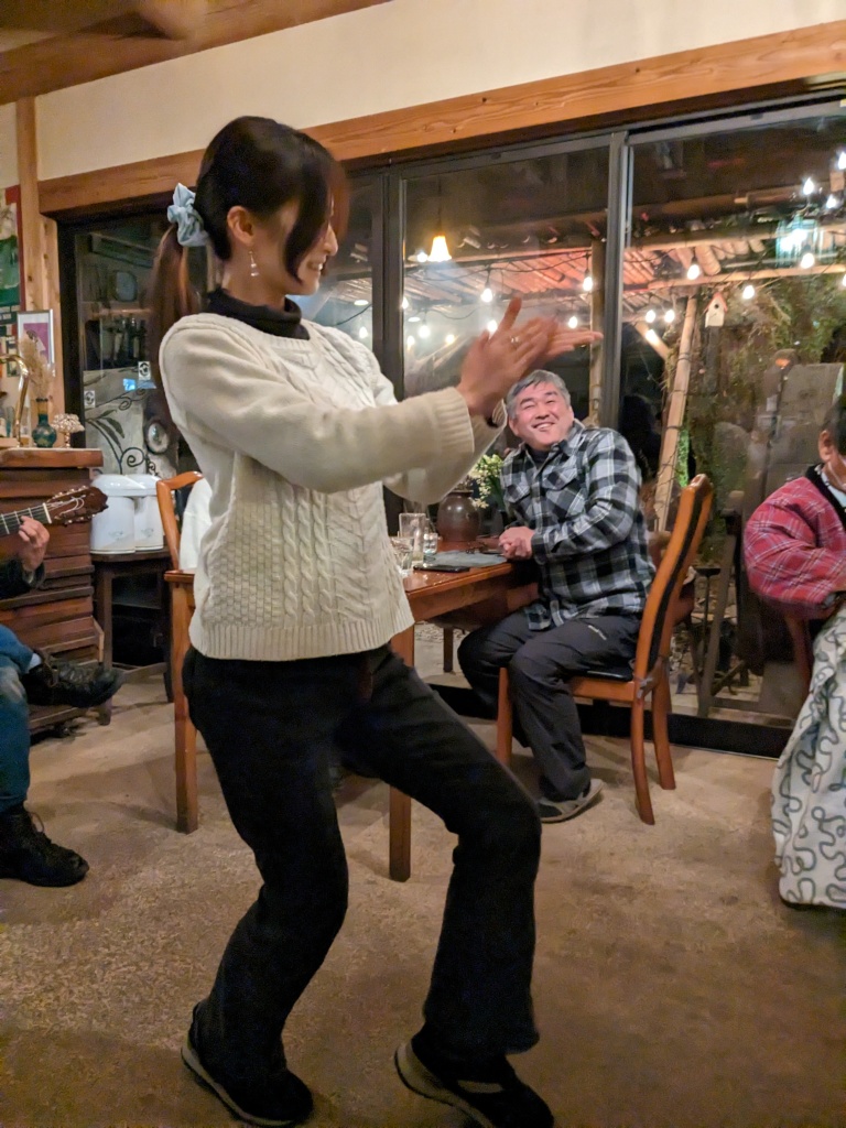
The Kumano Kodo is supposed to be about the walking, the spiritual connection with the way and the path. It also offers other experiences. Our hosts for our first night, Jain and his family, provided one of these experiences. Our evening meal was amazing. There were the usual array of Japanese dishes and morsels but with a plate of Spanish tapas intermingled. The family had lived in Barcelona for two years. Spanish music had been filtering from the sound system. Then our host, an active participant in the serving and describing of the meal, appeared with a guitar and played a beautiful flamenco number then his daughter, Ryo, shyly stepped forward and danced the flamenco in jeans and jumper. Our wine was topped up and a league of gentlemen diners – his friends – produce huge bottles of sake. The party was on. Later, the daughter played the guitar and sang – I now have her link to YouTube and Instagram. Our hosts two musical mates also demonstrated their guitar skills – more classical and some blues. All the time, another guest dispensed snacks from a huge bag. Two other Japanese couples, guests of the establishment, were the only other audience.
Jain, our hostHis daughter, Fyo, dancing the flamencoAnd singing (in English and Japanese)Sake for sharing Chris sampling the sakeThe blues guitarist The classical guitarist
Day 2 – Takahara to Chikatsuyu Village (11 kms)
After a farewell photo we set off from Takahara and climbed steadily up into the forest. Even though the sun was shining it was often gloomy in the forest and views towards the mountains were obscured by trees. However it was silent and peaceful. We looked forward to the numbered sign posts which appeared every 500 metres and the small shrines. The highest point of this part of the trail was the remains of the Uwada-jaya Teahouse at 690 metres. After that the trail descended steeply and came out on a road – civilisation was never far away. We were able to buy a snack and a drink at this point before re-entering an even darker, gloomier part of the forest. After over five hours of walking we reached Chikatsuyu Village, our resting place for the night.
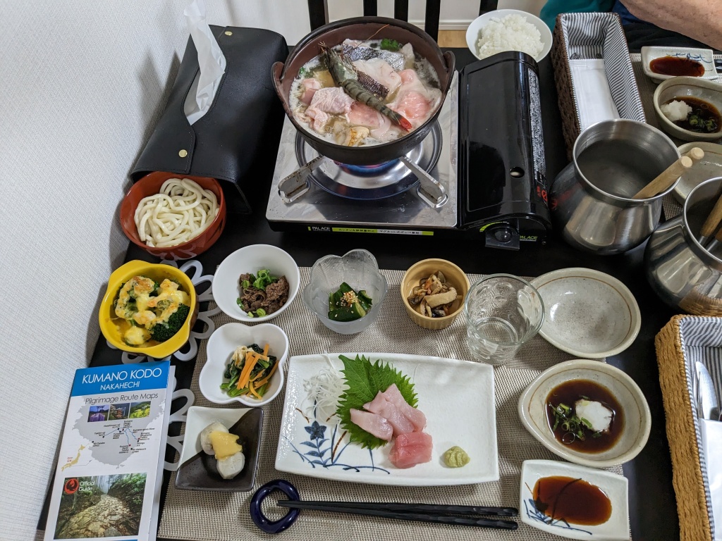
Our accommodation was such a contrast to the first night. It was in the newest house we’ve ever been in in Japan. Our hosts were a couple a decade younger than us. The husband spoke a few words of English but mainly relied on speaking into his phone translator for conversation. His wife relied on smiling. Our bedroom was small with two single beds (not futons on the floor for a change) and the toilets were state of the art with all the buttons a person could require. Our host ran us a deep temperature controlled bath as they didn’t have an onsen. A large and delicious fish hot pot meal, with all the extra dishes, was served in their kitchen-dining room and, in the morning we were back in the kitchen eating a huge Japanese breakfast. Noisy reality TV made up for the lack of easy conversation between us and our hosts although we did manage to communicate a little using the translator app.
On our way – Day 2Into the forest again Tall and straight A rest shelterOjiDescending Stone shrineStonework and damWalking into Chikatsuyu Village Our meal at Guesthouse Housen. The main dish was Nabe (a fish and vegetable stew cooked at the table)
Chikatsuyu Village to Kawayu Onsen(alternative transport)
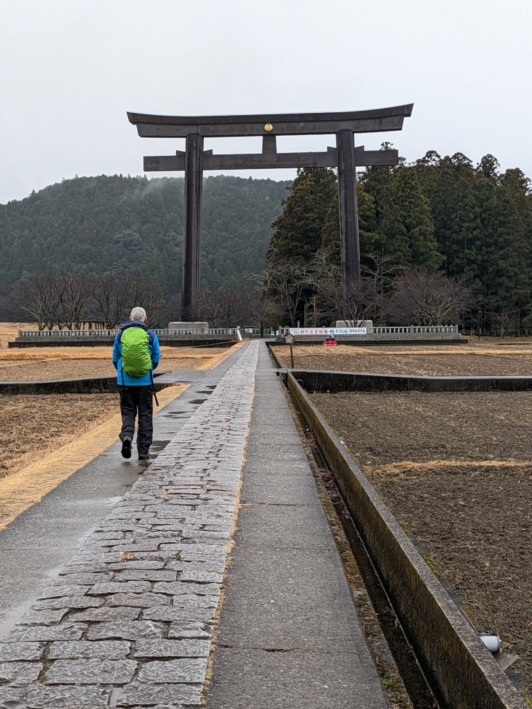
Rain had been predicted.We also felt that the distance to our next accommodation, more than 20 kms away, was unachievable as we have been only walking about 2 kms hour. Our host kindly offered to drive us to Hongu, the town with the largest shrine. True pilgrims that we are, we accepted his offer. Later, we did discover that most walkers use the bus for part of this section anyway. From Hongu we had options. The option we chose was taking the path up and over a steep hill to Yunomine Onsen, a distance of two kms then catching a bus to our accommodation at Kawayu Onsen. The tour leader, Chris, spent a great deal of time studying the bus timetable before we decided on this option and it all went smoothly.
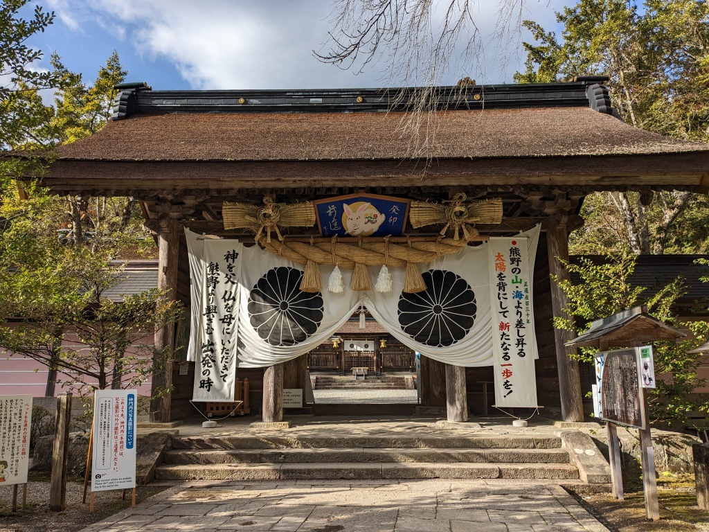
Thankfully the rain stopped while we were visiting Kumano Hongu Taisha Grand Shrine. The shrine was moved from its original location after huge floods in 1889. The Oyunohara O-torii Gate, which, we visited later, remains at the original site of the Grand Shrine.
Our chosen short but very steep and exacting walk was how I imagined more of the Kumano Kodo to be. Moss covered stone steps disappearing upwards into the mist, gnarled tree roots forming steps, towering cedar trees and ferns lining the path. Everything was shiny from the rain and the trunks of the huge cedars, 300 to 400 years old, were like polished mahogany. Even though it was only 2 kms, it was so steep and slippery it took us 2 hours to reach Yunomine Onsen. Thankfully we had our walking poles.
Our accommodation was at Kawayu Onsen, a town on a river with hot springs feeding into the river. It had an outdoor onsen on the river where you could bathe wearing a swimsuit. We had a small room with a tatami and futon and our host served an excellent dinner and breakfast. A young couple were also staying there. Wayne was Scottish and Jasmina was German. It was pleasant to chat with other English speakers over dinner.
Pathway to the Grand Shrine Oyunohara O-torii GateHeading upA path of stoneA path made of rootsTsukimigaoka-jinga ShrineThese giant cedars are 300 – 400 years old.Signpost to Yunomine Onsen Yunomine Onsen – hot springs feed into the river running through the townYunomine Onsen Winter bathing in Kawayu Onsen (near our accommodation)
Yunomine Onsen to Hongu (15 kms)
We caught the bus from Kawayu Onsen to Yunomine Onsen and started on a loop that took us back to the Kumano Hongu Taisha Grand Shrine (the end point for us). Sunshine was predicted but a very cold wind kept us well rugged up all day, reminding us that it is winter. The walking was easier, clearer more open pathways and not as steep so we moved along at a faster pace. The cold also made us reluctant to stop. As on the other days, we were mostly in the forest, either cedar or pine, but a few times we had clear views of the mountains. At our halfway point we rested at the Hosshinmon-oji, one of the most important sites on the Kumano Kodo. “Hosshin” means “spiritual awakening” and “mon” means “gate”. Passage through this gate was a transformational rite marking initiatory death and rebirth in the Pure Land paradise.
We ate out packed lunch – three different kinds of rice balls – in a shelter near a bus stop and resisted the temptation to board the bus which pulled up while we were eating. We settled for a hot coffee from a drink machine a bit further down the road. After this the path went mainly downhill and was in a more repaired condition than other sections. At last, the small torii gate leading to the back of the Grand Shrine and the end of our journey.
A clear viewAkagi-goe Stone Signpost pointing the way to Yunomine Onsen The forest pathNabeware JizoHosshinmon-oji (Spiritual awakening gate)Another mountain view Hot coffee from a machine The torii gate at the endEntrance to the Hongu Taisha Grand Shrine Hongu Taisha Grand Shrine
The Hongu Taisha Grand Shrine was the end of our Kumano Kodo. A winter walk meant we mostly had the path to ourselves. It was a journey of discovery as we were unsure about the route and how we’d cope with the distances. All good though and a great way to experience Japanese scenery, culture and religion.
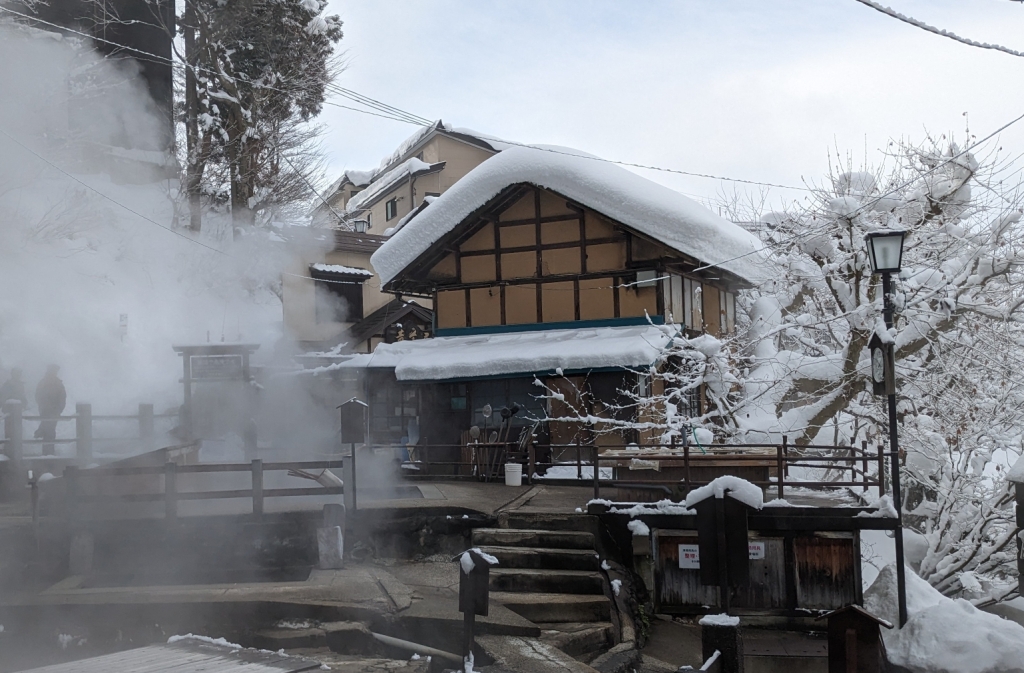
Nozawa Onsen, after a fall of fresh snow, is picture postcard perfect. We’ve left our Ryokan accommodation and are wending our way uphill to the ski fields above the village. The locals are out with snow shovels prising snow from rooftops and clearing walkways. The snow is soft and dry, softly mounded on tree branches, telegraph poles and beside the cleared roads crisscrossing the village.
We have left behind the thirty degree plus temperatures of Victoria and exchanged it for zero degrees in the district of Nagano in Japan. The journey to get here was long. It involved car, planes, a bullet train and a bus and took over 48 hours from leaving Yackandandah. Skiing at Falls Creek seemed like a much easier option until we experienced the magic of Nozawa Onsen on our first evening.
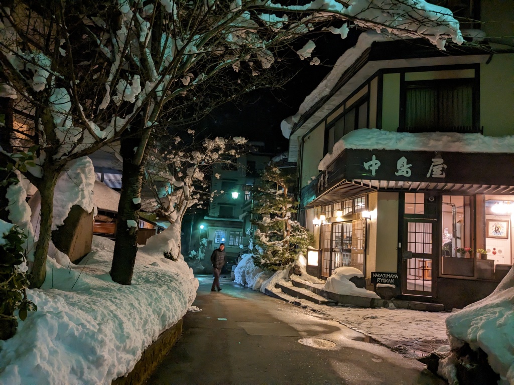
Nakajimaya Ryokan (on the evening of our arrival)
Nakajimaya Ryokan, provides Japanese style accommodation: futons for for sleeping, traditional breakfast and a private onsen. For those in our small group who are skiing, the ski slopes are a ten minute walk up the hill. Nozawa Onsen promotes itself as both a hot springs and ski resort. There are thirteen bath houses in this village using 100% hot-spring water. One of the oldest onsens, Ogama, is reserved exclusively for the people of the village. It has water hot enough to boil an egg and that’s what the locals use it for.
Our room in Nakajimaya Ryokan Breakfast at Nakajimaya Ryokan
Nozawa Onsen’s hot springs were, as legend tells it, discovered in the 8th century by the monk Gyoki. In 1870, there were 24 inns in the area, with 24,863 visitors for hot-spring cures. The tourists still come for the onsens but in winter they’re here for the powder snow and skiing. That’s why we’re here although I’m not a downhill skier so, on this trip, I’m a snow tourist. On our first day Chris, Peter and Sam sorted out their hired gear and I trailed along to see what I was missing out on. The slopes looked daunting to me but fresh snow fell before our arrival – 75 centimetres – and the prospect of great skiing in powder had them very excited.
Chris ready to skiThe highest point of the ski areaView from the top of the ski runsFrozen tree scape
A walking tour of Nozawa Onsen
On our second day, while the others skied, I walked the village streets, first in lightly falling snow then, towards midday, the snow stopped and the sun came out. Mushroom caps of snow were mounded on everything, soft and fluffy on cars, rooftops, trees and any flat surface. The layout of the village is a maze but as the streets go either up or down I often wound up back where I’d started passing small shops, houses, traditional onsens and, higher up, shrines tucked into the snow and a stand of magnificent Japanese cedars.
A traditional onsen – Kawahara-yu inCedars in the snowYuzawa ShrineThe corner shop. The owner made amazing potteryThe potter and her workNakajimaya Ryokan Dosojin: The gods of marriage and healthy children Drink machine and another version of carved dosojin
Dining Out
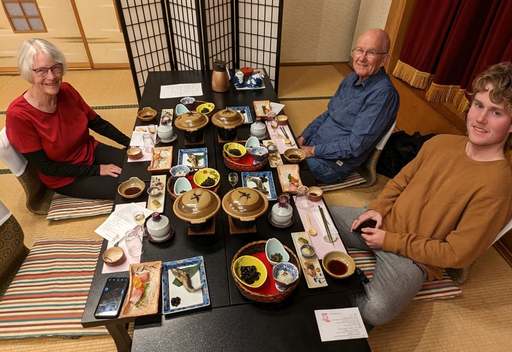
By my second day of wandering I felt I was mastering the layout of the streets, however, I kept coming out of laneways in surprising places. We have eaten each night in different restaurants and, because places look different at night it’s been interesting to come across them in daylight. Bland facades have opened up into warm and welcoming interiors serving delicious food. The meals haven’t all been Japanese; kebabs, tapas, pizza and pancakes have alternated with okonomiyaki (Japanese pancake), gyoza, dumplings, tempura, grills, soba noodles and sukiyaki. Some of these appeared as part of a banquet served in our ryokan. The village also has many bars; it is a ski village after all and Australians form a significant part of the winter population. We’ve particularly enjoyed the gin and tonics, locally brewed beers and sake.
Okonomiyaki restaurant Okonomiyaki made on a griddle The banquet served at Nakajimaya Ryokan – the main course was Shinsyu trout or porkWood ear mushroom & PicklesA smoky grill meal in a tiny restaurant – you pay by the stick
Further afield – Zenkoji Temple (Nagano)
Our host, Yukiko, recommended a visit to Zenkoji Temple at Nagano. This involved a bus from Nozawa Onsen, ten minutes on the Shinkansen and a local bus from Nagano to the temple. Buying the correct ticket and being on the right platform was the most challenging part of the day. I did manage to get myself there and back. I met a young woman on the bus who spoke no English but was keen to take my photo and have me take one of her in front of the temple gate. Gesturing is a universal language. My presence is recorded standing at the Sanmon Gate which dates back to 1750.
The temple is 1400 years old. It was founded in the 7th century and houses the first Buddhist statue to be brought into Japan when Buddhism was first introduced in the 6th century. Nagano, the town, grew up around the temple. Nagano now has a population of about 400,000.
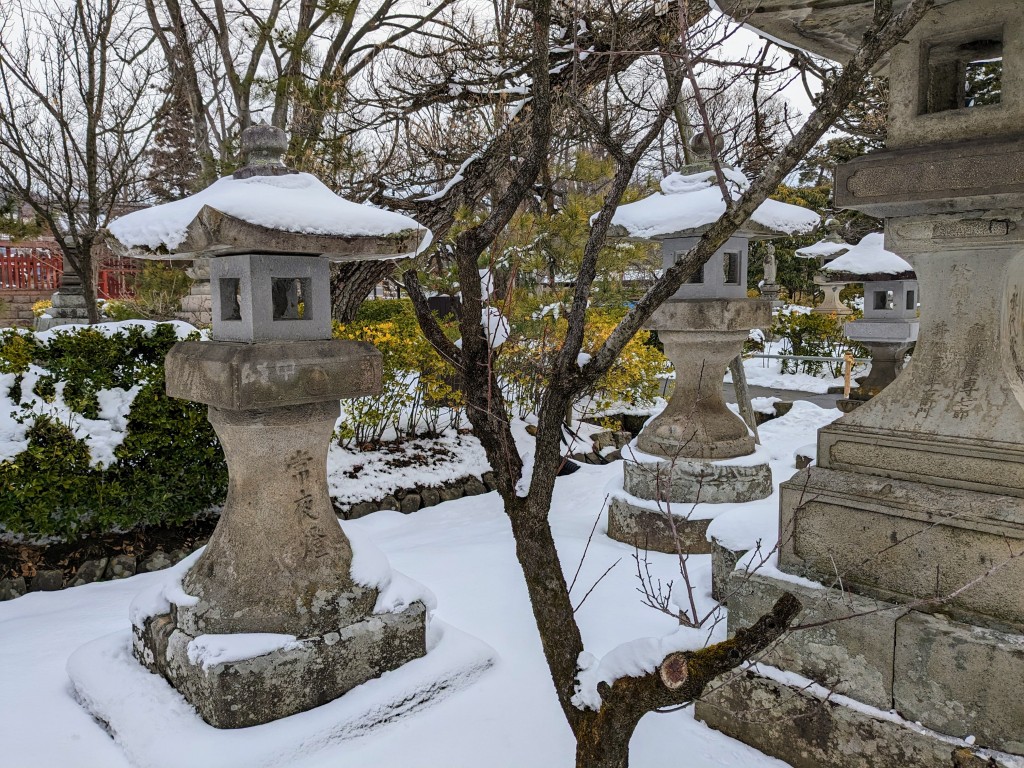
After looking inside the main temple, I spent an hour wandering through the gardens and array of small shrines topped with mushroom caps of snow. Splashes of colour were provided by a red camellias and red Nandina berries nestled amongst their russet leaves. Peaceful and perfect.
Sanmon Gate – entrance to Zenkoji Temple Zenkoji Temple Back view of Zenkoji Temple Winter flowering Camelia Small shrines Nandina leaves & berries
Further afield – Excursion to the snow monkeys
This was an afternoon activity for the four of us – a break from skiing. We went by a small bus to Jigokudani Yarn Koen, a park where monkeys can be observed in their natural habitat. The wild monkeys enjoy bathing in the hot springs in winter just like we do and because the area is covered in snow, they are called snow monkeys. It was an hour by bus followed by a walk through a forest of tall straight cedar trees along a wide but icy path for another thirty minutes. The monkeys are oblivious to the humans crowding around their hot spring pool. They were very entertaining and photogenic. In another area by the river the younger monkeys spent their time scampering about, play fighting and annoying their mothers.
Bliss is being checked for fleasDry and fluffy Enjoying a warm swim The monkey poolMotherMother and offspring Just posing
Snowshoeing
I enjoyed the company of Taka (guide) and two young Japanese women on an afternoon snowshoeing tour. Taka was very knowledgeable and patient, guiding us through the soft snow around a hotel complex and then around Hokuryu Lake, a heart shaped lake not far from Nozawa Onsen. It was a sunny afternoon: the snow sparkled, the distant mountains were clear and the cedar trees shed a fine rain as the sun melted their snow load.
Part of our tour around the lake was crossing to a small island on a snow covered bridge. The island is home to shichifukujin statues. In English the Seven Lucky Gods or Seven Gods of Fortune. We stopped near the statues for hot chocolate and a snack. It was a beautiful setting with the lake a smooth expanse of ice dusted with snow and bearing the delicate tracks of small animals. Anything heavier would break the ice. The lake was surrounded by forest, mostly Japanese Cedar, with beech higher up.
The view starting outSliding down on a plastic bag!A frozen Hokuryu Lake The snowshoeing teamThe path beside the lakeMe & the girls One of the Seven Gods of Fortune fortune
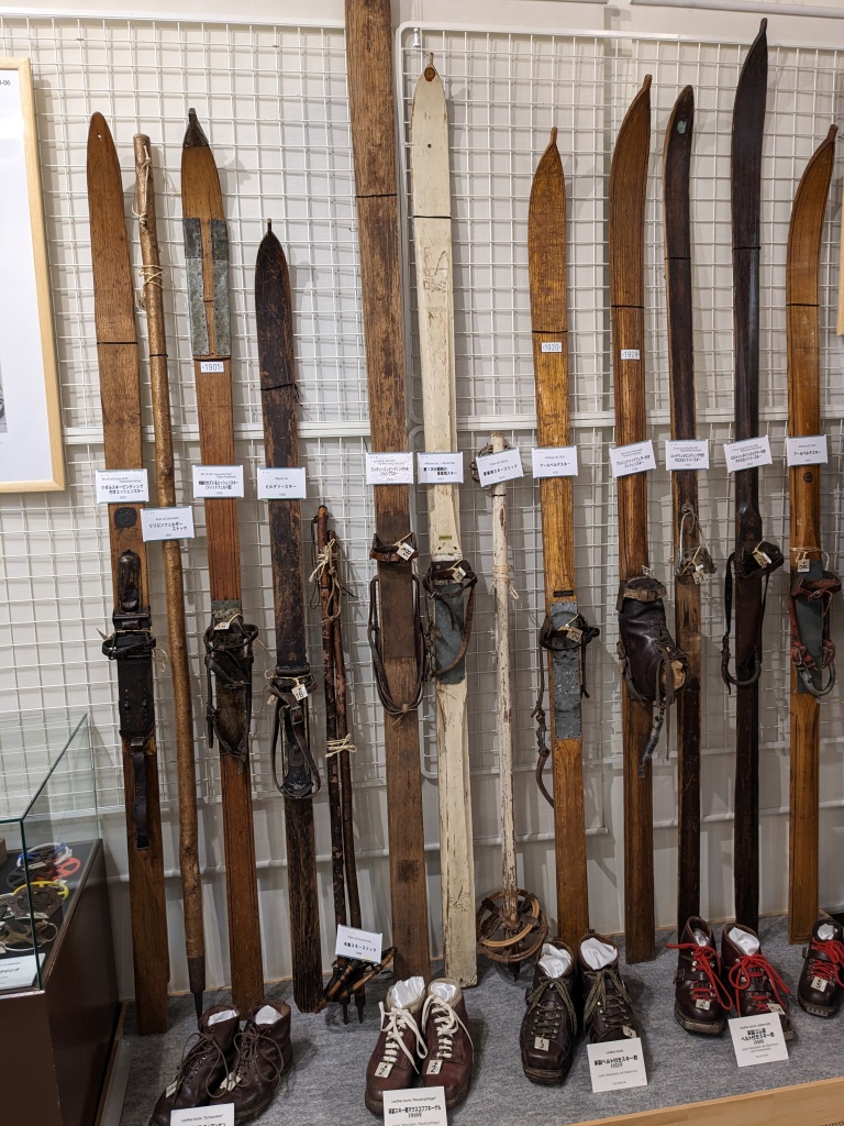
Museums and a day in Iiyama
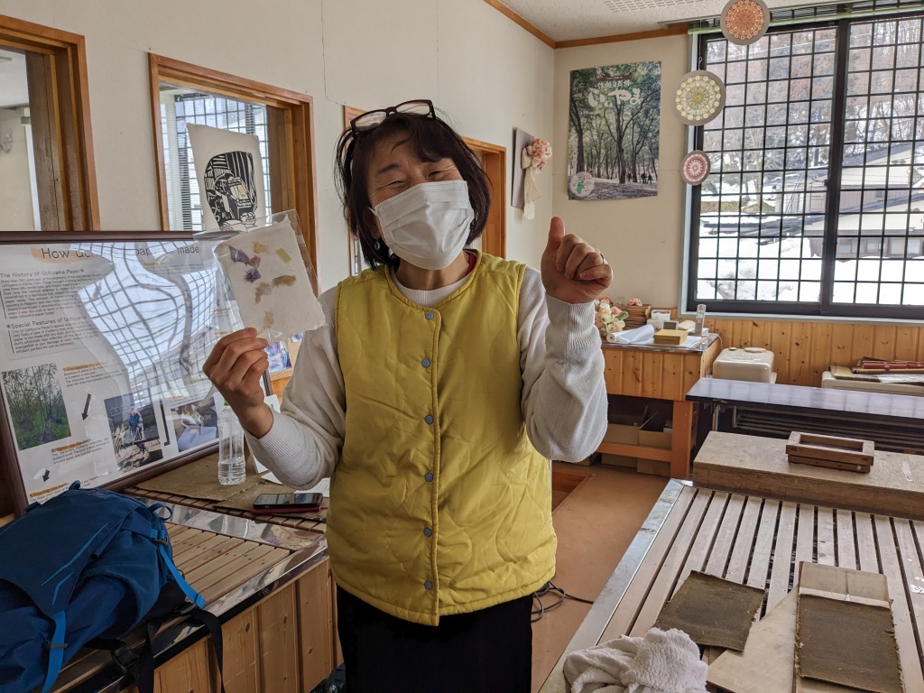
Nozawa Onsen has three museums. One was dedicated to a Professor of Literature and song writer, another to the history of skiing and a smaller one to ceramics. I visited them all. On our last day I caught the bus to Iiyama, 25 minutes away, where there was a doll museum and a paper making workshop. The photos tell the story.
The Takano Tatsuyuki Museum on Nozawa Onsen Ceramics Museum – Korean VaseDisplay of early skisDoll museum Ilyama – mostly depictions of elderly rural Japanese This lovely lady showed me how to make paper
Finally
We left Nozawa Onsen after ten days of great telemarking, skiing and snowboarding (for the boys – 75, 59 & 18) and village tourism for me. We were sad to say goodbye to Yukiko, our host, who had been a snowboard champion in her younger days and was extremely helpful and friendly during our stay. It was also goodbye to our onsen, slippers lined up in the foyer and easy access to a beautiful village.
Depiction of an onsen at the doll museum in IilyamaThe onsen at our ryokan minus the bathersSlippers lined up in the foyer of our ryokan Bev & Yukiko
The end of the first part of our trip to Japan – February 2023
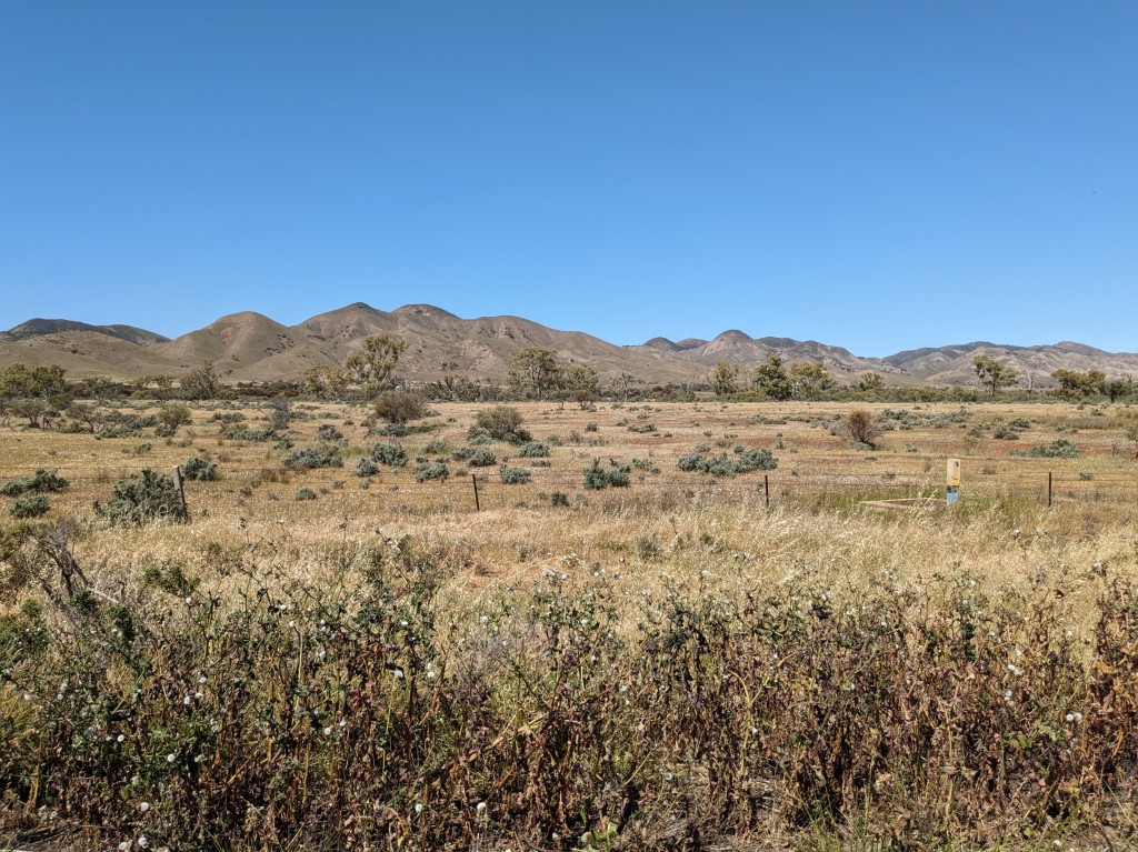
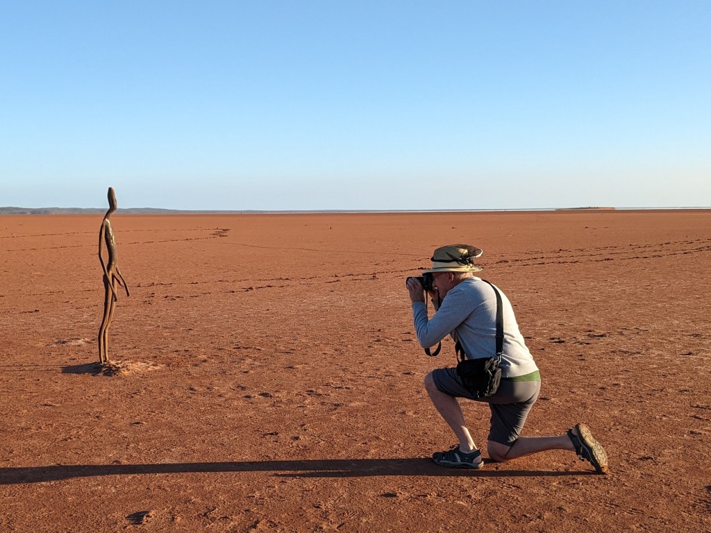
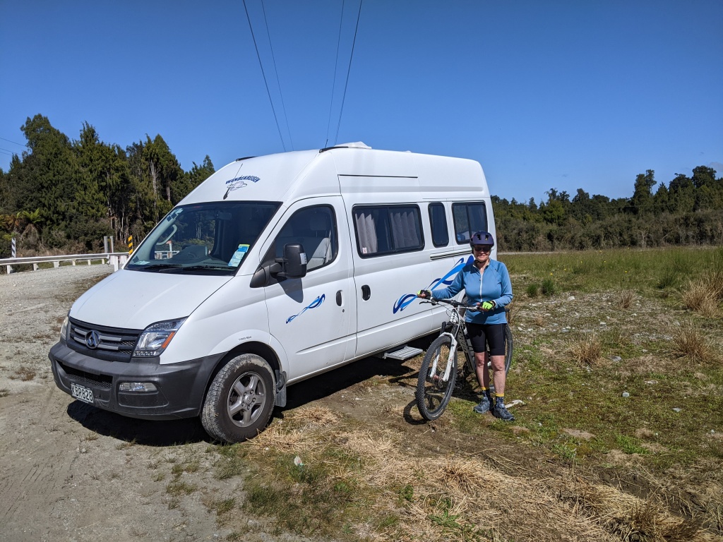
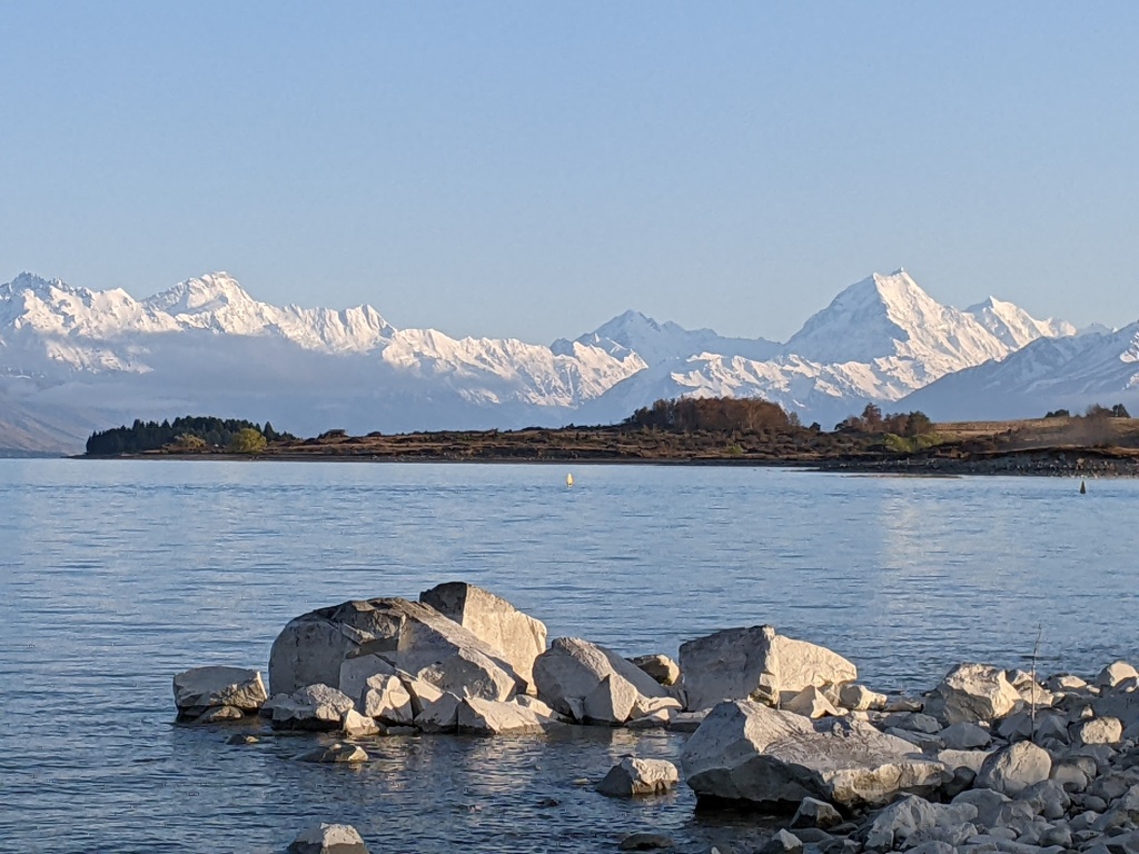
Yackandandah to Lake Ballard (north of Kalgoorlie)
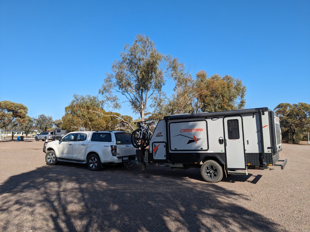
September 8, 2023 and we left Yackandandah in our Crosstrak off-road van and headed west. The weather on the day we packed was foul: wet, wild and windy. The front passed through and our first night’s camp at Koondrook was calm with a tranquil view of a Murray River backwater. It was cold enough for sleeping bags though.
Morning light Koondrook
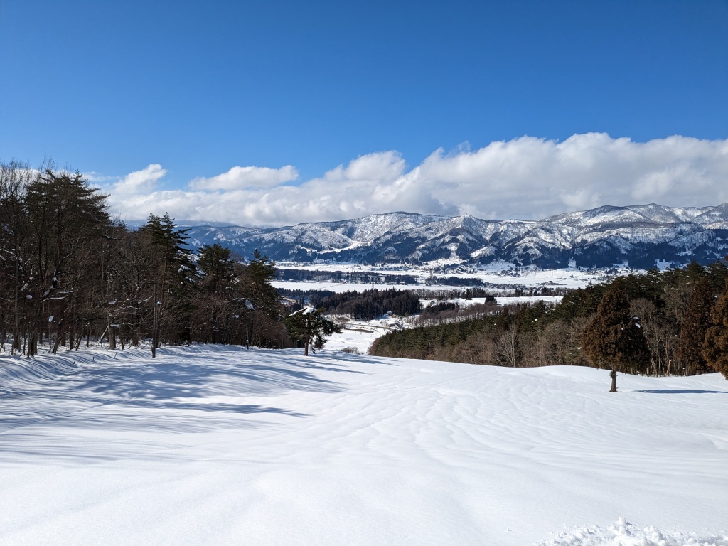
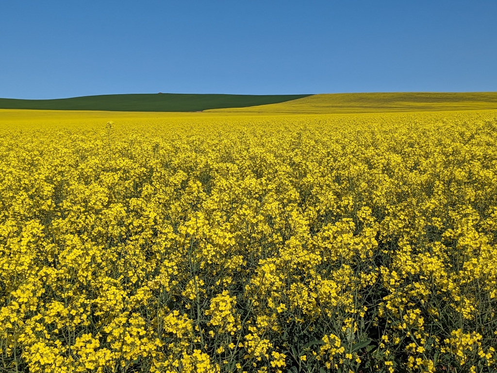
Our second day’s destination was Wyperfeld National Park. The countryside was green, fields of canola a garish yellow. The kilometres clicked by and we were eventually established in Casuarina Campground in the northernmost part of the park. It felt like the journey had properly begun.
Mallee silo artCycling in Wyperfeld NP Our campsite in Wyperfeld NP
The expanses of wheat and canola continued after Wyperfeld with colourful Gazanias on the road verges. Our third night was in Burra, South Australia, a sports’ ground camping experience where dog walkers liked to chat. These typical conversations will occur frequently, Where are you from? Where are you heading? What do you think of your van? Some of the other vans are BIG!
Gazanias decorating the roadside Canola as far as the eye can see
The sun was really shining as we headed towards Port Augusta. A coffee stop in Melrose, biking central and somewhere to revisit, then shopping in Port Augusta and on to Kimba. A hot tip from a Burra camper directed us to the best free camp in South Australia at Kimba. The facilities were great and all they asked for was a donation. We treated ourselves to a meal in the Kimba Hotel.
A morning coffee in Melrose, SASilo art in Kimba, SALandscape near KimbaThe big galah at KimbaKimba Campground – packed up and ready to move on
Onwards, Kimba to Streaky Bay and a view of the ocean. We had a great spot for lunch in glorious sunshine and settled on a commercial van site for the night. The night was very very windy.
Streaky BayStriding along Streaky Bay beachPig face in the sand dunes
We battled strong winds all the way from Streaky Bay to Head of Bight. Thankfully the wind subsided in the evening as we were free camped in a very desolate and exposed area just off the highway. Our intention was to drive down the side road to the Head of Bight to watch the southern right whales in the morning. This we did. Fantastic views of cliffs, ocean and whales and their calves. The females nurture their calves here in the sheltered waters before starting on the long journey south to Antarctica. We were fortunate to see several mothers and calves swimming and feeding directly below the walkway.
Head of Bight looking westMother and calf southern right whale Mother aloneThe calf is feeding as the mother floats on her backWhale and Southern Ocean
We were only about 15 kilometres from the Nullarbor Roadhouse, our next destination, so after spending the morning whale watching we established ourselves in an isolated corner of a very open campground, ate a picnic lunch then drove inland to visit a cave system, Murrawijinie Caves. The caves weren’t extensive but the largest one had a wall of aboriginal paintings.
Murrawijinie CavesHand print and carvings at Murrawijinie CavesNullarbor Roadhouse – our quiet cornerThe view from our van across the plains
The section of road after the Nullarbor Roadhouse is 146 kilometres straight with not much to see. When the road comes close to the ocean cliffs you can visit a few viewpoints and look back at the cliffs, a bastion against the swell of the Southern Ocean. We had a night at Cocklebiddy Roadhouse in another bleak spot before a final day on the road to reach Kalgoorlie. Our soundtrack was a talking book – Working Class Boy – Jimmy Barnes.
Looking eastThe start of the long straight stretchStraight aheadThe vegetation did improve Free campground near Kalgoorlie
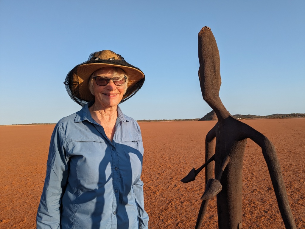
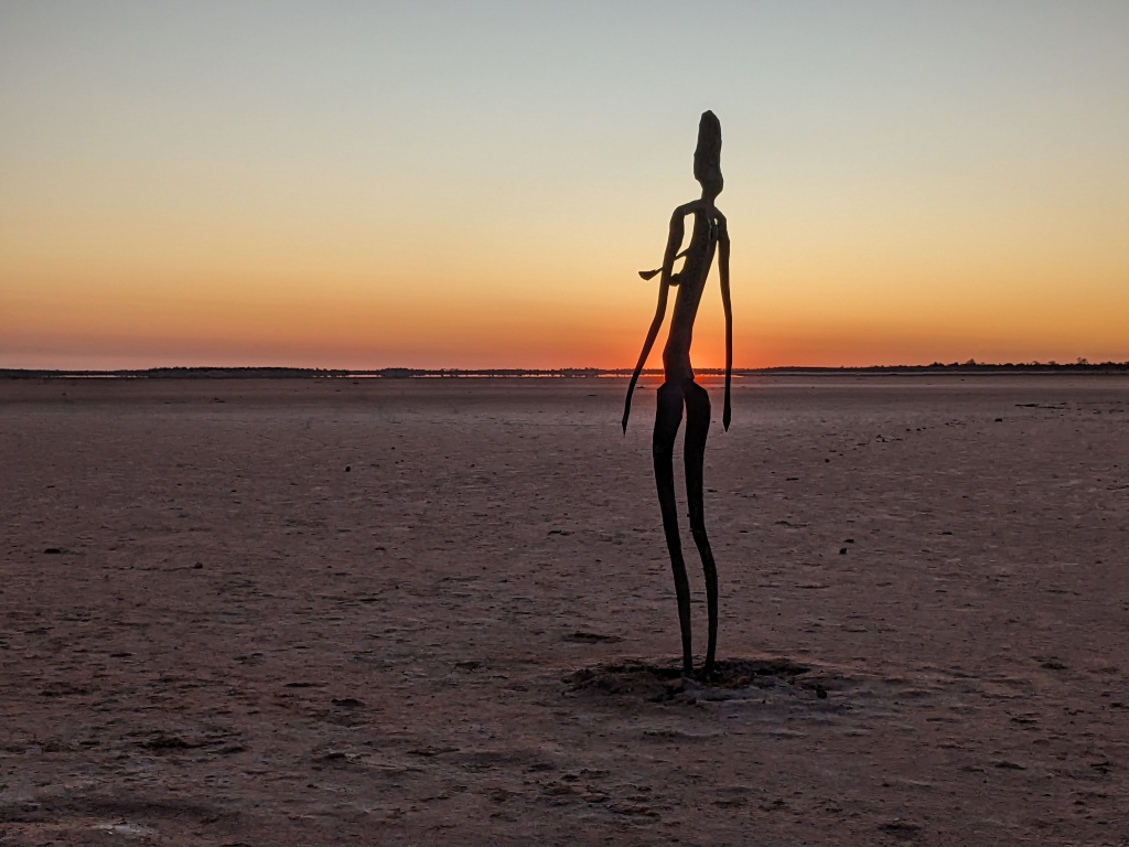
After shopping in Kalgoorlie we drove north to the old mining town of Menzies then on to Lake Ballard. Lake Ballard is a salt lake and the natural gallery for 51 sculptures by Antony Gormley all derived from laser scans of Menzies inhabitants. There is a free campground on the edge of this vast salt lake and the viewer is required to walk on the lake and visit each figure. The setting and carbonised steel figures are surreal, particularly striking at sunset and sunrise. We were able to enjoy both.
Lake Ballard Lake Ballard campsite
The next part of our journey will take us through wildflower country – Southern Cross to Kalbarri and Shark Bay.
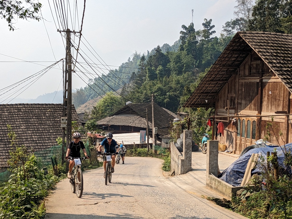
Our cycling tour in Vietnam continued with the twelve members of the group becoming fitter and cooler as rain brought relief from temperatures in the mid-thirties. In Moc Chau we awoke to rain. Our departure was delayed as no one wanted to ride through traffic in the rain and our luxury hotel was too nice to leave. Anyway Joe cracked the whip and had us riding through the streets of Son La by 9.30 am. The rain had stopped. The city traffic wasn’t too bad and the roads were wide. It was up and down then up and up. Spectacular scenery: misty mountains, rice paddies in the valleys, coffee bushes and banana trees on the precipitous slopes, villages and farms clustered close to the road. It was a steady climb and I kept peddling. It’s a given the others on the tour will make it! After some pleasant down hill and gentle up and down the road climbed steeply and my legs rebelled. Tung, one of our guides, suggested he call the van to come back and I agreed. Chris rode on. Soon after, there was confusion about direction and everyone, including the vehicles, wound up on the wrong road. A restaurant provided us with a meal, the usual selection of stir fry, and a new route to the main road was selected.
This turned out to be quite beautiful: a back road down a narrow valley populated by Tay people. The Tay women are particularly striking. When they marry they twist their hair into a topknot. This is often concealed by colourful scarves and, when they’re riding motor scooters, by helmets perched up high or helmets with an extra dome to accommodate the hair. Many of the houses looked quite prosperous. I had opted to stay in the van but regretted it as the riding was consistently flat and scenic. The day ended with a two hour drive to Moc Chau where we were accommodated in a homestay.
Leaving our luxury hotel at Son LaSon LaInto the countryside Looking down The first long climb upFarms and rice paddies Our guide, AnhTay farmers off to work Young Tay girl
Day 9 – Moc Chau to Mai Chau
A stormy night. The plan was to drive for half an hour to the top of a hill and ride from there. As we drove up, the mist became thicker and thicker to the point where we could hardly see the truck in front. No one was keen to ride. We drove on until Joe declared it was safe. Our riding jackets were oranges and lemons so we felt confident we could be seen and there was virtually no traffic. Tung did say, ‘Buffalo are worth more than a scooter so don’t hit a buffalo.’ Good advice. The descent was long and not particularly steep, about 25 kilometres. Then a 200 metre climb up and 10 kilometres on the main road followed by a narrow side road to our homestay accommodation. The mist cleared as we descended so we could enjoy the lush vegetation and, lower down, small roadside villages and rice paddies. Anh rode with Chris and I at the back and she did say my husband takes lots of photos.
We were at the accommodation in time for a late lunch. Most of the group went for a walk around the rice paddies and village where knick-knacks, clothing and weaving were for sale in abundance. In the evening we were treated to a concert of traditional music and dancing before dinner.
Reluctant to rideAfter being convinced we could ride Riding downAnd aroundThings became clearerDownhill Our room in our homestay Foot loom weaving Traditional dancingTraditional dancing Leaving our homestay
Day 10 – Mai Chau to Pu LuongHomestay
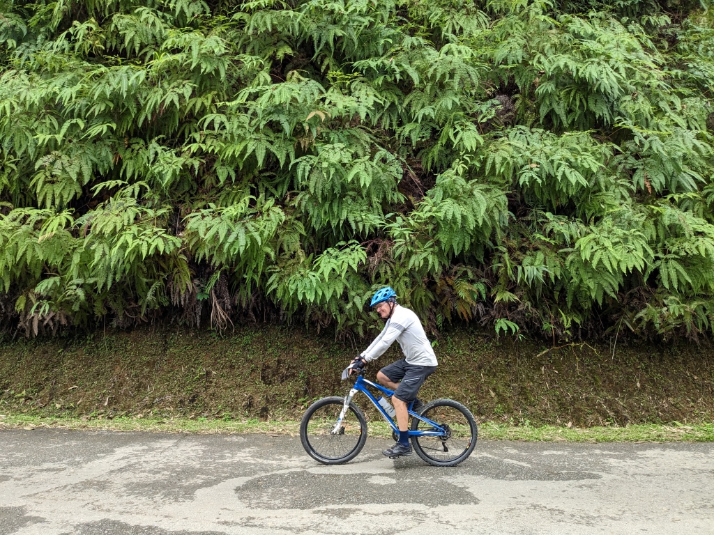
Some days are better than others. This wasn’t one of them for me. It started well with a racy slightly down hill stretch on a main road. We misplaced Hamish so had to hang about on the corner of a busy thoroughfare until he was located. All was well although confusion ensued about the road we would take. In the end it was a back road connecting to another back road before a long seemingly endless grind uphill. The compensation was that we were mainly riding through lush rainforest with only a few isolated farms and small villages. We stopped for a picnic lunch half way up but this was a hurried affair and we still had way too much climbing afterwards. When Chris and I finally reached the high point and descended a kilometre or so, we caught up with the group who set off straightaway. Two options were on the table and we had to decide quickly. I’m not sure whether we made the right choice but our long smooth ride descent was almost enjoyable. Unfortunately, to get to our homestay we had to go up and down on a very busy narrow road. The van picked us up after four kilometres, thankfully. The homestay looked very picturesque, tucked into the jungle but was crudely built. Soft beds and a good meal salved our aching limbs and the awareness that we’d ascended over a thousand metres became a source of pride.
Not all villages are attractive Street scene The bamboo harvestBamboo forest Roadside flowerChris and fernery Steeper than it looks
Day 11 – Pu Luong to Tam Coc (Ninh Binh region)
Another moist and misty morning. Sixty kilometres. Joe assured us it would be flat with ‘small up and down – no big hills like yesterday.’ He was right. Our bodies are a mixture of fitter but wearier. At least we kept together today and enjoyed a sociable morning tea and then a picnic lunch by the side of the road where the crew barbecued hot dogs. The riding was mainly in a lush river valley with much to see: goats, geese, roosters, chickens, ducks, a buffalo pulling a cart, people carrying bamboo, lemon grass, banana tree trunks and, because it was Saturday and no school, children so many of them wanting to wave and say hello or do high fives. Not a single one asked for ‘lolly’ or ‘pen’. The mothers also wanted to wave and greet us. The vans picked us up just on the 60 kilometre mark and from this point it was a long drive to the Ninh Binh area and four star accommodation at Tam Coc.
Pu Luong Homestay On the road to the homestay Thatched roof house The things they carry Another day begins A view through the bamboo Riding the concrete roadA load of bananas and banana tree trunks Jennie heading into limestone karst country A tranquil lakeGeese out for a walk Robert – valley riding One of so many children Finished for the day
Day 12 – Tam Coc
Excellent accommodation at the Golden Rice Hotel with very nice rooms, a swimming pool and great banana pancakes and omelettes for breakfast. Our final day of riding was around Tam Coc Lake and the river. Easy and flat but misty and wet. The mud and water on the road sent up spray. The result, stripes up our backs. It was pleasant though and more of a sightseeing tour with a visit to the Hoa Lu Ancient Capital, established during the 10th century during the Dinh and Le dynasties and later a pagoda complex set into a hill. At the capital there were hundreds of school children learning their national history and being drilled in team building. Chris and I had a go on a newish e-bike on the return to the lunch spot. Flat roads aren’t much of a test but my comment would be, ‘Too easy.’ We farewelled the bikes, the mechanic and one of the drivers. No more pedalling!
In the afternoon, Joe organised for us to partake in the major tourist attraction of the area, being rowed up a tributary of the Hoang Long River through the spectacular limestone karst country. The rowers alternate between using their hands and feet! The monolith-like rocks rise straight up from the rice fields fringeing the river. At several points the river drifted through caves in the rock. Spectacular. In the evening we organised our own dinner. Some of us chose a massage instead of food, some opted to have no dinner as a late lunch had been substantial. Four of us opted for Indian cuisine – a delicious change.
Gateway at the Hoa Lu Ancient Capital Dinh Bo Linh, founder of the old capital Team building Vietnam style PagodaAnh and JennieThe final stretch in Tam Coc The last wave Boats at Tam CocAllan and Mary-AnnInto the caveInto the caveAn unusual rowing style Heading backComing out of the caveTam Coc night life
Day 13 – Ninh Binh to Cat Ba and return to Hanoi.
The riding now over, we went by bus to Cat Ba. This involved a ferry crossing and a lot of driving. Hazy, as usual. Cat Ba was no longer the sleepy fishing village of our memory. Multi-storied hotels dominated and restaurants, catering for tourists, lined the waterfront. Our hotel was huge and in need of an upgrade and the beds, plank hard and unyielding. (We’ve had several such beds).
Our boat tour in Cai Beo was pleasant but the ever persistent haze/fog/smog limited visibility. The amount of floating rubbish also detracted from the beauty of the bay. Fish farming has become profitable and was definitely contributing to the pollution of the water. Six of us went out in kayaks and Dave took Anh for a paddle as she’d never been in a kayak before. She has been such an asset on the tour. At 25 she is defying the standard path for Vietnamese women of marrying young and bearing children. We were served an exclusively seafood lunch on the boat: prawns, oysters, shrimp, stir-fry squid and fish. It was hard not to think of the polluted water but all of it was delicious.
Back on land, back on the bus and back to May De Ville Premier Hotel in Hanoi. The journey over.
Ferry crossing to Cat BaPlenty of seafood Cat Ba waterfrontDwellings and fish farm in Cai Beo Life on the water Cai BeoKarst formation Traditional boatFish farmGroper being fattened for the marketDave and Anh kayakingChris R, Bev, Paul & Anh The groupBack in Hanoi
All journeys come to an end. It was a strenuous ride of about 500 kilometres, often on bumpy and broken back roads with 6,700 metres of climbing over eleven days of actual riding. Thanks to Joe Nguyen and his team at Biking Vietnam for a great experience in an amazing country.
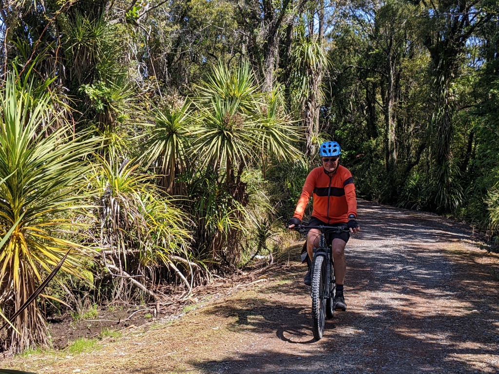
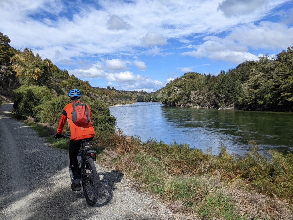
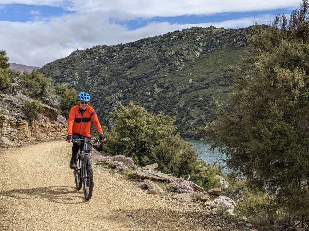
The 132 kilometre West Coast Wilderness Trail is usually completed over four days. We used the Cycle Journeys shuttle service on two days to take us to starting points so that we could cycle back to Hokitika where we had based ourselves with our camper van. The other section we completed as two ‘there and back’ rides from the end closer to Greymouth using our van to shuttle ourselves.
What distinguishes this trail from the others we have done is the amount of forest riding and, of course, a connection with the coast.
Old Christchurch Road to Hokitika
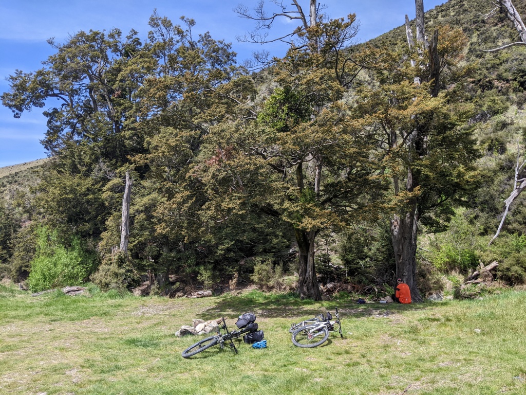
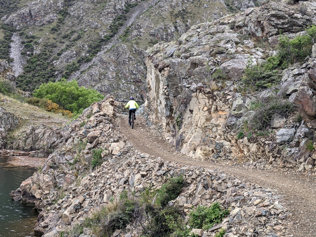
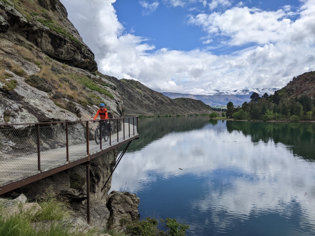
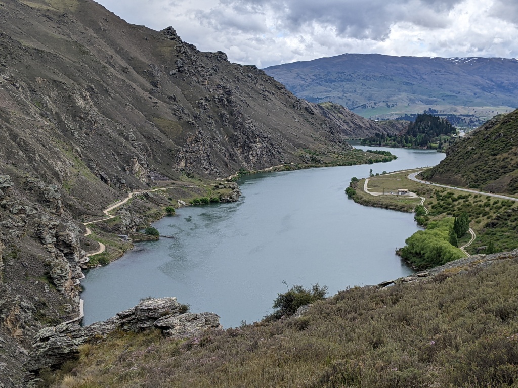
The shuttle unloaded five of us at a point perhaps 5 kilometres from the Kawhaka Intake on the Old Christchurch Road. We were on our non e-bikes, the other three on e-bikes. We never saw them again! Initially the trail was flat as it meandered beside the Kawhaka canal before gently heading up towards the Kawhaka Pass at 317 metres. The area is rich in gold mining history and the water races were constructed to supply water to the goldfields. The ‘wilderness’ trail has its origins in this aspect of New Zealand’s history. For much of the day we were immersed in forest. Highlights of the trail were crossing a suspension bridge at McPherson Creek, winding down through a twisty path of switchbacks after the pass, Cowboy Paradise (quirky accommodation near the pass), crossing the expanse of the Arahura River at Miltown and pausing for lunch on the shores of Lake Kaniere. Sandflies kept us moving and we were in Hokitika by mid-afternoon.
Start of the trail at Old Christchurch RoadTrail beside the Kawhaka Canal Part of the old Waimea Dam built in 1878Descending after the passMcPherson Creek suspension bridgeLooking down on the Arahura RiverThe Arahura RiverLake KaniereA wooden flumeRiding the water race pathThe water race path
Day 2: Ross to Hokitika
The shuttle delivered us and our bikes to the historic gold mining town of Ross. After the gold rush came the timber industry. The first section of the trail follows the Hokitika to Ross Railway which was opened in 1909 to meet the demands of this sawmilling industry. A highlight of this early part of the trail was crossing the old 5 truss bridge spanning the Totara River. After that the trail follows the old railway alignment for 9 kms. It was very straight with wetlands between us and the ocean.
The next section took us to the West Coast Treetop Walk. This provided excellent views of podocarp forest giants. These trees start with a conical shape but shed the lower branches as they grow. They emerge out of the forest with long straight trunks with a crown of greenery.
The final section to Hokitika makes use of the Mananui Tramline. Wetland and regenerated native forest made for shady and enjoyable riding.
The beach at Hokitika Start of the old tramway trail at RossOld 5 truss bridge spanning the Totara River Wetlands looking towards the ocean Podocarp trees from the treetop walkway Hokitika Tower on the treetop walkway Riding the Mananui Tramline Mahinapua Scenic Reserve The Hokitika Bridge Hokitika Beach
A day with no riding: Hokitika Gorge
This was supposed to be a wet day so we decided to declare it a rest day. It rained overnight and into the morning but fined up enough to encourage a visit by vehicle to the Hokitika Gorge. Stunning colour and unfolding vegetation of the ferns. Wekas were everywhere.
Hokitika Gorge Swing bridge over the gorgeYoung fernsWekaNew growth on the umbrella fernsA fern unfurling
Day 3: Paroa (11 kms south of Greymouth) to Kumara and return
We chose not to start at Greymouth because it would have made our ‘there and back’ ride too long. We parked our van at Paroa and started riding from there after a photo on the beach. Paroa is on the coast but the cycle path had a wall of vegetation and dune blocking our view of the ocean. However it was a pleasant pathway through dense vegetation before emerging next to the road. We turned inland after the Taramakau Bridge and followed a designated cycling path to Kumara. We were so impressed by the Kumara Theatre Royal Hotel that we decided to return for a leisurely dinner that night (which we did). Kumara and return to Paroa – pub to pub made for a good day out.
On the beach at ParoaView from the Taramakau Bridge View of the Taramakau River from the Chasm suspension bridge Cycle art along the trail The Theatre Royal Hotel – beautifully restored More cycle artThe trail near ParoaGrowth on a tree trunk The Paroa Hotel
Day 5: Old Christchurch Road to Kumara
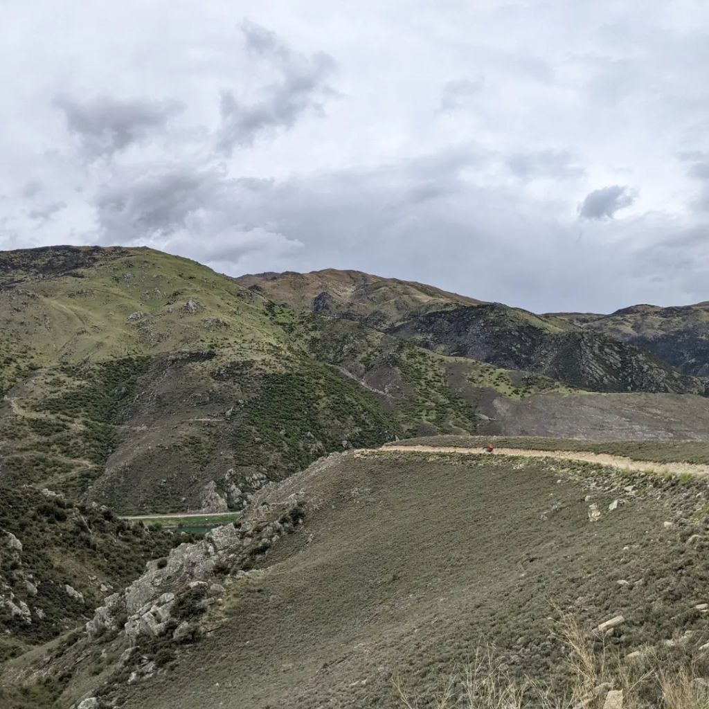
We drove the van from Hokitika to the same starting point as Day 1. This time we rode to Kumara and back. Mostly the trail followed an existing gravel road with short side trips into regenerated forest similar to what we’d ridden on the other days. The area is rich in gold mining history and Kumara is the scene of New Zealand’s last great gold rush in 1876. In its heyday it had 38 hotels! The beautifully restored Theatre Royal Hotel is the only fully licensed hotel left in the area.
Our own personal shuttle and accommodation West Coast Wilderness Trail signpost One of two boardwalks on the trail Part of Kapitea ReservoirKapitea Reservoir Regenerated Forest
So ends our West Coast Wilderness Trail ride. We rode the 132 km (more because of going there and back on the last two days) using only leg power. So many cyclists have e-bikes! The trail was a cobbled together collection of existing gravel roads, old water races, old tramways and railways but always through beautiful landscape. Well worth doing as has been all our cycling in New Zealand.
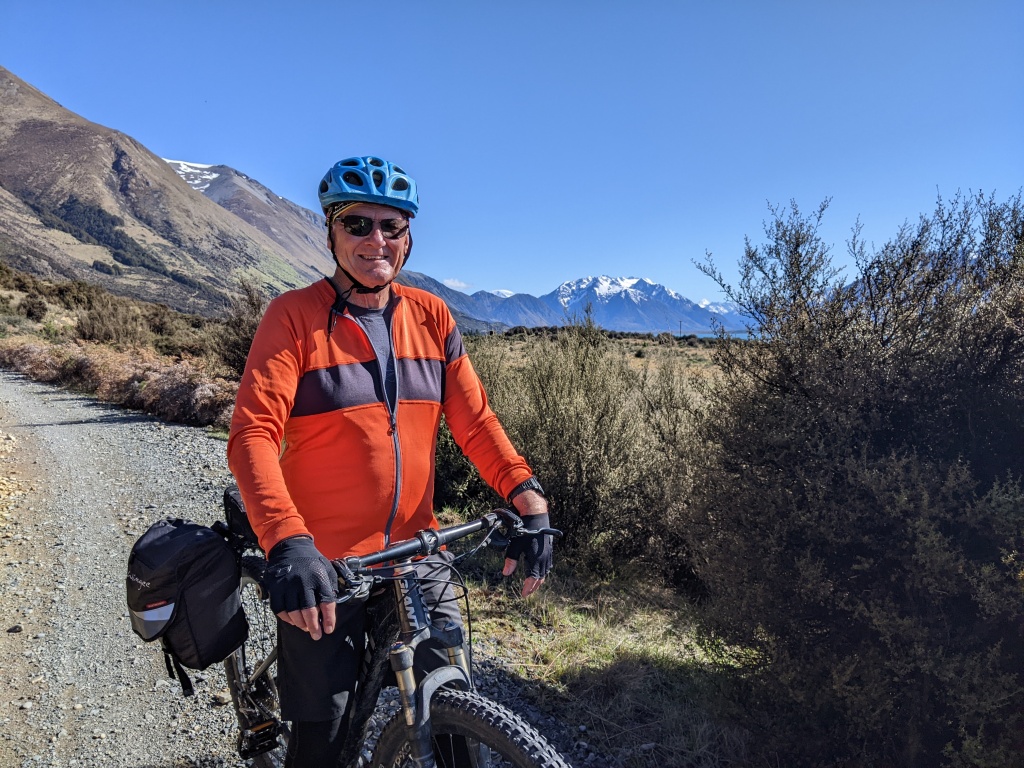
We completed this beautiful and varied ride in two parts, firstly in late September 2022 when we arrived in NZ, and four weeks later after completing the Otago Central Rail Trail and numerous day bike rides and hikes further south. Frequent shuttle services with a company called Cycle Journeys made it possible for us to complete a recommended section and have Chris picked up at the end of each riding day and taken back to retrieve our van. Our only night away from the van was at Ohau Lodge at the end of Day 3 when we returned in late October. Surfaces varied: sealed road sections, rough and rocky tracks but mainly smooth shingle.
Day 1 Lake Pukaki
Day 1 & 2 (late September 2022)
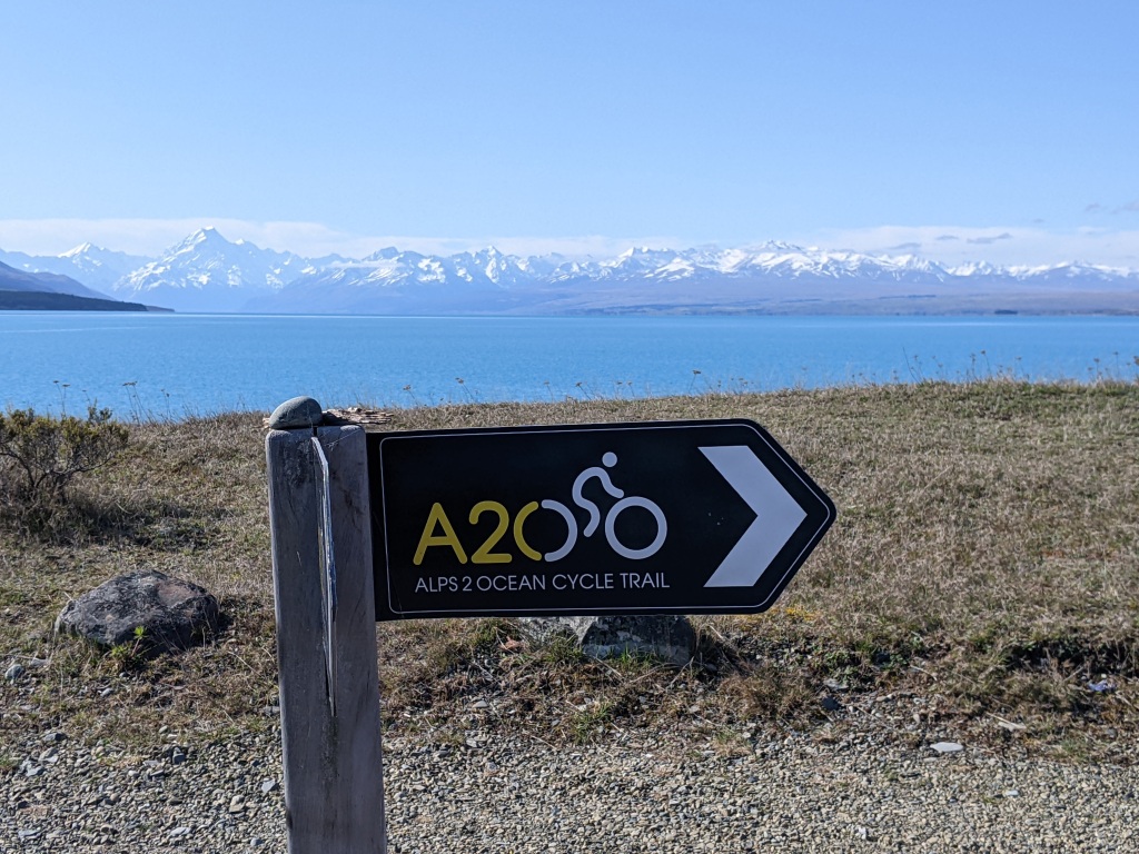
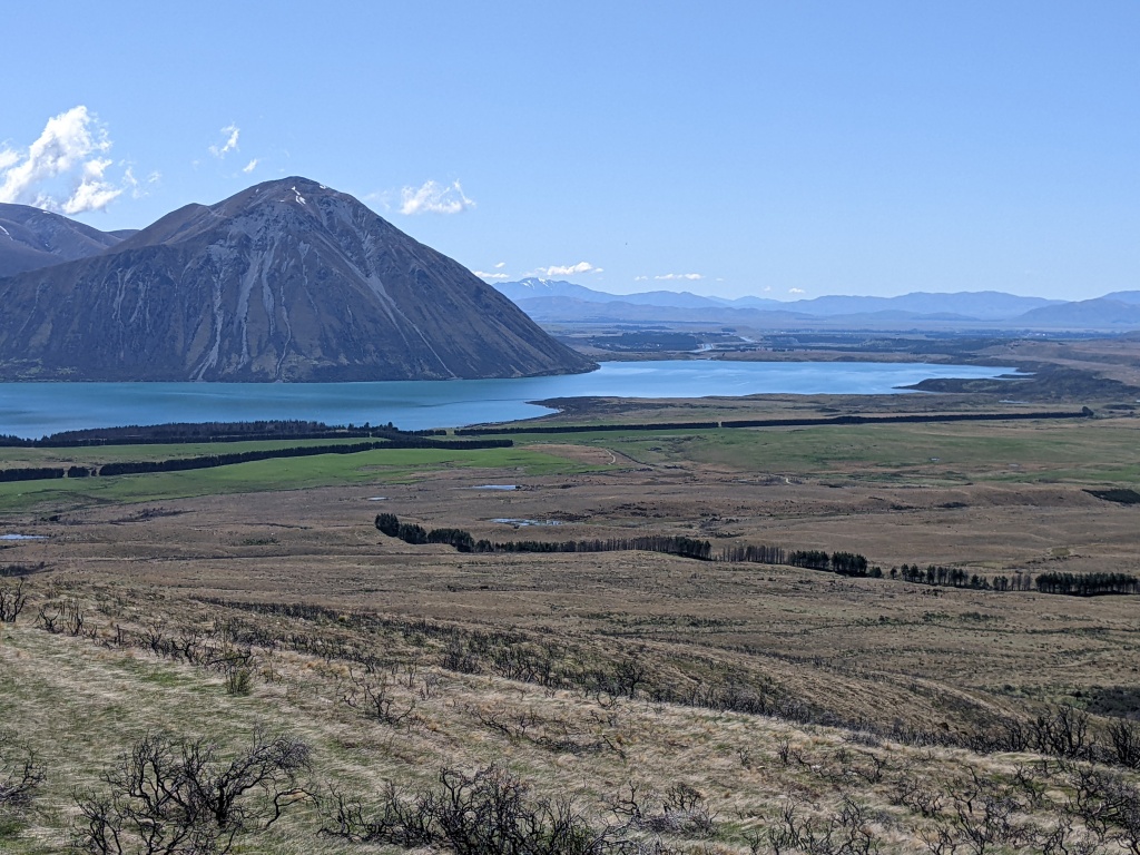
Officially, Alps2Ocean starts at Mt Cook. After a short ride, a helicopter takes bikes and riders over the Tasman River and deposits them at Rotten Tommy. The rough shingle road then heads down the valley hugging the glacial blue expanse of Lake Pukaki to the start of a dedicated cycle trail to the Lake Pukaki lookout. We cycled a section of this road on our first day after a night at a lakeside freedom camp. Mt Cook, which had been under cloud when we started riding, was unveiled as we rode. A spectacular view and a great start to our version of Alps2Ocean.
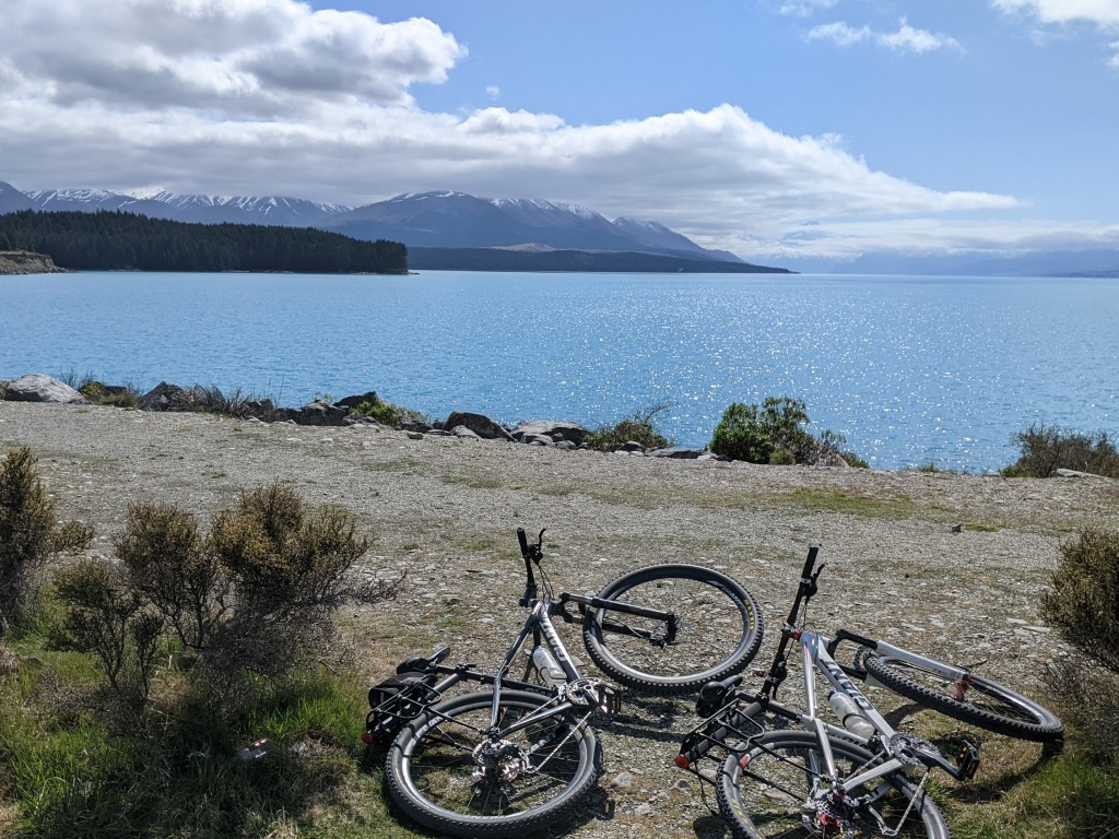
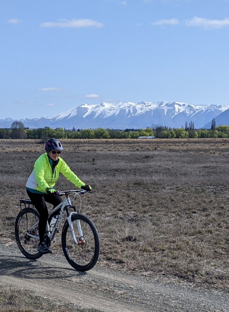
The next morning we tackled the off road trail around the lake to the Lake Pukaki lookout. Mt Cook, a mountain of many moods, was veiled by cloud and the lake was slate grey rather than the glacial blue of yesterday. Still beautiful though. In the afternoon we rode the section to Twizel and back across the brown flat expanse of Pukaki Flats with mountain views as a back drop. Mt Cook was clear again by late afternoon and we spent a second night freedom camping on Lake Pukaki, this time at a closer point to Mt Cook.
Lake Pukaki Mt Cook on our first dayBeer and cheese with a view Alps2Ocean sign On the trail heading towards Lake Pukaki lookout Lake Pukaki Lookout Pukaki Flats to Twizel Morning light on Mt CookEvening light on Mt Cook Freedom camping at the power station on Lake Pukaki
Day 3 & 4 (October 29 & 30, 2022)
Four weeks later we returned ready to complete the journey to the ocean. With a shuttle organised, we left our van at Twizel with the intention of staying a night at Lake Ohau Lodge and being picked up the next day in Omarama. All went to plan. The sun shone as we rode the sealed road section besides two canals before reaching Lake Ohau and cycling on a gravel path beside the lake. Unfortunately the sun had disappeared by the time we reached the lake and the mountain views were obscured by cloud. The last stretch to the lodge was on a sealed road again with mist over the mountains at the head of the lake.
Cycling along the canal out of Twizel Lake Ohau at the weirThe path around the lakeLake Ohau Lodge
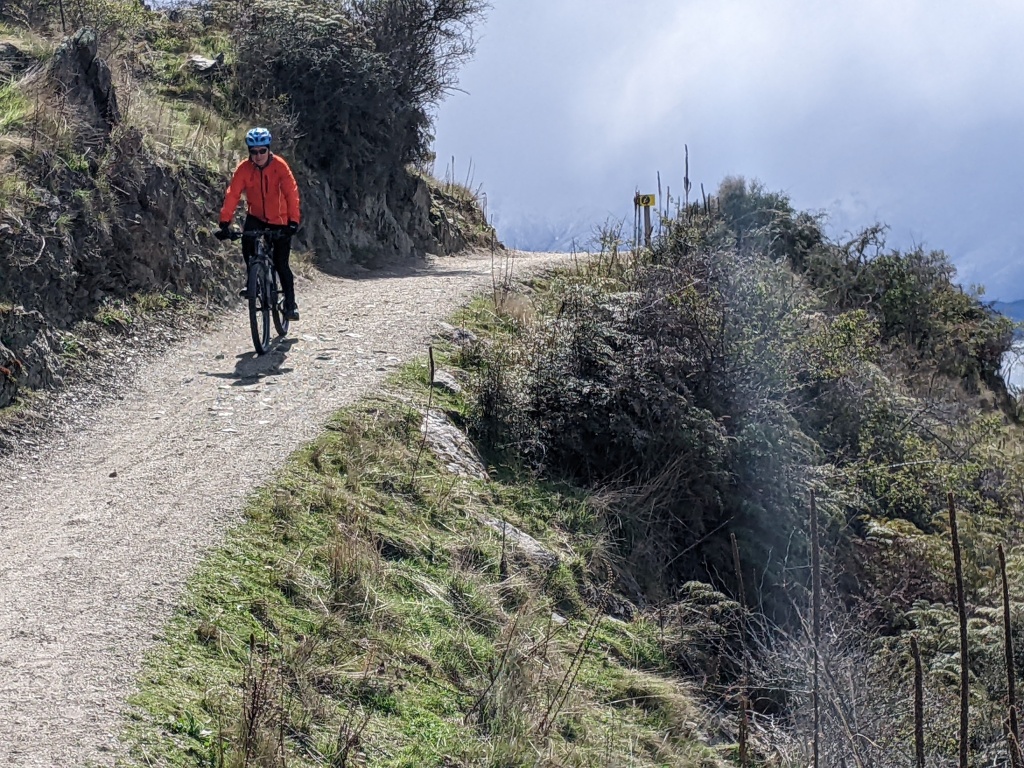
Dinner, bed and breakfast was included in the package and, for a change, we had a bed to sleep in and the company of other cyclists. We woke early next morning to clear skies and a stunning view of the lake and mountains. Mt Cook could even be seen behind the closer peaks. After leaving the lodge we began the climb up to the highest point of the trail at 900 metres. The ascent was steady, at times precipitous but what made it difficult was the large loose rocks that formed the trail’s surface. We bumped and bounced for over two hours. The ride was saved by rest stops to absorb the view of the snowy mountains and blue lake that we were leaving behind. This was the most difficult ascent of the entire Alps2Ocean. The reward was 27 kms of downhill, initially on a rough track, then a shingle and crunchy grey gravel road. We hardly pedalled all the way to Omarama.
Lake Ohau and mountainsBefore the ascentClimbing upLooking back at yesterday’s Lake Ohau routeCreek crossing before the topTarnbrae High PointLunch at Quailburn RoadThe descending road to Omarama
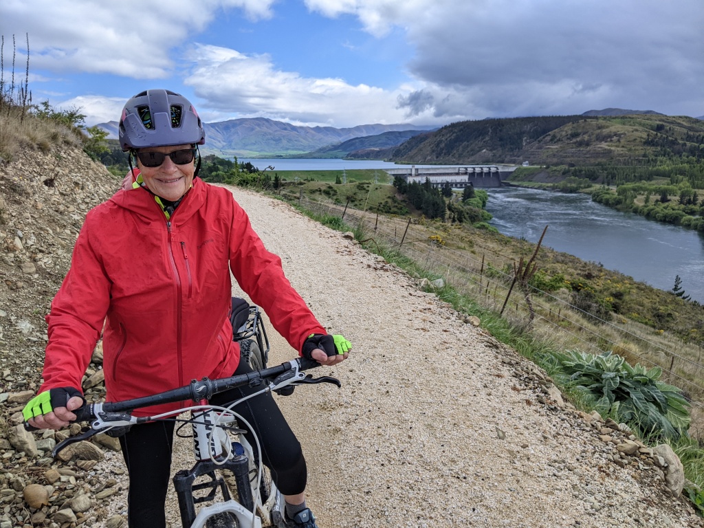
Days 5 & 6 – (October 31 & November 1, 2022) Omarama to Otematata then Kurow
The next two days involved riding around the edge of two huge dams, Lake Benmore and Lake Aviemore. These vast bodies of water have been created by the construction of huge dams. After starting out from Omarama in uncertain weather the trail runs down the Waitaki River Valley before connecting with Lake Benmore. The path was quite benign until a point called Sailors Cutting. From the cutting, the trail was rockier and more precipitous. It was spectacular riding though with views over bays and peninsulas and slab-like rock walls plunging into the water. We kept up a steady pace but it was slow going particularly climbing up to the dam wall. An enjoyable downhill run into Otematata, a beer and later a meal at the Otematata Hotel. Spent the night in our van on the Waitaki River.
On the trail Day 5 out of Omarama Lake BenmoreThe rocky section around Lake Benmore Another oneAbove Lake BenmoreLunch with a view
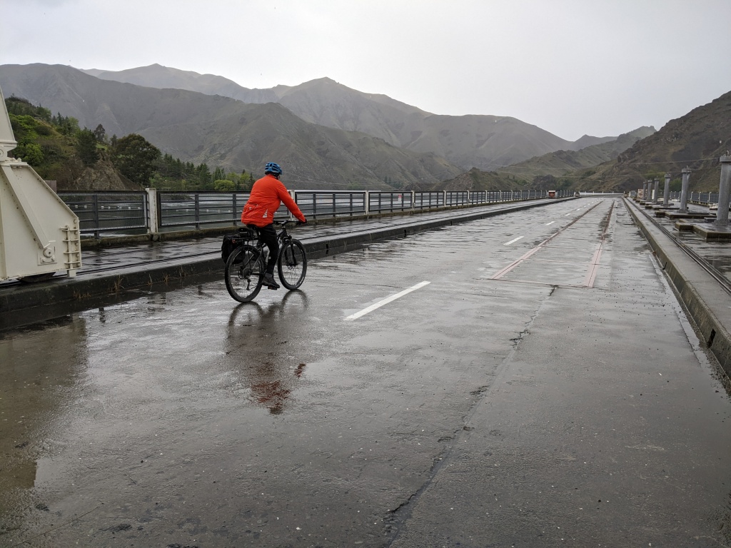
It was raining the next morning as we rode across the Benmore Dam wall and it rained on and off throughout the morning. However, it was smooth and easy riding around Lake Aviemore which came next. On this 22 km section, after yesterday’s rough track, it felt like we had wings. Vacant caravans were parked on every flat spot on the lake shore, ghost towns waiting for summer holiday occupation! We sheltered inadequately from the rain at the Aviemore Dam wall. Tried to be cheerful. Rode on and the sun came out! After the wall, we enjoyed the dedicated cycle trail that mainly followed a fairly busy road down the valley. We reached Kurow by lunchtime, had a very nice cafe lunch and, after Chris had been shuttled back, a night in a caravan park.
A wet ride over the dam wallAfter the rain on the trail beside the Waitaki River Looking down on the trail beside the road
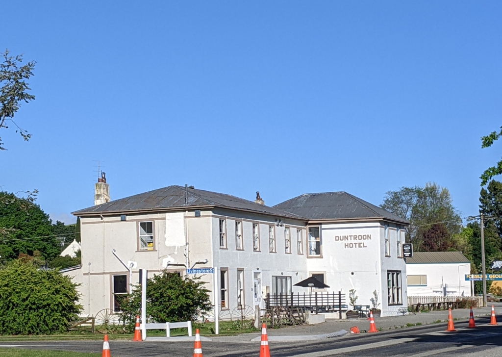
Day 7 & 8 (November 2 & 3) Kurow to Duntroon then to Oamaru
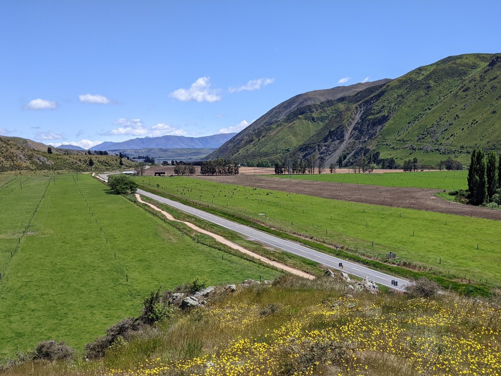
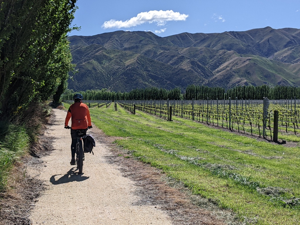
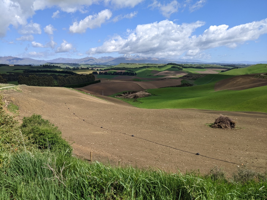
Back to sunshine and a tailwind to push us down the valley. No roads today, a dedicated cycle path all the way. Mainly flat riding past a vineyard, through lush farmland and avenues of riverside vegetation. Closer to Duntroon, the trail wound through a sculptured wetland. Duntroon offered another pub so we lashed out on an evening meal.
VineyardsPaddocksAnd a pub – Duntroon Hotel
Our last day dawned bright sunny and windless. This was to be our longest day with 54 kms to go to Oamaru and the ocean. It turned out to be a varied day, mainly off road, with a visit to Elephant Rocks after an easy 7 km. Often the trail meandered through paddocks with some uphill sections providing great views. There was even a railway tunnel at the end of a gravel road descent. Finally Oamaru and the ocean harbour, the end of the trail. On our version we rode about 300 kms.
Elephant Rocks A scene from Lord of the Rings was filmed hereAn avenue through the paddocksLooking down from the highest point of the dayArriving in Oamaru The end of the trail The end of the trail
New Zealand has embraced the idea of cycling tourism, not just multi day rides but trails that can be undertaken in a day or a few energetic hours. These are a few we tackled in the southern part of the South Island.
GlendhuBay Track
We rode this 15 km track, which follows the shoreline of Lake Wanaka, from Wanaka towards Glendhu Bay. The track is well formed but far from flat with some short, steep, rocky gradients. ‘Watch out for the gnarly bits,’ advised a walker as we set off. I took his advice. Even though we rode it on a grey and cloudy day – it actually snowed after we finished our ride – the views of the lake and mountains were spectacular. We didn’t make it all the way to Glendhu Bay because, for us, it was a there and back ride and those gnarly bits kept on coming.
A rocky descent Towards Wanaka Lake Wanaka and Mt Aspiring National ParkOn the trail Storm approaching
Lake2Lake Trail at TeAnau
This trail links Lake Te Anau and Lake Manapouri and follows the east side of the Waiau River. We thought, because the track follows the river, that it would be flat. Not so. It was quite a rollercoaster with some steep ascents and descents. The most interesting section was a narrowing of the track along a stretch that also wound precipitously up and down through the beech forest. A sign at the start of this advised walking your bike, advice I heeded going one way but ignored on the return. Again, for us, it was there and back and we didn’t ride all the way to Lake Manapouri.
The Waiau River A jet boat on the river Narrow track through the beech forest The Waiau River
Walter Peak (Start of the Round the Mountain Trail)
Walter Peak Homestead
This superb ride is actually the start of the much longer Around the Mountain Trail. It began with a journey across Lake Wakatipu on the steamboat Earnslaw on a perfect blue sky day. Our bikes travelled with us and we rode from the homestead, now really a tourist restaurant, along a grey gravel road to a 15 km turnaround point. The vistas were breathtaking: lush green pastures with grazing sheep and cattle, the blue lake and a snow covered mountain range beyond. Mt Earnslaw is the highest. We watched sheep being herded by working dogs on Nicholas Station and horses grazing with the lake and mountains as their backdrop. When we returned to Walter Peak Homestead we enjoyed a G&T on the patio then a smorgasbord dinner with the evening Earnslaw crowd. Back in Queenstown by 10 pm.
Laka Wakatipu The gravel road we travelled Mt Earnslaw Horses, lake and mountains Sheep and Mt Earnslaw A G&T, a beer and lakeview The Earnslaw arriving with the dinner crowd
Clutha Gold Trail
The Clutha Mata-au River
The starting point for this 73 km trail is the small town of Roxburgh. We sampled a 10 km section from our freedom camping at Pinders Pond, about 10 km from Roxburgh, to a lookout point along the river. The track stayed close to the river with gentle ups and downs. A feature of this trail is the farming and gold mining history described in panels along the route.
The trail and Clutha Mata-au RiverThe Clutha Mata-au River
Roxburgh Gorge Cycle Trail
Hidden Valley on the Roxburgh Gorge Trail
The Roxburgh Gorge Trail starts in Alexandra and finishes at Lake Roxburgh Village. The middle section of the trail requires a jet boat. We chose to ride there and back at both ends, riding a total of 30 km for the day. An impressive feature of the Lake Roxburgh end was a series of switchbacks taking us up above the lake and down again. My switchbacking skill had improved by the end of this section. After the curves the wide, gravelly path stayed close to the cliff face above the lake until we reached the Hidden Valley and turned around.
Lake Roxburgh and wild thymeOn the switchbacks Above the lake
The Alexandra end follows the Clutha Mata-au River into a gorge. The gorge walls are stark and the trail in the gorge section has been gouged out of the rock. For the most part it was undulating with a steep winding descent at Doctors Point where the jet boat would pick you up and whisk you and your bike along the river to Shingle Point. We rode back to Alexandra and our van.
Clutha Mata-au River and Roxburgh TrailNo jet boat Looking back to Alexandra – the Clutha Mata-au River
Lake Dunstan Trail
Lake Dunstan suspended pathway
The Lake Dunstan Trail is an amazing piece of audacious engineering. Everyone kept telling us that it was a ‘must’. We organised a shuttle – Shebikeshebikes – to transport us to Cromwell from Clyde, where we were staying in our campervan. We then road the 42 km trail from Cromwell back to Clyde. The trail links these two historical towns and follows the shores of an arm of Lake Dunstan before hugging the edge of the main part of the lake. The trail has been jackhammered into the cliff where necessary, suspended over the lake in sections and, in the middle, switchbacks take you up and over two precipitous bluffs. At times the trail was close to the edge with a sheer drop into the water. The path is wide though and, apart from a few short sections of twists and turns, two could ride side by side. And there was a boat, two actually, moored in a sheltered bay before the first steep ascent selling hamburgers, waffles and coffee! Very welcome and very enterprising. Fortunately we arrived in Clyde before the rain, tired but exhilarated by an amazing ride.
Our shuttle – all e-bikes except oursAn easy section of the gravel trailSuspended pathway Coffee and hamburgers at the halfway point Looking down on the trail and lake after switchbacking upThe longest bridge on the trail Away from the lakeThe trail seen from the other side the next day
Our next ride will be a continuation of the Alps2Ocean, started in early October.