Cycling in New Zealand: Otago Central Rail Trail

OTAGO CENTRAL RAIL TRAIL

The Dunstan Range Otago Central Rail Trail

We have had many trips to New Zealand. My first one was in 1969/1970 on a student flight. Chris and I spent two months here as part of a long overseas trip. On these and subsequent trips the focus has always been on tramping, mainly in the South Island. On this trip, late September 2022 until late November 2022, Chris and I are here with our mountain bikes to do some of the South Island cycle trails. On our way from Christchurch to Wanaka we rode the top section of the Alps2Ocean with some great views of Mt Cook. We will return to complete this. Our first trail was the Otago Central Rail Trail.

Starting out from Clyde Station

Day 1 – Clyde to Omakau (with a short side trip to Ophir) 44 kms

An icy blast of cold air ripped across NZ two days before we started this ride adding fresh snow to the cover already there and dusting the lower hills. We spent a relaxed day driving in our van from Wanaka to Clyde where we organised a shuttle service to return Chris to our van and move it to a new location along the trail for the first two nights. The third night we planned to do the trail there and back and, for the final section, we would drive to the end point at Middlemarch and have the shuttle take us back to Ranfurly where we’d spend the night in a hotel before riding back to Middlemarch and our van. This was not the conventional way to do the trail, but as we had the van as accommodation, it suited us.

After a night of “freedom” camping we started out from the main street of Clyde. It was zero degrees and we were wearing four layers of clothing, however, the sun was shining and there was no wind.

Chris on the first trestle bridge out of Clyde
Icicles on bare branches and vines

After eight kilometres, on the outskirts of Alexandra, there was a cafe bustling with bike riders, road travellers and locals. It was great to thaw out with a flat white and warm carrot cake before riding on through dry, rocky scenery and following the Manuherikia River upstream. We eventually crossed the river, rode on to Chatto Creek and stopped at the station site to eat our lunch.

Morning tea
Following the Manuherikia River and the Dunstan Range
A trestle bridge across the Manuherikia River
The Manuherikia River

After leaving the river it was a gentle but steady climb up Tiger Hill to the highest point on this section of the trail. We stopped to read the information at the Ganger shed. The board read “Behind the shed with more wrinkles than a bunkhouse blanket, the Merton Hills fill the middle distance. Beyond the Mertons the distant giant schist outcrop is Leaning Rock marking the southern-most summit of the Dunstan Mountains.” The still air was filled with the quacking of geese flying overhead and landing on the dam in the foreground of this scene. Beautiful.

The Gangers shed
The view behind the Gangers shed

The final stretch was an easy downhill into Omakau. We added a short ride to the historic gold mining town of Ophir. Lots of old buildings including the still operational PO. Chris was picked up from Omakau and taken back to Clyde to retrieve our van. I waited in the sun, soaking it up after the cold of the last few days. Spent the night in a council campground on the edge of Omakau.

The old PO at Ophir

Day 2 – Omakau to Oturehua – 30 kms

Another extremely cold start. There was frost on the grass when we woke up but by 9.45am when we started riding from Omakau the temperature had risen to four degrees. The day was eventually warmer if a bit breezier than yesterday and we shared the trail with more other riders, mostly on e-bikes. We moved along at a cracking pace, maybe it was the idea of a coffee at the Stationside Cafe at Lauder a mere 7km from Omakau. Like the cafe at Alexandra yesterday, this outdoor cafe was busy. The coffee and date scone were worth the wait.

Leaving Omakau
A short tunnel with a view
Stationside Cafe
Coffee and a date scone

The next section of the trail was more dramatic. We crossed the Manuherikia River over a long high curved bridge and gradually climbed up into the Poolburn Gorge and through two long tunnels. It was a bit disorienting riding in the dark before the light at the end offered guidance. After the tunnels the trail crossed the impressive Poolburn Viaduct. So much labour to bring a railway through this landscape.

Bridge over the Manuherikia River
The Manuherikia River
Looking back at the bridge
The Dunstan Range behind Chris
The scenery before the rise up to the gorge and tunnels
The first tunnel
Approaching the second tunnel

After the viaduct and tunnels it was gentle riding through the Ida Valley, a vast swathe of green paddocks with sheep, many of the ewes with lambs, often twins, many close to giving birth. Every time we stopped to take a photo the protective ewes would hurry their lambs away.

The trail flattened out as we approached Oturehua and, with more of a wind, it became a slog. The pie was tasty at the old Gilchrist’s Store and our accommodation at the quirky Crowsnest was just down the road. Chris was picked up again as arranged and I dozed in the sun with the Crowwnest’s owner’s dog, Jim.

The Ida Valley
Riding towards Oturehua
The interior of Gilchrist’s Store

Day 3 – Oturehua to Ranfurly and return – 54 kms

A warmer morning with more cloud. No shuttle back to our van today as the timing for the pick up seemed too late and we felt there and back to Ranfurly was within our comfort zone. What we hadn’t taken into consideration was the wind strength!

The trail was flat then rose up gently to the highest point at 618 metres. Other highlights, apart from the snow on the distant range, were the 45 south latitude marker and iron sculptures of the planets. These have been placed to scale along the trail and, because of their size, Saturn and Jupiter, made for impressive photos. From the highest point it was downhill to Ranfurly, passing the original station building at Wedderburn. A tail wind sped us on our way.

Early on day 3
45 south latitude marker
The highest point on the trail
Gazing at Saturn
Mother and twins
Wedderburn – the original station building
The front of Ranfurly Station

The price we paid for having a tailwind on the 25 km ride to Ranfurly was the headwind on the way back. It was hard going as the wind was strong and gusty and the trail was more uphill. We sheltered every 5 kms in the conveniently placed Ganger sheds just to have a break from the struggle. Even when we descended from the high point, we were still buffeted and had to keep peddling rather than coasting. It was a relief to be back at our van. We treated ourselves to an excellent meal at the Oturehua Hotel.

The next day we drove to the end of the trail at Middlemarch where we stayed the night in the caravan park. The shuttle drove us back to Ranfurly the next afternoon. Our plan was to ride the short distance from Ranfurly to Waipiata, stay the night at the hotel, then ride the final 52 kms to Middlemarch on Day 5.

Day 4 – Ranfurly to Waipiata (8 kilometres)

Easy riding with only a moderate headwind and then an enjoyable night in the Waipiata Hotel – great food and country charm.

The Waipiata Hotel
Dinner and wine
Waipiata Hotel next morning

Day 5 – Waipiata to Middlemarch (53 kms)

A cold and cloudy start after a substantial hotel breakfast with the prospect of some sunshine later in the morning and a trail that was mainly a gentle downhill. The most impressive section of the trail was following the Taipei River into the Taipei Gorge. The gorge is dry and rocky in contrast to the fertile green fields we’d been riding through. We also crossed the Prices Creek Viaduct and rode through the Prices Creek Tunnel.

Hyde Railway Station was a museum of railway history and was set up as it would have been in its heyday. Our rest stops all along the trail were mainly spent reading the comprehensive information boards in the reconstructed Ganger sheds or the preserved stations.

Looking at Saturn
A use for old railway bits
Taieri Gorge
Taieri Gorge
Prices Creek Tunnel
Hyde Station
Inside Hyde Station
Looking back at green fields
More sheep and lambs
A section of original rail line
The Rock and Pillar Range in the distance

The final section of the trail follows the Rock and Pillar Range, known in Maori as Patearoa, meaning the long fortification. This is a popular cross country ski area in winter and was one of the original South Island ski fields – the train used to provide access although skiers then needed to climb up onto the range.

It was straight riding for the last twelve kilometres from Rock and Pillar Station to Middlemarch. It had even warmed up slightly. An enjoyable ride through impressive scenery with the bonus of comprehensive information about railway and farming history. As always, at the end, there’s the satisfaction of completing a journey.

The end of the trail at Middlemarch

Jatbula Trail – Northern Territory

August 2021

At the start of the Jatbula Trail

On our first night on the Jatbula Trail, we camped under a Darwin silky oak (fernleafed grevillea). During the afternoon the woodland campsite had been alive with rainbow lorikeets feeding on the nectar of the feathery orange flowers. Little red flying foxes (bats) also feed on the nectar; that night they chose the tree as their restaurant. To stay cool, we had only erected the mesh inner. ‘Is it raining?’ ‘I felt spray.’ ‘I think we’re getting sprayed with bat pee.’ The tent fly went on and we slept peacefully after that.

The Jatbula Trail is a 62km one way walk departing from Nitmiluk Gorge and finishing at Leliyn, also known as Edith Falls. It passes through Nitmiluk National Park. The Jawoyn People traditionally travelled though this land and, on the third day on the trail, we see evidence of their presence in the rock art. Our first day had started with a very short boat crossing of the Katherine River and an easy track to our first idyllic swim in Northern Rockhole. The number of people who can start each day is limited so the campsites are never crowded. We were a family group: Chris and I, our daughter Miranda and Chris’s brother Allan and his wife Mary-Ann. The other group consisted of two couples and there was also a lone girl walker, Feather. We camped with them every night and often chatted during the day at rest spots. Good company.

Our group at Katherine Gorge
On the trail through Savannah Woodlands
Brachychiton paradoxus – Red-flowering Kurrajong
Campsite One – Biddlecombe Cascades

Each day we were up by 6.30am to take advantage of the cool early mornings. Apart from the fourth day, when we walked seventeen kilometres, our days averaged between ten and twelve. We ate lunch after we reached the campsites then had the afternoon to swim and explore the river vegetation, rockpools and waterfalls. As these places are inaccessible by road, they were ours exclusively for the time we were there. The afternoons were warm, the water cool, the vegetation green and the sound track at night was usually water tumbling over rocks. Idyllic.

The views aren’t the spectacular expansive vistas of sections of the Larapinta Trail, but we enjoyed the variety of savannah woodland, grassy plains, rocky escarpments and the lusher, greener vegetation near the water sources, often with stands of spiky pandanus and shady white trunked gums. When the temperatures climbed during the morning there was the realisation that, at the end of a heavyish pack carrying morning, there would be a cooling swim because our campsites were always close to water: Biddlecombe Cascades, Crystal Falls, Seventeen Mile Falls, Sandy Pool Camp and Sweetwater. Always just the ten of us.

Grassy plains
Jawoyn rock art beside the trail
Miranda at Crystal Falls – Campsite 2
Evening light above Crystal Falls
Crossing Crystal Falls Creek at the start of Day 3

On our third day on the trail we had an opportunity to drop our packs and descend via a metal staircase into the Amphitheatre, a cool and shady gorge sliced into the escarpment. The high rock walls shelter the plants and create a pocket of monsoonal forest. The walls are covered with the art of the Jawoyn and Dagoman people. One rock canvas was particularly eye catching: two emus and the figure of a man above them. Time and water have also etched coloured patterns on the rocks. The Amphitheatre was a cool respite before ascending again onto the hot, sunny plateau and another one and a half hour’s walk to Seventeen Mile Falls.

Two emus on the wall of the Amphitheatre
Colours created by time and water – the Amphitheatre
Rock pools above Seventeen Mile Falls

Our longest day, with seventeen kilometres to cover, was Day 4. It began with a steep and rocky start, a descent into a large gully with a creek and a long stretch of open woodland. We enjoyed a lunchtime swim in a deep pool at the edge of a huge rock slab before trudging through more woodland to Sandy Pool Campsite and another opportunity for a swim. The campsite was on soft sand with plenty of shade. Pandanus leaves rustled in the breeze and there was a constant chorus of birds.

Miranda swimming in Sandy Pool
Sandy Pool campsite

Much of the trail on Day 5 was on a grassy plain known as the Lerombol Flats then, eventually, alongside the Edith River. We followed this down to the campsite at Sweetwater. It was a nudge back to reality when we camped at Sweetwater because this gorgeous cascade and vast lagoon are accessible to day walkers. However, by late afternoon we were alone and indulged in more swimming, floating and exploring knowing that we were soon to leave paradise.

Sweetwater Lagoon
Chris, Miranda & Bev – a family portrait at Sweetwater

Even more of a reality check was the number of people at Leliyn (Edith) Falls which is accessible by car. It was also the end of our 63-kilometre hike. Anthony, Miranda’s partner, who had stayed behind in Katherine with an ankle injury, was there with our Isuzu to take us back to Katherine and a welcome change of diet after five nights of freeze-dried meals and lunchtime Vitaweats with warm cheese slices. A memorable trip and an assurance that our pack carrying days aren’t over yet.

Bev leaving Sweetwater – Day 6
Upper Pool – Leliyn (Edith Falls)

August 2021

Larapinta Trail Highlights

July 2021

Mt Sonder

Introduction

We had intended to do the trail as a series of day walks from base camps close to the road. Friends, Neil and Karral, were to fly into Alice Springs on a Friday and we’d all travel together in our campervan with Neil dropping us off at a trailhead point each morning and picking us up at the end of the day. We were poised ready to collect them from the airport when Covid intervened. The whole of Victoria in lockdown, flights cancelled and the threat of two weeks quarantine if they did manage to fly to Alice Springs.

We opted to do the trail as a series of ‘there and back’ day walks, making Ellery Creek Big Hole our first base camp. With two weeks food stored in the van, we arrived at Ellery Creek early because sites were few and, with so many on the road, competition for them strong. We were fortunate and nabbed an ideal site.

Day 1 & 2 East and West from Standley Chasm – Sections 3 & 4

The Larapinta Trail is divided into twelve sections. We skipped Sections 1 & 2 and began our day walks with Sections 3 & 4. They both involved driving sixty kilometres back to Standley Chasm. On the first day, after visiting the chasm, we ascended the steep rocky steps above the chasm, absorbed the view across the plains then headed east in the direction of Simpsons Gap. Strenuous, a bit testing on the knees because of all the steps, but stunning views of sunlit orange rock walls dotted with cycads (MacDonnell Ranges Cycads), small shrubs and spindly ghost gums. For a long stretch we walked in the dry bed of Angkale Creek. A highlight of the day was a large rock step that initially seemed impassable, but a path-like ledge provided a route and gave us access to a sheltered gorge to eat lunch and listen to and watch the busy budgies, green flashes in and out of the trees. Our return – because all our walking was ‘there and back’ – was made different by the changing light and a descent, rather than an ascent of the steep stone steps.

Standley Chasm
The view from above the chasm looking south
Bev, east of Standley Chasm

On our second day, our aim was to reach Reveal Saddle with the prospect of great views of Brinkley Bluff. Climbing Brinkley Bluff is promoted as a highlight of the Larapinta Trail; we had to settle for the view of the summit from Reveal Saddle as to go all the way to the summit and return to our car was too long to contemplate. For the first hour the trail followed a dry creek bed with an abundance of wildflowers, red gums, acacias with golden balls and vicious spikes, cycads with burnt bases because cool burns had taken place here. Budgies chattering, chirping and mating was our soundtrack. After the river bed, the trail climbed up the side of a valley where we were lucky to see a small flock of painted finches, firetails with red and black underparts spotted with white and red on the belly. We reached Reveal Saddle by lunchtime. It was a brilliant blue-sky day and both the saddle and the view were stunning: spikes and shards of orange and white shattered rock in the foreground with the rounded dome of Brinkley Bluff in the distance. The ridges of the mountain seemed puckered and pinched in contrast to the jagged rock. Despite the harsh rocky ground there was an amazing abundance of delicate wildflowers: tiny orange and pink pea shapes, blue tubes, spidery grevillea flowers, pink feathery Mulla Mulla and the ubiquitous spinifex, spiky, tough and painful if you accidentally take hold of it.

Heading towards Brinkley Bluff
View from Reveal Saddle
Brinkley Bluff in the distance
Grevillea on Reveal Saddle

Day 3 – East from Birthday Waterhole (part of Section 4)

To get to this section of the trail we drove the 14-kilometre 4WD road from the highway to Birthday Waterhole. It took an hour on the rough sometimes sandy, sometimes rocky, road with one particularly challenging rutted, raised rocks and scooped out descent into a creek bed. I’m a nervous 4WD passenger; Chris and the Isuzu coped better than me. Of course, we had to go up this section on the way back to the highway, but it was negotiated without mishap.

Driving into Birthday Waterhole

This was a shorter walk as we only went as far as Stuart’s Pass. This was where John McDouall Stuart crossed the Chewing Range and achieved, on his third attempt, the crossing of the continent from Adelaide to the northern coastline east of Darwin. It was a good day for birds, particularly zebra finches. Agitated flocks would burst out of spinifex clumps, flit into the mulga, perch and take off again. Mintbush Spring, a small water hole, gave us an opportunity to observe them dipping and sipping and flitting back up into the trees. Later, we ate our lunch in a sandy creek bed sitting on the branch of a fallen gum and listening to the electric typewriter chatter of hundreds of budgies. They were flickers of bright green and yellow amongst the foliage, occasionally pausing to perch and preen and even indulge in some frenzied sexual activity. I sat patiently close to a nest in a tree hollow and was rewarded with three adults settling on the trunk, close and remaining still enough for a photo. The other aspect of our lunchtime view was the dome of Brinkley Bluff closer but rising steeply in front of us.

Birthday Waterhole
Brinkley Bluff from Stuart’s Pass
Budgerigars
River Red Gum

Day 4 – An Interlude

That night the wind rocked our small van and we had to retract the awning because it was flapping so loudly. We had declared the next day a rest day. It continued to be windy and not particularly pleasant, but we drove to Serpentine Gorge and sat by the water reading then returned to Ellery Creek Waterhole and indulged in some more sitting and reading. Late in the afternoon I did the circular Dolomite Walk, great afternoon light on the cliffs and the big blocky dolomite rocks in the final section. About 8 pm the wind finally dropped. Just stars and the moon and the murmur of voices from people sitting around a campfire close by.

Ellery Creek dry river bed below our campsite
Serpentine Gorge
The view from above Serpentine Gorge

Day 5 – Ellery Creek Waterhole to Saddle (Part of Section 6)

We checked out the beautiful Ellery Creek waterhole and climbed up away from the camping area onto a ridge, our goal for this day being a saddle in the Heavitree Range with a view of the main part of the West MacDonnell Range. The terrain was rocky and clumps of spikey spinifex, much of it grey and brittle but with new growth in patches, clustered on the slopes. Small mulga (acacia) trees sprouted out of the broken reddish-brown rock. Plants have to be so tough here. Blue sky and the view of the range and plains as promised in the route description.

Ellery Creek Waterhole
East of Ellery Creek Waterhole
Pink Mula Mula

Day 6 – Serpentine Gorge to Count Point (Section 8)

We returned to Serpentine Gorge for our day six to undertake a 7-kilometre hike up to Counts Point. It was scenic all the way, but the view from the point was superb. Parallel spines of uplifted rock with a scooped valley in between dwindling into the distance. Far away, Mt Zeil, the highest point in the region and Mt Sonder, the end of the journey for many Larapinta walkers. Uplifts and erosion, a geologist’s dream, as were the ripple marks on rock slabs that would once have been on the ocean floor. Millions of years are inscribed in this amazing landscape.

It was quite a social day. We chatted to two young women walking the whole trail by themselves using food drops; a girl with a prosthetic leg hiking the length alone and a couple our age doing much as we were, their day walking was from a Quest Apartment base at Alice Springs! There are so many ways to enjoy this magnificent scenery. We had heard the trail would be crowded, but we did not find it to be so. Then back to Ellery Creek campground which was almost starting to feel like home although our neighbours were constantly changing.

Sturt’s Desert Rose at the start of the trail to Counts Point
On the way to Counts Point
Looking east as we climbed up
Ripple rock once beneath the ocean
Looking west from Counts Point with Mount Sonder in the distance

Day 7 – Ormiston Gorge to Hilltop Lookout (towards Finke River – Section 10) and Ormiston Pound walk

It was time to move camp to access the western end of the trail. We spent one night at Ormiston Gorge on a more closely packed site. In the morning, after catching up with a friend we’d known from university, we explored the gorge. In the afternoon we hiked part of the Section 10 trail to Hilltop Lookout, five kilometres there and back. Our reward was a not-so-distant view of Mt Sonder. On our return from the lookout, the mellow afternoon light defined the ridges and hollows of the range.  We returned to Ormiston Gorge (day 10) on our last night before returning to Alice Springs and completed the Ormiston Pound walk, another scenic circuit with an icy wade to get to the passable side of the gorge at the end.

Ormiston Gorge
Heading west from Ormiston Gorge
Looking east – Hilltop Lookout with Mt Sonder in the distance
Ormiston Pound Walk
Upper part of Ormiston Gorge
Glen Helen Gorge visited on the way to Redbank Gorge

Day 8 and 9 – Redbank Gorge and Mt Sonder (Section 12)

We established ourselves at the High Camp at Redbank Gorge. This campsite offered magnificent sunset views of Mt Sonder. It was a rocky walk into the gorge and we were fortunate to see a pair of peregrine falcons, perching and in flight. Many hikers climb Mt Sonder in the dark so that they are on the summit at daybreak. We opted for a dawn start. We started walking at 6.45 am by the light of a full moon and, very soon after, the rising sun. The light was perfect, warm and mellow and the prospect of 8 kilometres gradual uphill didn’t seem too daunting. On the ridge we were buffeted by a strong cold wind but, amazingly on the summit, we found a sheltered spot to eat a snack and look east and back toward some of the places we’d hiked over the past week. After that it was 8 kilometres down, a nap in the van and another great sunset.

Mt Sonder
Redbank Gorge
Peregrine falcon – Redbank Gorge
Ready for the Mt Sonder sunset
Mt Sonder sunset
Ascending Mt Sonder – looking west
Getting closer to the summit
Bev on the summit
Looking east from the summit
The end of the trail

Goal achieved – Larapinta Highlights.

Cycling in north-east Victoria

Not Portugal this year – starting a five day ride from home in Yackandandah.

Day 1 Yackandandah to Rutherglen

In 2019 we were cycling in Morocco, Portugal and Wales and hiking in the Pyrenees. This year, 2020, the coronavirus pandemic has kept us close to home. On Sunday 8 November, taking advantage of the freedom granted us a few weeks ago to travel anywhere in country Victoria, we rode down our driveway on a five day circuit taking in a small corner of north-east Victoria: Rutherglen, Wangaratta, the Warby Ranges and Myrtleford. Day 1 was wonderful for a number of reasons: there had been nine consecutive days of zero new cases of Covid-19 in Victoria, Joe Biden and Kamala Harris were declared the next president and vice president of the USA, it was a beautiful blue sky spring day and we felt fit enough to ride 60 kilometres beginning with a four kilometre uphill stretch out of Yackandandah. This was the busiest stretch of road for the day – by next year we should be able to ride this section on the new rail trail.

The view, looking down the Indigo Valley from the Beechworth/Wodonga Road was stunning – green as far as the eye could see. Rolling down the valley to Chiltern was pure pleasure. We met an old teaching friend at the Chiltern Bakery. Mick suggested a quiet route to Rutherglen along the Howlong Road, then Old Howlong Road, Indigo Post Office Road and then Cornish Town Road. It was definitely quiet, apart from the squawk of cockatoos in the roadside trees. Magpies flitted between the trees, fortunately minding their own business. No swooping. And the sweet smell of harvested hay. Finally, Rutherglen, our motel and dinner at the Poachers Paradise Hotel.

Looking down the Indigo Valley
Bev and the Indigo Valley. New panniers.
Blue Finger-flower by the side of the road.
Lunch at the Chiltern Bakery
Historical shopfronts in Chiltern
Farmland between Chiltern and Rutherglen.
Rutherglen – the sunny side of the street
Rutherglen pub

Day 2 Rutherglen to Wangaratta

Another blue sky day. We rode out of Rutherglen on the main road to Yarrawonga (the Murray Valley Highway). We were on this for 17 kilometres before turning off just before Warrabilla Wines onto Jones Swamp Road. (No wine tasting on this trip even though the area around Rutherglen has great wines and numerous wineries). The road was sealed but mainly traffic free. At times, we were riding along a tree lined avenue with flat wheat fields stretching either side. We had hoped to access the Ovens River but side roads, marked on the map, turned out to be non-existent or blocked by farmhouses. Our one attempt, via a cemetery, took us to a swampy mosquito infested pool. Not the highlight of the day or the relaxing lunch spot we’d hoped for. The day became warmer. Wheat coloured sheep dotted the fields, black cows congregated in clusters under available trees. Onward for another 20 kilometres and into Wangaratta, a bit saddle sore and hot, but happy to be on the rail trail for the last few kilometres. Every town seems to have a Thai restaurant, Wangaratta is no exception. Generous serves, a bottle of wine. Nice.

The Murray Valley Highway
Grasses
Jones Swamp Road
A place of rest
Roadside scenery

Day 3 Out and back to Warby – Ovens National Park

A day’s riding without panniers. After a raisin toast and coffee breakfast at a restaurant on the Ovens River, we rode out on another dead straight road to Warby – Ovens National Park. Even though this national park is close to home we haven’t visited it for many years. Wildflowers, at this time of the year, are the main attraction and they were out in abundance particularly everlasting daisies and bluebells. After the flat stretch, it was a steady climb up to Ryan’s Lookout – from there we could see Mt Buffalo to the east and Tabletop to the north. More uphill on the gravel road to Wenhams Camp and the start of Friends Track. We locked up the bikes and walked – all the better to see the wildflowers. The photos show some of the flowers we saw in the park. It was an enjoyable descent back down and along the flat to Wangaratta. We finished the day with a swim in the motel pool then wandered across the road to have a delicious meal at Watermarc Restaurant – a great gnocchi and pizza and a delectable dessert.

The Warbys
Bluebells in abundance
And Shiny Everlastings
Fringe Lily
Bulbine Lily
Grass tree
It’s not just about cycling
An unhealthy indulgence – shared – at Watermarc, a restaurant across the road from Parkview Motel

Day 4 Wangaratta to Myrtleford

The Murray to Mountains Rail Trail links Wangaratta and Myrtleford, a distance of 52 kilometres. As you leave Wangaratta the trail winds along the Ovens River past giant gnarled river red gums before following the highway to the old railway station site of Bowser. The rail trail cuts through farmland and it was pleasant flat riding. There are a few a scenic highlights: the shady banks of Reedy Creek; Everton, with it’s unique bus shelter; a junk yard for cars; views of Mt Buffalo in the distance; Taylor’s Gap after a climb up from the flats; Gapsted Winery as you whizz down the other side to Myrtleford. After three days of clear blue skies, the weather had been very warm, humid and mostly overcast. A cabin in the Myrtleford Caravan Park was our resting place at the end of the day and. We enjoyed a beer at the pub before a meal at Tu Vietnamese in the main Street. Gourmet travelling is possible in Victoria.

Leaving Wangaratta on Murray to the Mountains Rail Trail
Bowser Station
On our way to Myrtleford – we’d already ridden 6 kilometres.
Reedy Creek
Everton bus shelter
On the rail trail

Day 5 Myrtleford to Yackandandah

There is the short way between Myrtleford and Yackandandah – the main road – but we opted for a more scenic and quieter route first along the rail trail towards Bright then up the Happy Valley Road before turning left onto Carrolls Road, up and over to connect with the road into Yackandandah. Rain threatened. The skies we’re stormy. We got a bit wet, then it cleared as we struggled up Carrolls Road, past Rosewhite – where we had contemplated staying the previous night – and down the other side. The panoramas of valleys and hills with dark brooding clouds was as stunning as the first few sunny days. There was nowhere to buy lunch, and we hadn’t stocked up in Myrtleford, so we were sustained on nuts and water. This wasn’t enough to get me up the hill into Yackandandah although I’d managed a sustained climb at 10 percent on the Rosewhite stretch earlier in the day. We eventually trudged up our own driveway, energised by a cup of tea and a slice of cake when we called on friends on our way through town. Good to be home and happy to have managed 250 kilometres with panniers over the five days. We weren’t in Europe, but the spring countryside in north-east Victoria offers great scenery, quiet roads and plenty of places to stay. And you don’t need a passport or hours in airports and on planes.

View from Carrolls Road
Another one
Rest spot with a view
Clearing skies
Back in Yack
Our driveway
Our 250 kilometre route

Hiking in the French Pyrenees – Part Three

Pic du Midi d’Ossau

Unlike the other areas of the French Pyrenees, Pic du Midi stands alone. It’s a huge isolated slab of rock that towers above Lac de Pombie and it was a pleasant hike of about two hours to reach the lake and Refuge de Pombie. It was another popular hike and the bus we followed up the narrow winding road released a group of about sixty senior citizens – they made us feel quite young as most must have been in their eighties – into the car park. There is definitely a hiking culture in France – slow and steady gets you there seems to be the philosophy. We had time on this hike to be a bit lazy for a change and simply drink in the view and enjoy the wildflowers.

Pic du Midi and Lac de Pombie (2032 metres)

More delicate wildflowers

Chris contemplating the Ossau Valley and our car parked below

The second hike in the Pic du Midi d’Ossau area was a long circuit with the almost compulsory challenging height gain, this time about 800 metres. We started at Lac de Bious-Artigues. First we walked beside the lake, then the river flowing into the lake and eventually into a forest and out onto lovely green buttercup pastures. From this point on, Pic du Midi was clearly visible.

A large section of the trail took us past a group of lakes, Lacs d’Ayous, the first being Lac Roumassot at 1845 metres, then Lac du Miey and finally, after climbing up beside a beautiful waterfall, Lac Gentau and the Refuge d’Ayous.

‘We’re going to come back down that valley.’

Woodland

Lac Roumassot

The route up to Lac du Miey

Lac Gentau and Refuge d’Ayous

Nature’s garden

Lac Gentau and Pic du Midi from Refuge d’Ayous

The path continued on past several more tarns with spectacular views down into the valley and across to Pic du Midi. It was a glorious day, tending towards hot, but a gusty wind kept us cool as we walked. We ate lunch on a rise looking down the valley in one direction and onto a crystal clear tarn in the other. It couldn’t have been better. Then the inevitable long descent, made interesting because the view of this vast and magnificent landscape kept changing. After the long descent and a total of sixteen kilometres in distance, we were glad to reach the car park and the prospect of a beer back at the hotel.

Pic du Midi and wild azaleas in the foreground

The route down to the valley

This circuit made a superb finish to our Pyrenees’ hiking, but with one more day to go and temperatures of 38 degrees predicted for the valley, we opted to go high again and make use of the Train d’Artouste, a tourist train touted as being the highest in Europe. To get to the train you ascended in a telecabine then boarded the small train – this looked remarkably like something in a fun park for kids. It was, thankfully, much sturdier than it looked because it went up the side of an immense valley with some very long drops. After this precipitous journey, the passengers had an hour to climb up a short way to a lake then make the train journey in reverse. Spectacular, but we thought hiking was better.

Train d’Artouste entering a tunnel

And going up the valley. The journey up took over an hour, a bit faster coming back

So ends our twelve days of hiking in the beautiful Pyrenees.

END of HIKING in the FRENCH PYRENEES – Part Three

Hiking in the French Pyrenees – Part Two

Waterfalls and lakes, wildflowers and the last patches of winter snow, rock pinnacles and alpine meadows, we had it all in two beautiful but strenuous walks in the Luchon area of the Pyrenees. We drove from the small village of Sazos to the large town of Bagneres de Luchon after a misty walk in the area of Pont d’Espagne. The Free Range Chalet in Bagneres de Luchon was a gem, run by an English couple who’d decided to make their home and business in France. Geoff and Victoria were excellent hosts who made us feel at home and, best of all, served delicious three course meals with wine three of the four nights we were there. Meals were communal and we were able to have conversations in English with our hosts and other guests who came and went while we were there.

Lac d’Oo and the Cirque d’Espingo

After a rest day – it rained most of the day – we drove to the start of the trail to Lac d’Oo. We were not alone. This is a very popular walk and both climbing up and descending we were passing families, young people, older plodders like us, runners, people with packs who were on a longer trek and dogs. This hike wasn’t in a national park. We were in woodland all the way up to Lac d’Oo. This was a very pretty lake even though it had a dam wall and a refuge. It was a steep climb from this lake to Lac d’Espingo through trees and occasionally out in the open with waterfalls spilling from above and tumbling to the lake below. Lac d’Espingo was a gorgeous place to rest and eat lunch offering impressive views of the cirque and rock pinnacles. We’d climbed up about 1000 metres; it was a long way down and very hard on the knees.

After dinner, we joined the throngs in the park to watch a parade with locals dressed in national costumes, a group of horseman who put on an impressive synchronised whip cracking display to music, listened to some very long boring speeches In French – even the French became restless – and finally, watched a huge tree trunk sized log set alight. (no photos because we’d left the phone and camera back at the chalet).

Lac d’Espingo

Descending – looking down on Lac d’Oo

Wildflowers

Lac d’Oo and a drink at the refuge

A bit like coming home – the Free Range Chalet in Bagnères-de-Luchon

Port de Venasque

Our second hike in this area was another long climb. We were either going up or down – steeply. Still leg weary from yesterday it seemed impossible, but it was a beautiful day and the goal was to reach Port de Venasque at 2444 metres starting at Hospice de France at 1385 metres. Port de Venasque (or Portillo de Benasque if your Spanish) is a gap or door in the ridge that separates France from Spain. In 2013, Chris and I climbed to this point from the Spanish side and looked down on the lakes and Refuge de Venasque on the French side. We were keen to look down on Spain this time.

The hike had three stages – up to a river crossing on a zigzag trail, then to the Boums du Port, a group of tarns, and the Refuge de Venasque and then more zigzags across scree and snow drifts to the narrow cleft of Port Venasque between Pic de la Mine and Pic de Sauvegarde. We were not alone. Hikers of all ages and fitness levels were on the trail. We are amazed by how many people go hiking in the Pyrenees. Not everyone continued on to the “Port” though. I slipped over in the scree and snow once but apart from that we made it without mishap and were rewarded with the view of the Maladeta massif in the Spanish Pyrenees. After that it was back into France and all the way down.

The first creek crossing

There’s a lake up there

Approaching Port de Venasque

Port de Venasque

On the Spanish side

The view on the Spanish side

We last stood here in 2013

Looking down on the icy tarns on the French side

Five Cols in the car

On the day we moved areas our car GPS took us over five passes of significant height: Col de Peyresourde (1569), Col d’Aspin (1490 metres), Col de Tourmalet (2115 metres), Col du Soulor (1474 metres) and Col d’Aubisque (1709 metres). The narrow steep windy roads were busy with cars, caravans and cyclists and it was far from relaxing with precipitous drops on one side and often stone walls on the other. The Tour de France will pass this way and cyclists were lining up to have their photos taken to prove they’d done the passes too. I was happy to be driving not riding, but Chris was looking at them with some longing. Our admiration for the effort of the Tour de France cyclists has increased considerably. We were pleased to arrive at Eaux Chaudes and La Caverne Hotel, our final accommodation in the Pyrenees and starting point for two more hikes.

END of HIKING in the FRENCH PYRENEES – Part Two

Hiking in the French Pyrenees – Part One

Cirque de Gavarnie

We spent twelve nights in the French Pyrenees in three different areas. The description of the first area needs to start with a geography lesson. What is a cirque? It’s an amphitheatre like-valley formed by glacial erosion. The Cirque de Gavarnie was described by Victor Hugo as “the Colosseum of nature” due to its enormous size and horseshoe shape resembling a huge amphitheatre. During the warmer months there are a number of meltwater falls that spill down the enormous rock face. The highest is Gavarnie Falls which descend 422 metres into the floor of the cirque.

The falls were the end point of our walk. There was a rough road straight up the velvet green valley, but we chose the high level route through woodland and, once above the tree line, across high meadows sprinkled with wild flowers. The amphitheatre was always ahead revealing more and more of its rocky face as we grew closer. After resting to absorb its magnificence from a distance – and eat a ham baguette, purchased in the village of Gavarnie – we reached the hotel – yes, there was a hotel – and made the final upward trudge to the foot of the falls and a closer view of the cirque slab. After a beer at the hotel, we walked straight back down the river valley to Gavarnie.

Our accommodation for the four nights we were in this part of the Pyrenees was in the small mountain village of Sazos in a gite called La Maisonee. The gite, a house dating from 1891, was extensively renovated and opened as accommodation in 1999. In winter the village is often snowbound and the gite busy with skiers. Early summer, the main guests are walkers and cyclists. Meals were communal and very social. On our first night we ate with a Belgian hiker and a young couple Layth and Erin. He was Iraqi and his wife American/Canadian. Lots of talk and thankfully, English as a common language. And delicious and plentiful home cooking provided by our hosts Anne and Christophe.

The high level route

Me, the high meadows and Cirque de Gavarnie

Another stretch of woodland

422 metres of waterfall

The cirque wall and more meltwater falls

A beer with a view


Cirque d’Estaube

Our second walk in the area was to Cirque D’Estaube via a small lake, Lac des Gloriettes (our room in the gite was called Gloriettes). One of the challenges of getting to the start of the walks is driving there. The roads are narrow and winding and in some places only wide enough for one and a half cars. Someone has to move off the bitumen while the other car edges past. Not so easy when there’s a rocky cliff or wall on one side and a long drop on the other. Chris drove, I clutched the seat and made anxious noises. There’s a reason why most cars are small (our hire car was a Ford Fiesta). Later we saw a van and a truck pass on one of these roads – heart stopping just watching from a distance. It felt safer to be walking, although we did become a bit more relaxed on the high mountain roads.

Another stunning walk. First the lake, glacial aqua, then a gradual ascent up the river valley with the cirque always visible. Wildflowers: buttercups, delicate daisies – pink white, purple and yellow – blue gentians and purple violets, all dotted in the grass or sprouting from the edge of a boulder. Waterfalls gushed over rocky drops in the river and snow melt falls cascaded down the rock walls. We had to step aside to let a herd of cattle pass, being driven up to graze on the higher pastures even though the area was in the national park. It was a reminder of having cattle in our own high country and the debate surrounding their presence. We could see the damage these cattle were doing in the wet areas close to the river, but a long tradition of grazing probably prevails. Higher up, and at the best vantage point to see into the cirque, we were followed by a small herd of goats. They seemed particularly taken by Chris and clustered around him as if he was the Messiah delivering a sermon on the mount. They really wanted the loaves and fishes.

Our treat when we returned to the lake was a beer and a lemon crepe at a stone hut set up especially for summer walkers. The beer, the crepes, the view – all great. When we returned to the gite it was to discover that sixteen French cyclists had arrived. We were relegated to a side table with a young German woman, Nicola, with the cyclists occupying the main table. Nicola was a lovely dinner companion and the hum of French chatter was background noise.

Lac des Gloriettes with Cirque d’Estaube in the distance

Cattle being driven up the valley

Wildflowers

Cirque d’Estaube

The cafe at Lac des Gloriettes

Pancakes and beer and another fine view


Cirque de Troumouse

Our host Christophe recommended the third walk to us because he thought the one we’d chosen had too many people. His suggestion was a harder version of a fairly popular walk. It involved climbing steadily up another lush green valley with the Cirque Troumouse looming in front of us, another of Victor Hugo’s “Colosseum of nature”. Because we were doing a variation of the standard hike, we climbed even higher than the floor of the cirque to a small stone hut from where we could look down across, down and around. The cirque walls were a vast grey panorama with snow patches clinging to the higher slopes. We ate lunch at the hut to the sound of bells attached to the sheep grazing the grassy meadows. One other hiker was at the hut, but on the return high level route we were completely alone. This route passed through a spectacular area of rock and boulders with a section plunging down into the valley below. C’est magnifique! It was a long way down and not so easy on the knees.

We shared our evening in the gite with twelve Spanish cyclists, an older Belgian couple and an older French woman doing a seven week traverse of the Pyrenees. Another delicious meal followed by a promenade of this very beautiful village.

Leaving the car park

Approaching Cirque de Troumouse

Cirque de Troumouse

Taking an alternative route down

The valley below and more high peaks in the distance

 Lac de Gaube and Pont d’Espagne

Our fourth and final walk in this area of the mid-Pyrenees was to Lac de Gaube. This should have offered us views of the highest peak in the Pyrenees, Vignemale. Unfortunately, our luck with the weather had expired. All was mist and fog. This did mean a very atmospheric hike up the Valle de Gaube among conifer woods to a hotel at the lake. Yes, another hotel in the middle of nowhere! There was no point going any further as the mist was dense so after a coffee and a chocolate pancake at the hotel, we returned the way we’d come.

The area is also famous for Pont d’Espagne (Spanish Bridge). This bridge used to join Spain and France through the mountains. The waterfalls, tumbling and leaping down from the high country above, were spectacular even with the shroud of fog. This national park area is extremely popular, but because of the weather there were no crowds – 30 cars in a car park that has spaces for 300.

Then on to Bagneres de Luchon to explore the eastern part of the Pyrenees and celebrate my 69th birthday.

Conifer forest – the trail to the lake

Lac de Gaube (what we could see of it)

Too cold for a beer, but had a coffee and a chocolate pancake

Wildflowers

The falls – a huge tumbling mass of water

Pont d’Espagne

The falls

END of HIKING in the FRENCH PYRENEES – PART ONE

Cycling in Portugal – Part Three

The final week of cycling in Portugal unleashed a few more hot days before giving us the relief of a cool change. The terrain continued to be hilly and many of the villages were built around impressive castles and forts. The smaller villages often seemed like ghost towns, with a few elderly emerging to sit on a bench in the sun. No aged care facilities in this part of Portugal; we were the day’s excitement when we clattered across the cobblestones into the centre of these mazes, as if out of nowhere. The final leg of the journey took us into the Douro River valley which has a UNESCO World Heritage listing. Vila Nova de Foz Coa was the end of our journey.

DAY 17 – CASTELO BRANCO to IDANHA-a-NOVA (34 kilometres)

Still hot and another Sunday. Gently down and gently up and the roughest section was on the cobblestones going through a village. Idanha-a-Nova and the prospect of a large air-conditioned hotel with a swimming pool lured us on. No coffee stops and very few photo stops – too hot. Fortunately, we were able to check in at 11.30 am so it was almost a rest day. Such a nice restaurant in the town too: wild mushroom soup, lasagna and good red wine. And the promise of cooler weather by Tuesday.

DAY 18 – IDANHA-a-NOVA to MONSANTO (34 kilometres)

This was a lovely day – cool avenues of trees, mostly coasting downhill, an archaeological site – until the dreaded ascent to the castle-village. We had entered a region of Historical Villages of Portugal connected by the GR-22 walking route and a designated bike route (although our route wasn’t taking us to all the historical villages). On our way to Monsanto, where we’d booked for two nights, we rode into the archaeological site of Idanha-a-Velha. This was a functioning farming community built on top of and around a Roman in the 1st century BC. Later it was the episcopal seat during a period of occupation by the Suebi and the Visigoths. It was occupied by Muslims in the 8th century and taken back by the Christians in the 12th century. I’m sure this was of no interest to the sheep cropping grass at the foot of the Roman wall , the swallows darting in and out of the eaves or the storks nesting on the bell tower. The most significant building, a historical agricultural complex, was closed because it was Monday. This may have accounted for the lack of visitors because we had the place to ourselves. The restaurant owner, who spoke English, said their restaurant is mentioned in the Lonely Planet.

A stork with a nest of chicks in the bell tower at Idanha-a-Velha

Fortress gateway, Idanha-a-Velha

Pillory and church, Idanha-a-Velha

Roman stones

Roman bridge with pointed arches – it had undergone renovation

Stone coffins

It was tempting to linger here – the restaurant looked enticing – but Monsanto was up hill and it was already too hot. The significant thing about Monsanto is that it’s built on top of a granite mountain, called an “island-mountain” because it rises 350 metres above the peneplains of Castelo Branco. The road we took circled around the mountain like an orange being peeled without a break, taking us slowly closer to the village below the castle. We diverged onto an old Roman road – now the GR-22 walking trail – about 100 metres below the village. The novelty of being off road soon wore off when it became too steep and rough and there was no choice but to push the bikes up to where the trail reconnected with the road and our accommodation, Casa da Maria. The compensation for all this hard sweaty work were the views across the plains to the hills beyond.

Still peddling towards Monsanto – an “island-mountain”

The old Roman road – not the normal route. Still peddling!

Not peddling anymore – and the reason why it’s not the normal route

The view that made the pushing worthwhile

Our plan was to have a rest day. Emilio, our 84-year-old host, turned up with a big bag of cherries to welcome us. He spoke good English and talked almost non stop for the next half hour as he explained the intricacies of the house and shared quite a bit of personal information. He was very proud of Casa de Maria and had named it after his wife. The building had been renovated and the couple had been running it as accommodation for twelve years. It was crammed full of furniture and ornaments from another era. Emilio and Maria arrived – they lived elsewhere in the village – on both the mornings we were there to prepare breakfast for us. This was a feast way beyond our capabilities to consume but we did our best not to insult Maria.

DAY 19 – MONSANTO

It was very relaxing to wake up to a day of no cycling. All we had to do all day was eat breakfast, explore the village and climb up to the fort and castle, then eat dinner. What a gorgeous village. Huge granite boulders are an integral part of its construction. The houses are built to incorporate the massive boulders and the brick work is all granite. No white walls here just dark, somber often lichen covered grey. The streets wound steeply up to the castle walls and those amazing views of plains and hills shimmering in the distance.

Monsanto – a village built out of granite

Monsanto

Monsanto – house and granite boulder

Looking back on the village of Monsanto on the climb up to the castle

The fortress wall

The reason why this was an excellent defensive position – Spain is in the distance

We ate pancakes here – savoury and sweet – and delicious cherry tarts

Monsanto in the evening light

The village of Monsanto – looking up towards the castle and fort

DAY 20 – MONSANTO to MEIMOA (32 kilometres)

Maria and Emilio arrived promptly at 7.30 am to prepare and serve our breakfast. We did such a poor job in Emilio’s estimation of eating enough that they were more than happy for us to make a roll for our lunch. They both came out to the street to wave us off; it was like mum and dad saying goodbye to the kids.

Nothing too steep. Cooler but not cold. Because it was a short day, we lingered late morning in another town with a castle, Penamacor. It was a fifteen dog day though. When we first considered riding in Portugal we read several blogs of others who have done the journey. Dogs as a hazard were mentioned; you’re riding along when a dog comes flying out from a house and sends you flying or nips your ankle. Up to this point all dogs had been leashed, but not on this day. We had a few little ones nipping at our heels and several large menacing pooches growling from the sidelines. No mishaps though. Or maybe the dog I heard barking all night could be considered one.

We were in Meimoa, a village one could easily bypass, by 1 pm which gave us a long relaxing afternoon in our small, new guesthouse and time to build up an appetite for another substantial meat and carbohydrate meal in one of the two restaurants available.

Penamacor

DAY 21 – MEIMOA to SABUGAL (23 kilometres)

The day started sunny but cool; the riding was very gently uphill to start. The only other people about were workers slashing the roadside vegetation with tractors and whipper snippers. We rode past a huge dam, through plantation pine, below wind turbines and had our first encounter with wildlife when a deer bounded across the road. After coffee in a second village, Meimao – not to be confused with Meimoa, our overnight stop – the road climbed up very very steeply for about 300 metres. We’d already done 200 metres of less steep ascending so this stretch was sheer hard work. Even Chris walked most of the way on this section assuring me that once we got to the top it was downhill all the way to Sabugal. It was.

Sabugal was a large unattractive town – by the time we rode in the sky was grey and the wind cold. Portugal was finally giving us a taste of what the weather could have been like all the time. The heat and the endless blue skies were seeming a bit more attractive. Our visit to the castle – yes, it did have a fine example of one – had us longing for a cappuccino and a tarte de natal. The best thing on offer was a cafe in a section of the supermarket and a milky coffee, a concoction we usually avoid.

Meimao and those cobblestones again

An espresso in Meimao – beer crates in the background – mostly that’s all the cafe/bars have

The castle in Sabugal – free for over 65s – someone turned off the sun and cranked up the wind

Hotel Robalo in Sabugal with a statue of a firefighter in the foreground

DAY 22 – SABUGAL to VILAR FORMOSA (52 kilometres)

A long day. Was it enjoyable? Some of the time. It was yo-yo riding that added up to about 700 metres. I oscillated between feeling fit and strong and just plain tired. It stayed cool all day and the heat wave was a distant memory. It had even rained in Sabugal in the late afternoon, but had cleared by the morning. The villages we passed through – Vilar Maior and Malhada Sorda to name two – had a different feel: less of the blank walls and more evidence of gardens, in fact many of the houses had extensive vegetable gardens which reminded me of the persistent absence of vegetables in our restaurant meals. A few dogs but they confined themselves to barking and heel snapping.

Closer to Vilar Formosa, we rode through an extensive area of granite dry stone walls. The area supplied granite cut to size for building houses. We saw some men actually cutting the blocks to size – not easy work. Many of the newer houses in the villages are built from stone and mingle with the older granite constructions. Vilar Formosa, a large, unremarkable town was a welcome sight mid afternoon. A comfortable hotel and a spot for our bikes in the foyer. Nowhere have our bikes caused a hassle.

Vilar Maior – a picturesque village to ride through

I was the morning’s entertainment in Malhada Sorda for two senior citizens

Just hanging out against a new stone barn

A vegetable garden in Malhada Sorda – our lunch was a banana roll eaten in the local park

It’s amazing what sort of fence can be constructed when you have the materials on hand.

DAY 23 – VILAR FORMOSA to FIGUEIRA de CASTELO RODRIGO (47 kilometres)

Today was more like spring than summer and as it involved only half the climbing of yesterday it was actually enjoyable. This was good because the end of our journey was in sight, just a bit further up the map. We had a significant stop in Almeida (also on the list of Historical Villages of Portugal). We were thinking – oh no, not another castle, but this was actually a military stronghold built in a hexagonal shape after the Restoration to control the border. The town within the walls still had a number of military buildings. The nicest thing from a cyclist’s viewpoint was that it was on the plains and not on top of a mountain. We toured around the perimeter on our bikes before a coffee stop. Unless we opted for a full meal, there were no snack lunches to be had so we cycled on through the afternoon on a square of chocolate.

Closer to Figueira de Castelo Rodrigo we moved into vineyard country, an indication of what we could expect in the Douro Valley the next day. Our guesthouse room had a balcony so we availed ourselves of the small supermarket across the road and made our own cheese, meat and salad platter for dinner with a good bottle of Portuguese wine.

Defensive walls – Almeida

Almeida – the old and the new

Part of the defence system

A modern sculpture

Clock tour and cemetery gate – Almeida

Another Roman bridge

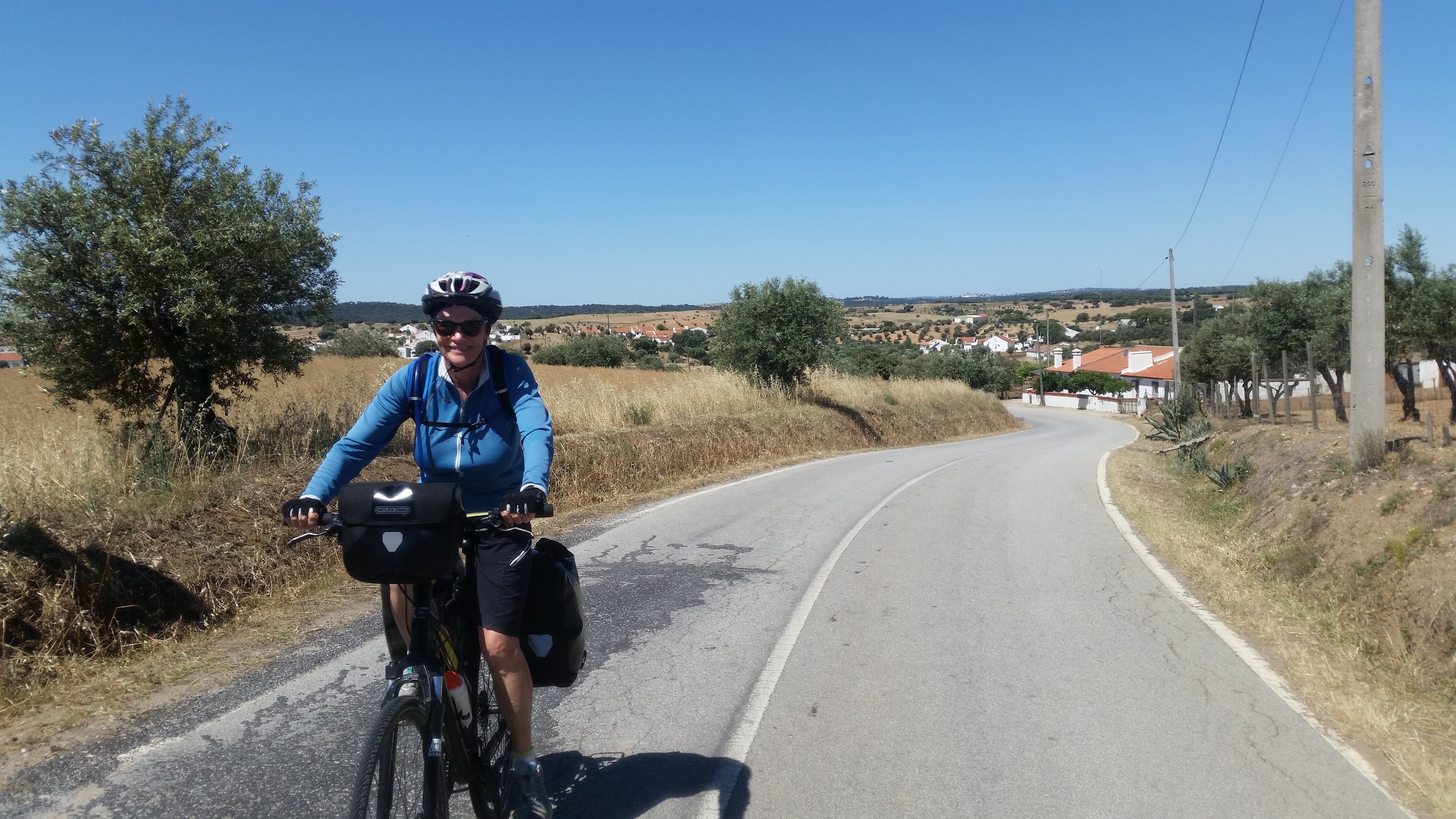
Riding into wine country
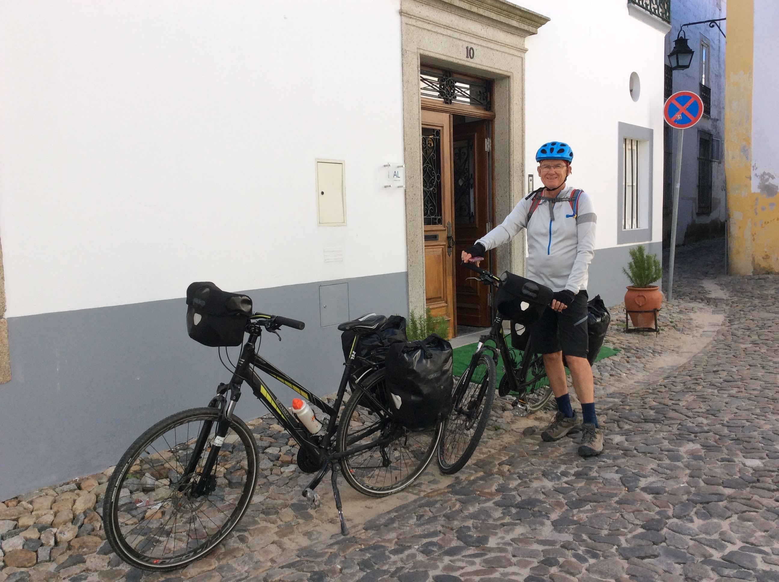
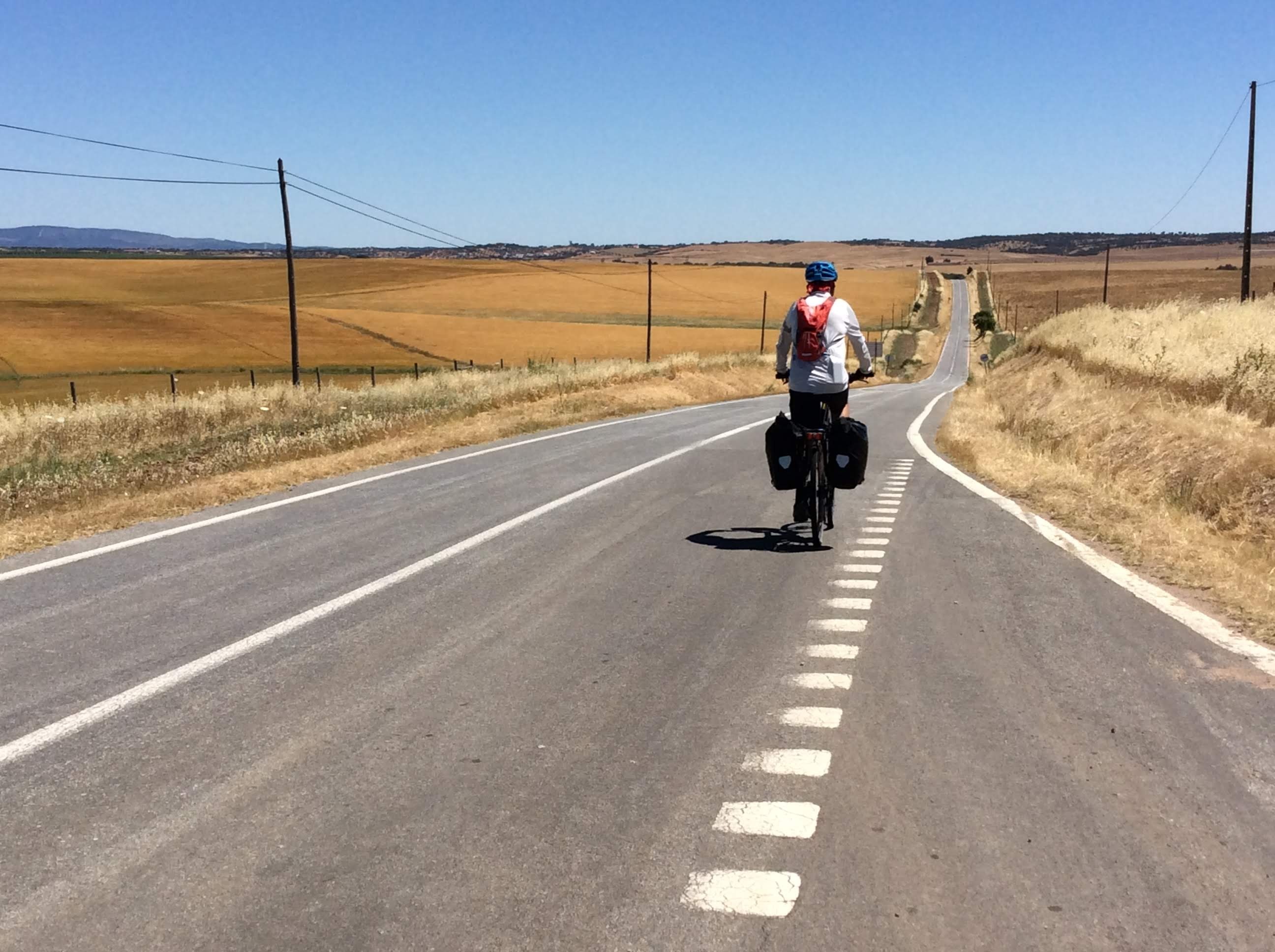
DAY 24 – FIGUEIRA de CASTELO RODRIGO to VILA NOVA de FOZ COA (37 kilometres)

Journeys have to come to an end sometime. Ours finished in the beautiful Douro River Valley at Vila Nova de Foz Coa. It also, fittingly, finished with a 240 metre climb up to the village. Up to this point in the day, the riding had been pure pleasure with a long breezy downhill coast. Even the last climb was okay given that we knew there was no more riding with panniers. The vineyard views were amazing. Every part of the hills rising out of the river valley seemed to be cultivated with the vines laid out in different directions and patterns: some straight, some zigzagging with the planting along the edge of switchbacks. Other patterns were created by rows of almond trees. A unique landscape.

Vines in the distance

Rio Coa before our climb up to Vila Nova de Foz Coa

On our descent – looking down to the Rio Douro

Rio Douro and unusual planting of vines

There was no one about to cheer us as we cycled into Vila Nova de Foz Coa so we took a selfie. Finally the guesthouse, a hot shower and the prospect of no more padded shorts and helmets for weeks to come. Chris, in charge of statistics, announced we’d covered 807 kilometres over 20 days of riding and climbed 10,239 metres. This translated to an average of 40 kilometres a day and 500 metres of climbing, not bad for an older couple with an average age of 70. Chris’s more technical account of our journey can be found at http://www.chrislello.wordpress.com.

A selfie to mark the end of our 800 kilometre cycling journey in Portugal

Our final accommodation was at Casa Vermelha (Red House), once a stately home and now a guesthouse

We spent two nights here and on our very last day did a short ride, without panniers, seven kilometres down to the Rio Douro and had lunch in the best restaurant we’d eaten at in Portugal. It was a set menu – different dishes and wines just kept coming – and the host was so enthusiastic about having Australians in his modest restaurant that he called us back, after we’d already paid and left, to give us port and insist we sign his visitor’s book. It was the hardest thing we’d done, riding back up the hill after all the food and wine. Were the bikes wobbling or was it us? The next morning, leaving the bikes to be collected from Casa Vermelha, we caught a train along the Douro Valley to Porto.

END of CYCLING in PORTUGAL

Cycling in Portugal – Part Two

20190526_112700-1

Hot and hilly will be our memory of our second week riding in Portugal. We’d worked our way from Tavira on the southern coast up the map to the historical and very beautiful town of Evora. This was a great base for a day trip by train to Lisbon to see the sights and for a more restful day exploring and resting in Evora. So DAY 8 & 9 of our journey from south to north in Portugal were not on the bikes. This section, often close to the Spanish border, opened our eyes to historical Portugal with many towns having castles, forts and walled centres. Chris had made use of cycling blogs and a paper map to work out a route taking in the best possible scenery, a very time consuming task because it also had to be matched with available accommodation via Booking.com. Distances between accommodation became even more important because of temperatures being predicted in the low to mid thirties. Unless there was a lot of downhill, 40 – 45 kilometres was deemed enough. Several times this turned out to even be too much when the steep climbs occurred at the end of the day’s ride when temperatures were at their most excessive. We met very few other cyclists on the way, a few day riders on road bikes and only a few other groups touring with panniers. Roads were good, cars and trucks infrequent but nearly always respectful of cyclists.

A few photos of Evora because we did ride into the town and out again three days later.

A turret on the gothic cathedral in Evora – the largest in Portugal

A view from the cathedral terrace

The Romans were here

Chapel of Bones – a reminder of our mortality

Relaxing on the balcony of our guesthouse – Evora in the background

DAY 10 – ÉVORA to REDONDO (42 kilometres)

Feeling rested, we rode out of Evora at 10 am already feeling the predicted heat. Temperatures in the low to mid 30s would be with us for the next ten days or so. The farmland scenery continued and mostly we had the road to ourselves. Apart from a 6 km deviation we were on the same road all the way. We’ve established a routine of coffee mid morning in a village whenever possible and one appeared conveniently after an hour’s riding. The small village with a big name, Nossa Senhora de Machede, had a very pretty blue and white church, 15th century of course. The cafe, with its permanent customers of older men, was being set up for Sunday lunch, a long tradition in European countries. The bar/cafes in all the small towns seem to function as meeting places for the elderly and underemployed – our arrival, helmeted and sweaty, was always a diversion.

img_4770

Leaving INn MURUS Guesthouse – ÉVORA 

img_4771

Farmland vista

img_4774

This town had a touch of dark blue

img_4778

We had the road to ourselves

In the next village, Santa Susana, we found a convenient shady tree and a bench seat to eat our picnic lunch before doing the last 12 kms to Redondo. It was hot and we were hot but our room, entered through a door off the street, was cool.

The problem with the tradition of Sunday lunch is that many of the restaurants then close on Sunday evening. Our accommodation was run by a couple who also had one of the top rated restaurants in Redondo, but they were closed when we turned up at the door anticipating a delicious regional dinner. Very disappointing. Fortunately an alternative was open on the main square and the cook served up a very nice plate of fried sardines and tomato rice with wine only one euro a glass. Had to put up with the compulsory soccer/football on the TV though.

Redondo – View from our accommodation door

DAY 11 – REDONDO to VILA VIÇOSA (27 kilometres)

Managed an earlier departure from Redondo because we made our own breakfast. I bought milk in the tiniest mini market next door to our room – it had a little bit of everything, including clothing. The scenery was similar to the day before but our coffee stop took us into a large village, Alandroal, with a castle and new housing. This housing is in keeping with the traditional white washed concrete squares with red tiled roofs – just newer. Obviously building regulations are there to maintain the harmony of these villages – no outlet at all for creative architects.

Alandroal Castle

Modern housing coming into Vila Viçosa – yellow a change from white

Near Vila Viçosa, we passed huge marble quarries which were probably the reason for the position and prosperity of the town.

Entrance to the marble quarry

The highlight of this relatively short day was our accommodation, Casa do Colegio Velho (Old School). The town itself had significant historical buildings; this house was acquired by the Jesuits in 1602. They moved out in 1664 to New School premises. In 1931 The Sisters of the Slaves of the Sacred Heart of Jesus in Cadiz needed a refuge after the proclamation of the constitution of the II Republic of Spain in 1931. In 1946 the building was acquired by the parents of the present owners and restored as a residence. The next generation had converted it beautifully into accommodation. We’d booked the apartment in the garden thinking this would best accommodate the bikes but they were assigned the garage. The older senora who welcomed us was lovely. Her English was very good and she was keen that we were given as much information about the house and town as we could absorb. She did confuse us later by telling us we’d booked in on the wrong night (we hadn’t) but this was eventually sorted out.

Our apartment (in the corner) in the grounds of Casa do Colegio

The Palace in Vila Viçosa

A street in Vila Viçosa – geraniums in pots at last

La Señora recommended a restaurant in the park for our dinner. This meal as described is “typical”. You are given a basket of bread, a plate with plastic sachets of butter, cheese and tuna spread, slices of cheese, a dish of olives and, in this case, a plate of octopus salad. Because you have not ordered this, you think it might be complementary, but no, it’s listed on your bill at the end. You need to say no, we don’t want this, thank you. When you order there is an alarming amount of meat listed as being available in half or full portions. The full portions are the best value price wise and they are huge. We made the mistake of ordering a full portion each back along the road somewhere and Chris was faced with a plate of eight grilled lamb chops and I had a huge lump of fish in batter. On this occasion, in Vila Viçosa, we ordered veal stew to share. It came as slices of thin veal in gravy served with a mound of brown rice and topped with thinly sliced deep fried potatoes (no vegetables). To get anything green you must order a salad – a tomato and lettuce salad is simply that, perhaps with a bit of onion. The dessert menu is packaged ice cream eg. Vienetta. This is regional dining. With a bottle of wine the meal was about $65.

DAY 12 – VILA VIÇOSA to ELVAS (38 kilometres)

The temperature graph was going up – Tuesday 31, by Sunday it was predicted to be 35. This forced us into thinking we should be on the road much earlier than 10 am. Included in the price breakfasts might need to be sacrificed, we thought, especially when they’re not served until 8.30 am. The prospect of the Casa Colegio breakfast was impossible to resist. It didn’t disappoint and we did manage to be riding by 9.30 am.

Part of the breakfast at Casa Colegio

Leaving Vila Viçosa – the local bull ring in the background

It was pleasant riding once we were on our way – an encounter with a snake stirred into action by roadside clearing – and the joy of an avenue of eucalyptus trees giving us the smell of home.

Haymaking

An avenue of eucalyptus trees bringing the scent of home

 It started to seem that this journey is as much about the accommodation as the day on the road. The villages are part of the passing scenery as much as the farmland with its hills and dales, but the highlight is the town at the end of the day, the bed it offers and the historical sights, best explored on foot in the cool of the evening. Vila Viçosa had been a real treat, Elvas came in close. We’d opted for a hotel, Sao João De Deus, in the historic town of Elvas, and it turned out to be a beautifully renovated building that had begun life in 1645 as a military hospital. Our bikes spent the night tied up in a gorgeous courtyard decked in bougainvillea and we had a bedroom of palatial proportions off a grand corridor.

Elvas itself boasted about twenty churches and numerous military buildings all dating from the 17th century as well as a wall with inner and outer gates around the old part of the town, a Roman aqueduct and several forts on surrounding hills. Defence and religion, a dominant theme and so much history in the rise and fall of different powers contained in these solid and enduring structures. When we’d rested from our hot morning’s ride we wandered the town, had a beer and tapas (not usually on offer but we’re close to the Spanish border) and then another typical Portuguese dining experience very similar to the one as described for Vila Viçosa.

Not everything is tastefully done

A gate in the old city wall

Aqueduct

The courtyard of our hotel in Elvas

Our hotel in Elvas – built as a military hospital in 1645

DAY 13 – ELVAS to ESPERANCA (45 kilometres)

Uphill out of Elvas, not easy after a big hotel breakfast, but it became easier with some long downhill stretches with a cool morning breeze behind us for some of the time. A highlight was passing through avenues of old cork trees lining the road and young oaks, a change from the open farmland. Often the mature cork trees are in fields where cattle are grazing or hay is grown.

We went through two villages with the names of saints and stopped in the second one for our coffee hit. A group of older women were having their morning coffee in the cafe and doing a spot of shopping at the clothing van parked in the square outside. The towns don’t seem to have shops – it must be hard keeping up with fashion trends. The old men were occupying the seats in the square – time moves slowly in the small villages.

We found, after considerable confusion with maps.me, a decent sized supermarket in Aronches. Our accommodation – ten kilometres further on – was on the edge of a very small village too far from a restaurant, so the plan, later executed, was to eat bread, cheese and cold meat with a bottle of the local wine and watch the sun go down over the hills. We had a very hot uphill ride to Esperanca and felt very relieved to see the big yellow building amongst the vines and slide into their pool. Swimming pools have been added to desirable extras when making bookings.

Watching a tourist taking a photo

The pool at Monte da Esperanca

DAY 14 – ESPERANCA to MARVAO (49 kilometres)

High temperatures were predicted so we managed an early start and really enjoyed the cool clear morning and impressive valley views. Men were actually harvesting cork as we rode down a minor road, leaving the trunks of the trees looking quite raw. We’re now more interested in a cold drink than coffee at our morning tea stops, conscious on this day that we had a lot of climbing ahead. I walked some of the gradients – too steep, too hot. We were eating our roll by the side of the road under a shady chestnut tree when a man pulled up next to us and offered us access to his spring fed water supply. He had given up life in Lisbon to raise his family in the countryside – his parents lived on the other side of the hill. He told us that temperatures had reached 55 degrees in August last year – and we were feeling hot when it was a mere 35. He also showed us a film of a squirrel on his phone. There’s not very much wildlife left in Portugal and this was a rare experience for him.

The day was going well until the last five kilometres. We stopped after an enjoyable downhill coast and saw Marvao, the next village, perched on a hill way way above us. It was 5 kilometres by road and a 300 metre ascent. To get me up there – was I happy? No – Chris took first one, then the other pannier, so I had a show of not spending the night in a heap by the side of the road. We did eventually make it to Dom Dinis, a gorgeous small hotel inside the castle walls. This was a castle town, hence the high position.

During our exploration of the castle later, we were besieged by flying earwigs, a phenomenon apparently of the first heat of summer forcing them out of the castle walls and sending them into a suicidal frenzy.

Cork trees after harvesting

Farmland vista

Sometimes 2 kilometres seems further than 42

Chris taking my load

Marvao was like a beautiful French village that had gone undiscovered – no tourist shops, no tour groups, only couples touring with cars (and two crazy ones on bikes). It was very peaceful in the evening and the view from the castle wall was spectacular. An excellent (and expensive) restaurant served up another hearty meat meal.

View from Marvão Castle – our small hotel is on the right

Looking down on the village below from Marvao Castle – it was a long way up!

Pork shaslick for two

Marvao accommodation – Dom Dinis

DAY 15 – MARVAO to VILA VELHA de RODAO (57 kilometres)

The morning’s reward was going down the hill we’d struggled up yesterday. Chris, in his role as route planner, had promised a mainly downhill day. Unfortunately, the bit that wasn’t mostly downhill occurred mid afternoon in temperatures that could have been moving into the high 30s. We were late because there had been another gorgeous village, Castelo da Vide, with a double whammy of delicious cakes and a castle to distract us. Finally we dropped down to the Rio Tego, accommodation with a pool and a restaurant meal with a view of the river.

Descending through the village – we were right at the top

The view from Castelo da Vide

DAY 16 – VILA VELHA da RODAO to CASTELO BRANCO (45 kilometres)

Strava recorded 775 metres of climbing. I probably pushed my bike for half of this as it was sooo hot. A hill I might have had a hope of getting up in the early morning when the breeze was cool, seemed impossible later in the day. Because we were slow we were out in the heat longer, needing numerous rests. The water in our camel backs was as hot as we were. Everyone we talked to said such high temperatures were not typical for May. July and August yes. The Portuguese accept global warming is here. For dinner that night – a great Italian pizza in an Italian restaurant followed by an ice cream sundae. The Portuguese customers were all tucking in to a pizza as well. No loyalty being shown to the traditional section of the menu!

A source of cool drinking water

The road went down to the river – then up again

Chris, loaded up with an extra pannier, sets off uphill after a rest under a shady gum tree

After a week of high temperatures – mid 30s, but often it felt like 40 – and unrelenting clear blue skies, we declared this day the end of Part 2 of Riding in Portugal.

END of CYCLING in PORTUGAL – Part Two

Cycling in Portugal – Part One

DAY 1 TAVIRA (a town in the Algarve on the Gilao River)

Our bikes, looking clean and shiny, were delivered to our hotel in Tavira the day before we arrived: bikes, panniers, handlebar bags and repair kits, everything we needed for four weeks cycling from Tavira on the south coast to Porto via the most scenic route we could find.

We’d used Cycling Rentals, a company in Portugal, when we rented bikes for our ride in northern Spain in 2013. We were five years older, a bit leg weary from our Intrepid Cycling Tour in Morocco, but determined to do the distance. We had only a vague inland route in mind; the intention was to fill in the details once we’d made an assessment of the terrain and our physical ability to navigate it.

Hotel Princesa do Gilau had stored the bikes in their laundry room, but we finished assembling them in the back lane before riding around Tavira, out on the route we planned to take when we started to ride north and down along the coast. Tavira is described as the prettiest town in the Algarve and it did have a relaxed feel. The main beach in the area is Praia do Barril which boasts a broad white sand beach. It’s actually on an island and part of a small national park and is accessed by a bridge and a boardwalk as well as a small train. The Brits holiday here so there was an abundance of top rated restaurants serving a variety of dishes – fish meals featured highly.

Inlet at Tavira – a shakedown ride without panniers

DAY 2 TAVIRA to CORTELHA (a place very much “not” on the tourist route for Australians) 50 kilometres, 638 metres ascent, 327 descent

Apart from Chris having been given two left panniers, the bikes and gear were very good. We left our hotel at 10 am and only needed to negotiate a few streets of the town before we were on our chosen side road travelling north. It seemed cumbersome to be riding with panniers again, but our loads were as lean as we could make them and both of us felt balanced and comfortable.

Loaded up

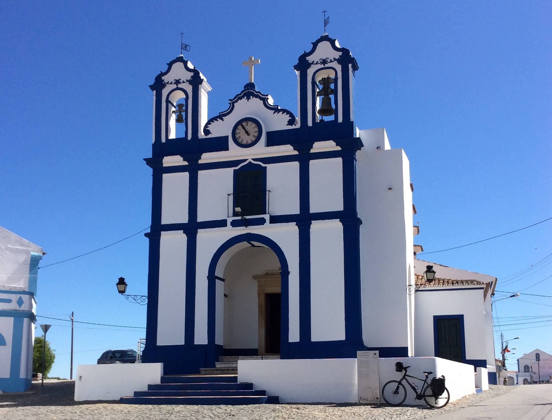
A village on our first day

What we saw on this day of riding was varied: orange groves and olive trees early on, sparse forest as we climbed away from the coast. The minor road was broken and bumpy; riding became smoother when we resorted to a more major road. The villages were really just clusters of white buildings with some pretty gardens. Lots of weeds and wildflowers away from the villages. The wind added a degree of difficulty to the riding especially on the ascents and there were far too many of those.

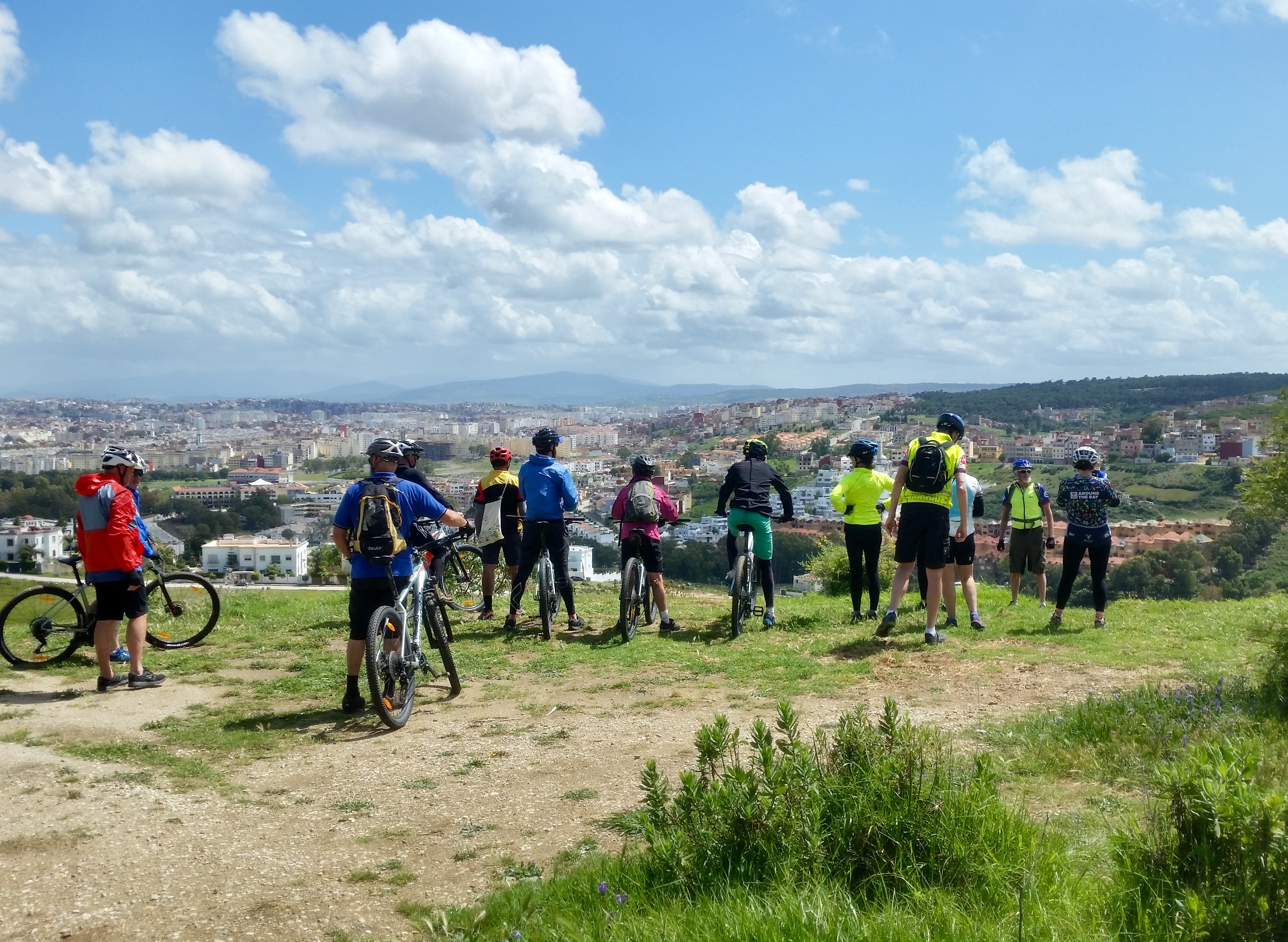
Resting at a lookout point – this area was a national park

The news of the Australian election intruded on our day – it was clearly bad news as far as we were concerned. By the time we’d struggled up the very long ascent to Cortelha and our accommodation, seemingly in the middle of nowhere, it was clear we would be suffering another liberal government. On a happier note, Casa dos Punteros provided a comfortable room, traditional bar and cosy restaurant. Our hosts were quite enthusiastic about having Australians staying. Our opinion on Portuguese wine was sort and we enjoyed the bottle of regional wine our host recommended – it went well with the sliced cold meats, cheese and bread and a hearty lamb stew.

Our first night’s accommodation

DAY 3 CORTELHA to ALMODOLVAR (very quiet on Sunday afternoon) 42 kilometres, 500 ascent, 600 descent

A cooler day, almost cold, but it warmed up as we rode and it wasn’t as windy as the previous day. Still more uphill before a vast vista (you could almost see back to the coast) then mostly downhill to a small town with a Sunday market. Tried the local barbecue – bits of fatty pork spare ribs – then rode on. Amazed by the number of eucalyptus trees, mainly lining the road. The scent of home!

Someone had said Portugal was hilly; after the first two days we were inclined to agree. Over the course of the third day we ascended about 500 metres and descended 660 metres – a lot of that was undulating, up then down, up then down. Even the last few kilometres into Almodovar threw a few ups at us. Our accommodation was in a small apartment with pizza for dinner at a local Italian restaurant.

Another high point – looking south

A Sunday market – barbecue and coffee for morning tea

The bike path matched the roofs – it only lasted for a kilometre

DAY 4 ALMODOVAR to FONTES BARBARAS (an Enoturismo farm) This was many kilometres from a town) (42 kilometres)

Our accommodation was always determined by the distance we thought we could ride each day. Booking.com revealed the winery and accommodation, Fontes Barbaras, to be a comfortable 40 kms from Almodovar and the reviews made it very tempting, hence it became our destination for Day 4. Chris had his first haircut for the trip before we left Almodovar and I snapped a few street scenes to convey small town Portugal. The towns so far seem to exist in a time warp; the pace is slow and sleepy but the barber was a real hipster.

The riding was through farmland – mainly fields of wheat and round bales of hay. The road was undulating with a good lashing of headwind to add an edge to what could have been enjoyable and easy cycling.

We did not know what to expect as we rode up the long gravel drive to Fontes Barbaras. Oh that we’d booked in for two nights: a beautifully renovated farmhouse offering rooms with our own sitting room, access to two other sitting rooms, a pool and poolside loungers, a games room, a library, free wine tasting (white and rose), a complimentary bottle of wine and a snack bar menu that easily gave us a meal. Our hostess, Patricia, was bubbly and chatty and made us – dusty and windswept as we were – feel right at home. A swim, a shower, a toastie for a snack and we were ready to indulge in the wine tasting. We followed this up with a cheese platter and our complimentary bottle of wine and fell happily into a satisfied slumber.

Getting a trim in Almodovar

The barber shop

A small store and mural

Riding up the road to Fontes Barbaras

Fontes Barbaras – pool and a view of the vines

DAY 5 – FONTES BARBARAS to FERREIRA DO ALENTEJO (43 kilometres)

We were reluctant to leave our small patch of luxury (an excellent breakfast too). Patricia, our lovely host, told us how impressed she was by our adventure. “You’ve got to be a little bit crazy in life,” she said as I was given a farewell hug. She also said that if we come to Portugal again we must call in and have a glass of wine and share a cheese plate with them, even if we don’t stay. Portuguese hospitality at it’s finest.

More farmland unfolded before us as we rode: fields of wheat, hay, potatoes and, after we’d turned off onto a minor road, hectares of olive groves. Coffee in a small town cafe after 15 kms then a bread and cheese lunch amongst the olive trees an hour before our destination, the town of Ferreira Do Alentejo. This was another white washed town looking very much like all the white washed towns we’ve ridden through so far.

Rural Portugal on a sunny day

Lunch among the olive trees

Another gem of accommodation. Casa do Enfantes was in the town of Ferreira do Alentjo. It had the look of a mansion, imposing and white, and the interior was decorated with beautiful antiques and bedroom decor from another era. Our host spoke not one word of English but made herself clear with gestures. The flow of Portuguese she maintained contained the odd vaguely recognisable word because some Portuguese is similar to Spanish. We managed to determine where our bikes could be stored, that the cherry liqueur was there to be tasted and the fridge and very impressive kitchen was ours to use if we wanted to prepare food.

Decor from a different era

Chris enjoying the pool at Casa do Enfantes

DAY 6 – FERREIRA do ALENTEJO to HERDADE da SAMARRA (Agro-Turismo accommodation surrounded by farmland) (43 kilometres)

After an all you can eat breakfast at Casa do Enfantes, we rode through the town and out into the countryside. The sun was shining and there was no wind. After about 15 kms of mainly flat riding (for a change), the whitewashed town of Odivelas rose out of the plains. It had bright white houses with red tiled roofs and cobblestoned streets that went straight up – 27% incline made the main access street impossible to ride up. We could have bypassed the town, but it’s position on a hill promised good views of the countryside. Sometimes you have to remind yourself it’s as much about the journey as the destination. Our efforts were rewarded with a panoramic vista of the surrounding countryside.

Some local craft work

The view from the top of the town

The local church

After Ovidelas we turned off the EN2 onto a minor and quieter road. We could even ride two abreast. Past a lake, our route branched off again onto an even smaller road. Unlike our first few days, we were experiencing flatter easier riding. This section of road was through plantations of cork trees with some of the trees obviously very old. A truck loaded with the cork bark trundled past us at one point but we were too slow with the camera. Wine in Portugal, Italy, France and Spain is still corked.

Young cork trees

A very old cork tree

We rode into another sleepy town on a hill feeling hot and thirsty. There’s always a bar/cafe with a group of customers, in this case, young, who seem to have nothing better to do on a weekday morning. Very few people around, shops are few and public spaces scarce. The small towns, unlike French villages, are not made pretty with flower boxes and pot plants – the country is possibly poorer or less concerned with the appearance of their towns. Behind the blank walls and firmly closed doors, no doubt, there are attractive courtyard gardens.

Our day’s destination was an Agro-turismo farm. It had the appearance of a Spanish hacienda and the interior was on a grand scale. The flagstone floor, the wood and leather furnishings, paintings of rural scenes all gave the place a film set feel. Our room was less grand but we had access to two sitting areas, a patio and a pool. Unfortunately the gardeners only swung into action after we arrived so we sat on the loungers and watched the pool being cleaned, serenaded by the lawnmower. The dip in the pool was refreshing when the pool was finally ready and the home cooked meal, served on the patio, was hearty and filling. The Portuguese do seem to like meat. We were the only guests. We had been greeted by a man, possibly the owner, who spoke English, but after that we were left in the company of the housekeeper who only spoke Portuguese and seemed a bit disapproving of us being there.

HERDADE da SAMARRA – an agro-turismo farm stay

DAY 7 – HERDADE da SAMARRA to EVORA (27 kms)

We lingered a while and had breakfast at 9 am because our riding distance was under 30 kilometres and we were not able to check into our Evora guest house until 5 pm. The riding was more of the same, some wind and a very long straight road with only one bend. We passed through one town early on – too early for a coffee – and were on the outskirts of Evora by 1 pm. It’s a much larger commercial town with an old centre and that’s where we had booked to stay. We filled in the day by eating lunch, booking a train ticket for a sightseeing day in Lisbon and doing our laundry in a very swish laundromat. The guest house was happy to store our bikes in an unused dining room – two days without riding! Lisbon then a rest day.

End of Part One – Cycling in Portugal

Travels through Southern Spain

After Morocco came southern Spain. We crossed from Tangier to Tarifa on the ferry experiencing some confusion with a time change then onwards to Marbella by bus and the start of our two weeks of travelling in southern Spain. The weather was always sunny, but not too hot in early May, flowers were out in abundance and orange trees, in the parks and lining the streets, were heavy with just out of reach oranges. We moved easily from city to city via an excellent bus system, the only effort being lugging our not-on-wheels duffel bags from bus station to our hostels. Our accommodation was always in the more interesting old parts of the cities and not usually close to the bus stations. Taxis? Yes, a couple of times.

MARBELLA
The waterfront at Marbella was lined with glitzy hotels and bars, but the streets of the old part of the city, where we stayed in Hostal La Luna, were lined with pot plants and pristine white walled houses. No cars allowed, which made wandering a pleasure.

A street in Marbella – Bev travelling light

RONDA

We stayed overnight in Marbella in order to catch the bus to Ronda, away from the coast. The road just kept going up offering spectacular views back to the coast and across valleys and ridges – felt glad we weren’t tackling this on a bike! Ronda is a small picturesque city famous for its Puente Nuevo (new bridge). Enjoyed an excellent classic and flamenco guitar concert in a small music shop. Paco Seco, the guitarist, also makes guitars. The sound was superb.

Puente Nuevo which spans the 120-metre-deep chasm that carries the Guadalevin River and divides the city of Ronda in Spain

The view from the cliff tops

Chris and Puente Nuevo

GRANADA

Hotel Andalusia in Ronda was opposite the train station but our plan to travel by train to Granada was thwarted because the train was replaced by the bus. On the way to Granada we had a further taste of high plateau scenery and endless vistas of olive trees the rows looking like a hair transplant on a bare skull. The Italians had been scathing about Spanish olives, especially when they were passed off as Italian in the oil that’s exported. The Spanish oil we’ve sampled so far tastes good though. Granada by late morning and a taxi to our hostal because it really did seem too far to walk. Hostel Suiza was “budget” but the room was very clean and spacious with a very helpful host who made us feel good about our Spanish by speaking very slowly and clearly.

The highlight in Granada is La Alhambra. Drifting along, as we do, oblivious to the need to book ahead, we almost missed out on this treasure. Fortunately, Sheenagh and Graeme, a couple on our Moroccan cycling trip had told us you need to book months in advance. In the end we got two of the last four tickets for individuals for May. Our designated time for the jewel in the crown, the Nasrid Palaces, was 7pm so we had nearly five hours wandering the magnificent gardens – so many stunning roses – and exploring the other buildings of this huge complex. The sun shone all day so we had great views of the city of Granada as well.

Roses in the Generalife complex and Granada beyond

More gardens

A courtyard garden in the Generalife complex, outside the actual walls of the Alhambra

Inside the Nasrid Palaces – each palace is identified by the sultan who ordered its construction

Nasrid Palaces

A beautifully restored section of a wall

Decorated arches and soaring ceilings

More intricate decoration

A smaller space – the tiles are made up of individual chips

Palace of Charles V

Alcazaba – the military section of La Alhambra

We loved Granada – some real pockets of peace in a busy city. Our contacts from the Moroccan cycling trip, Sheenagh and Graeme, had enrolled to do a Spanish course here for two weeks and we met up with them, first to have a drink in their apartment then for a tapas, racione style dinner in a quaint bar – one we would never have gone into on our own initiative. There was lots to reminsce about Morocco and time to move on to talking about other shared interests.

Another highlight of eating out in Granada was our first paella, freshly cooked and beautifully presented in a restaurant called Loft. We were also treated to a complimentary oil tasting and chocolate strawberries as a “gesture”. This might have had something to do with Chris complaining nicely about the red wine being chilled and not being given a taste because it was a newly opened bottle with a cork.

CÓRDOBA

Another day, another bus and we’re in Cordoba. Our hotel was more expensive than Granada but only marginally better. High season rate apparently. The only real extra was faster WiFi which has become quite important.

Our hotel in Córdoba. The restaurant was called Seneca because of the statue (a headless Seneca) and the Roman fountain.

More wandering in narrow streets, but the real attraction of Córdoba is the Mosque-Cathedral (Mezquita) another stunning building, with a twist. It started life in 784 as a mosque, expanded by later Muslim rulers, but when Córdoba returned to Christian rule in 1236, the building was converted to a Roman Catholic Church, with a Renaissance cathedral nave in the 16th century.

We discovered that the hour from 8.30 to 9.30 was free entry. There was still a queue but we were inside quickly and the real bonus was no tour groups. The photos give only a small taste of this vast and paradoxical building. It felt overwhelming.

Inside the Mezquita

The Cathedral within the Mezquita

An inner sanctum

All that glitters

After the Mezquita a visit to the Jardines del Alcazar and the Alcazar de los Reyes Christianos. This was where the royal family had their holidays. Oranges trees and flowers in abundance.

The icing on the cake for any garden lover in Córdoba was Fiesta D Los Patios D Córdoba. It was a chance to see behind those blank white walls and firmly closed gates. There were fifty open patios – we visited four. Pot plant heaven!

CÁDIZ

Another bus, another city, Cadiz – back on the Mediterranean. We spent a warm and windy day wandering the grid of small streets, battling the wind on a walkway out to a fort (closed for repairs) and enjoying an art gallery with works by modern Spanish artists depicting places in Cadiz. Particularly impressive was the colourful, collage style paintings of Jose Alberto Lopez.

Our wanderings in the evening lead us into an Italian restaurant where we ate an amazing salad – a leaf of cos lettuce wrapped around a slice of tomato, fresh creamy mozzarella, topped with a slivered slice of melon and drizzled with balsamic vinegar. Sometimes simple things are the best. We followed this with an excellent pizza. Later discovered our random choice had lead us to the second top restaurant on trip.advisor. Our second night choice was also excellent in a Spanish restaurant this time called El Jardin. We are learning to walk away from the main squares and seek smaller more hidden places for better value and tastier food.

Castillo de San Sebastian

Playa de la Galeta

Vista de Cadiz 1 – Pila Requera (artist)

My stylised photo of Gran Teatro Falla

Gran Teatro Falla – Jose Alberto Lopez

SEVILLE

Another brilliant sunny day and we were on the road to Seville. This time we stayed in Pension San Pancracio. Our room was large, opening out into an internal courtyard, a shared bathroom but all very nice for a budget price and central location.

Again, Christianity constructed on a base of Islam. Seville Cathedral is claimed to be the largest Gothic cathedral in the world. It’s Giralda Tower, which we climbed, was the ancient minaret of the Almohad mosque. It was completed in 1198. The cathedral was vast, solid and overwhelming and many of the altars behind heavy iron grills. Apart from containing opulent treasures of Catholicism, it had the tomb of Christopher Columbus. It also had the greatest numbers of tourists concentrated in one place since our arrival in Spain. We’re here with our cameras and Smartphones on a new style of pilgrimage! More accessible, but overly opulent altar pieces, were in the Baroque Church of the Divine Saviour.

It was a big tourist day as in the afternoon we’d done an online booking for the Real Alcazares at 2 pm. This was a good move as the unticketed queue was left standing in the hot sun. The Real (palace) was another stunning complex with equally grand and gorgeous gardens, cool and shady in the Seville heat and a restful place to linger.

Seville Cathedral

Seville Cathedral

The tomb of Christopher Columbus

Statue of Christopher Columbus

The altars were locked away from the tourists

The glitzy altar on full display in the Baroque Church of the Divine Saviour

The 12th Century Giralda Tower

View from the Giralda Tower

Reales de Alcazares

Exquisite tiles

Garden and wall of the Reales Alcazares with crape myrtle in flower

Bev and Mercury’s Pond

Small pavilion

Our second day in Seville was less focussed on the big ticketed landmarks and more about wandering the streets, crossing to the other side of the river and encountering a few surprises like the flamenco performance on one of the balconies of Plaza de Espana. We soaked up the coolness and greenery of Parque Maria Luisa mid afternoon then retreated to our pension for a rest. Tapas by two bars for dinner the first being El Ronconcillo the oldest bar in Seville. The waiters were a bit grumpy – either part of the image or they are very tired of being a tourist attraction – but the tapas was tasty and the atmosphere suitably aged. Our best meal in Seville had been in a Lebanese restaurant where we had an amazing and delicious platter of dips and falafel.

Flamenco for little girls

Flamenco Performance in Plaza de Espana

Plaza de Espana

Parque Maria Luisa – a cool place to be on a very hot day and a tranquil end to our two weeks of sightseeing in Southern Spain. We left Seville by bus the next day heading for Portugal and the start of our own private cycling trip from the south to the north of Portugal.

Morocco, Intrepid Cycling Tour

After navigating our way around Marrakech and over to Essaouira on the Atlantic coast, we were ready for someone else to organise us. So, 14 days on an Intrepid Cycling Tour. Our group, when we gathered in the hotel in Marrakech on the evening of Sunday 21st of April, consisted of sixteen cyclists all Australians, except for a lone Englishman, Gerry. Eight were from Yackandandah or close by, three from Melbourne and four from Sydney – not very cosmopolitan! Our young Moroccan guide Said was lean, fit, enthusiastic and with an engaging sense of humour. We were in good hands.

Day 1 was really just being gathered together, introduced to each other and, most importantly, fed. The inaugural group feast took place at a stall in the main market square, Djeema el-Fna, a busy place during the day, a seething mass of humanity at night. Said shepherded us to a stall where we were served a multitude of Moroccan delicacies and entertained by a few wandering musicians and the cooks and waiters clapping and calling out to attract more customers.

Marrakech – our first Intrepid meal from this market stall

Day 2 (Marrakech) we met Said’s younger brother Essau who is our mechanic and designated tail end rider. We had two mini buses, one for us and one for the bikes and luggage, and two drivers both called Hassan. We were driven to a point ten minutes from the hotel where we were assigned our bikes and then taken for a twenty-three kilometre crazy, whirlwind ride around the streets of Marrakech dodging traffic, gutters, intersections and pedestrians. Morning tea was in a paddock on the outskirts where our buses were parked with the provisions for snacks: fresh dates, dried figs, nuts, oranges and bananas. This mini-meal would be a fixture on the cycling days ahead. The oranges were juicy and delicious and big glasses of freshly squeezed oranges were on the menus everywhere. My camera stayed in my pocket all day – too focussed on the road – and on the night train to Tangier so nothing to illustrate this section.

Day 3 (Tangier) began as we stumbled off the train and into the rain at 7am. Our nighttime companions were Sheenagh and Graeme from Melbourne and it was a great opportunity to become acquainted with two other people on the trip and swap travel stories. Our hotel was large and unremarkable, but comfortable. Tangier offered a medina, a fort and a port which we explored after a thirty kilometre ride, initially in the rain then later in the sunshine. It was city then coastal road riding with a couple of long ascents and the rewarding downhill follow up. The ride included sightseeing stops at the Caves of Hercules and Cape Spartels with lunch in a barbecue/grill restaurant. The group meals mixed up the group with everyone sharing potted life histories and assorted travel tales.

B5AF119C-3431-4D86-BDBE-EADF70614DD0

A wet start to Day 3 (Tangier)

84BFC2F6-42E0-4357-876F-4D9277F19BC1

The caves of Hercules where Hercules allegedly rested during his labours (entrance in the shape of Africa)

FAD00B9D-3230-4B68-8B7B-BEB94A2CCA8C

Our “Intrepid” selves at the meeting of ocean and sea

71005DF6-1C17-4E95-870B-0CFDCB426BC1

Cape Spartel Lighthouse

8DC2289D-7739-4CBB-B2A5-BD91B136087A

The group enjoying the view of Tangier in the sunshine at the end of the day

Day 4 (Tangier to Chefchaouen) and the riding became a bit more serious. After a substantial hotel breakfast we were driven through the city of Tétouan to a point on the Mediterranean coast thirty kilometres before the seaside town of Oued Laou. The thirty kilometres followed the relatively busy coastal road (it did have a nice wide verge) and included five hills, all of them long and steep; two of them extra long and steep. Great views from the rest points and an interesting encounter with a very elderly lady somewhere in her nineties who lived alone in a small mud hut beside the road. She was keen to tell us her life story – in Arabic.

A strong gusty wind buffetted us about on the final decent to Oued Laou and this wind made the picturesque valley riding after lunch close to torture. Or was it my very tired legs? Was I keeping up? On the hills, no, but pushing the bike got me to the top on the coast road and I had Chris for company, always keeping an eye on me, together with a couple of other not so strong riders. I did hop onto the bus a few kilometres before the end of the day’s ride, defeated by the wind rather than the hill.

The Mediterranean

Morning tea with the girls – Leanne, Zinna, Jenni, Louise and Sheenagh

Me looking a bit wind blown with an elderly lady in her nineties and living alone in a stone hut

Day 5 (Chefchaouen) This amazing city is mainly painted blue and built on the side of a steep valley. We had a rest day here, or a day of no cycling as Said took us for a long muddy walk in the fields above the town. Some of these fields were planted with marijuana, a local enterprise that slips under the radar. Dogs are used to warn the owners of the crop. “What happens when someone does come,” I asked. “They run away and hide and return when the authorities leave. No problem.” We had mint tea at the home of his friend Mohammed who possibly had something to do with the crop!

Chefchaouen in the evening light

An excellent restaurant in one of the bluest streets. We ate on the terrace with a guitar music filtering up from below

Bev and cat

A walk in the hills above Chefchaouen

Louise, Chris, Jenni and Graeme enjoying mint tea

Robert, Chris and Zinna

Dave, Graeme and Zinna dipping into fried egg

Our hotel in Chefchaouen

Day 6 Ride to Fes – This was a day that did not work out well for Chris and Robert (part of our Yackandandah group). We drove away from Chefchaouen to a downhill starting point. All was green and hilly with clusters of farms. The sun was shining after a day of rain. All was well until Chris and Robert, descending side by side on the pot-holed road must have clipped tyres. Chris went sprawling on the road, Robert was flung onto the roadside gravel and Gerry, who was riding behind them, swerved and wound up in a ditch. Chris and I, riding behind, were the first to stop, although initially I kept going because I thought they’d stopped to take a photo of a couple of donkeys! Robert’s face was covered in blood from a cut on his head so all attention was on him as the bus arrived and later Simon (doctor from Yackandandah) was summoned from further down the road. We also had an audience of locals who stopped to comment on the spectacle. Once patched up, Chris and Robert retired to the bus (the ambulance which had arrived only had a driver) It was decided they would be better off in Fes, our destination for that day. Gerry rode on, undeterred by bruised ribs.

The pot-holed road eventually improved and the ups and downs weren’t too unpleasant. I did have a bit of extra support on one long ascent. I’d hopped off to walk and Essau insisted on wheeling his bike and mine. The late picnic lunch was delicious and then a longish drive to Fes, a city of 3 million people and a hospital where Robert was patched and stitched and it was confirmed Chris, who’d seemed okay, had a broken ankle. Sadly, no more riding for them, just pain and insurance company hassles.

Day 6 scenery

I’m getting by with a little help from my friend

Day 7 Sightseeing in Fes – We had our bus and a local guide for the day, a great way to efficiently see the royal palace, the outer ramparts, the amazing medina – a labyrinth of ten thousand streets, the oldest university in Morocco and a madrassar. The tiling and mosaics associated with these buildings is, in a word, magnificent. Within the medina we visited a fruit, veg and meat market, a pottery where they made tajines, a mosaic factory, a tannery and a weaving shop – all with opportunities to buy, of course. Gerry became lost in the medina and was briefly adopted by another Australian tour group. “I was at the lost children’s booth,” he said when our guide found him and returned him to the fold. He was a man with a sense of humour and he needed it because this was the first of many times we were to lose Gerry or even, on one occasion, leave him behind. It was a hot and exhausting day and anything but a rest day. We ate a farewell meal with Robert and Chris who (we later learnt) sorted out their insurance claim and flew home two days later.

The old city of Fes – a medina of ten thousand streets

Decorated door of the royal palace, Fes

The Fes Madrassar

Bev and Graeme getting ready for the desert

Robert and Chris after they were patched up

Day 8 Fes to Midelt – We drove out of Fes at 9am and headed into the Middle Atlas range for another random start. Said began each day by describing our route – he always said, ‘Mostly up hill’ our ‘Mostly down hill’ – rarely was the description ‘flat’. This day was no exception – uphill. We were rewarded with a coffee stop in Ifrane, ‘the Switzerland of Morocco’. After the caffeine hit it was a twisting turning climb through the wooded hills of Ifrane Nation Park with a stop to take photos of Atlas monkeys. The riding did seem to go on and on, the road was narrow and the traffic quite aggressive. I bailed out on the last ten kilometres and felt happy with my choice as the group struggled up to the very bleak lake that marked the end of the day’s riding.

Our hotel that night was beyond the town of Midelt. It had the air of past splendour or, had never been quite finished. They did serve wine and beer, however, and we had our first bottle in two weeks. It lubricated the singing and dancing that came later. One of our drivers really had the moves and it was a fun night.

Riding through the national park

An Atlas monkey

A stormy end to the day

Day 9 Midelt to Merzouga/Desert Camp – Even though the morning was clear and bright and the scenery stark and spectacular, this was not a very nice day on the bike. There was too much traffic going somewhere in a hurry and Leanne was a victim. A bus clipped her handle bar and sent her sprawling into the gravel. She wasn’t as badly injured as Robert and Chris, but she was too grazed, bruised and sore to do much riding for the rest of the trip. This time an ambulance came with paramedics but it was decided they weren’t needed.

The camel ride at the end of the day was a highlight for some, tolerated by others. Graeme (see earlier photo with scarves) complained and whinged about how uncomfortable camels were, how his was the worst camel, he was hot, he was … He went quiet after I told him off. Really it was a lovely way to have a taste of the shifting sands of the desert and a change from riding bikes.

Leaving the hotel

Ready for riding

Rest stop with a view

Picnic lunch with a view and an approaching storm

Desert storm seen through the bus window – a half hour later all was clear

Our desert accommodation – we ate a great buffet meal in the hotel

Ready for riding

Our guide Said mounting his camel

Day 10 Todra Gorge – we drove through the bleak, wind scoured landscape of the Sahara all morning, had a restaurant lunch along the way, then at 3pm started a hike that was to last four hours. It was a very steep and rocky ascent in bleak, windy conditions. The highlight was seeing the nomad camp tucked into the hillside. The families spend the spring and summer tending their goat herds and the women descend daily to collect water which is carried back up on donkeys. It was my turn to hit the gravel; I tripped on the descent and hurt my chin, knee and wrist. While Said was tending to me the others got ahead and took the wrong way back. Only Chris and I had the scenic walk along the river through the irrigated vegetable gardens. My wrist was very sore that night.

Our Todra Gorge accomodation

Chris on our very rocky Atlas Mountains walk

The nomad camp

Day 11 Dadres Gorge/Mountain Gite Stay – My wrist was still sore but I managed the ride down the gorge and for twenty kilometres or so before a twelve kilometre stretch of off road, very rough riding. This I did in the bike bus with Zinna who had developed a hacking cough. Our dancing driver was very happy to have us in the cabin. We were shown photos of his family and treated to his favourite music as we bounced along behind the bikers. Somehow Gerry took a wrong turn and his absence was not discovered for some time. Often Chris and I were at the back with Gerry, but Chris was taking advantage of not having to keep me company and had taken the lead on the rough stuff. Gerry eventually realised his error, retraced his path and caught up with the pack. The off road section was more of the same barren landscape, but it was a relief for everyone to ride without cars whooshing past.

When we arrived later at a family run gite in a very small village, we were fed the best Moroccan meal of the trip. This was repeated again at night after we’d rested and watched a cooking demonstration – goat tajine. The kids in this village had been very annoying to the cyclists – more than just high fives which we’d become used to. They were throwing rocks and chasing the bikes until Essau appeared and ticked them off. Said told us – he’d grown up in a remote Berber village – that there wasn’t much in the way of entertainment and this was easy to believe. We were the entertainment.

Dadres Gorge – early morning riding

The oases were incredibly green, such a contrast to the barren hills

Desert road

The villages are at one with the landscape

Off road

Essau riding off road

Dave, Mike and Juliette (without Leanne) They were the Gang of Four from Sydney and the young ones on the tour.

View from our balcony

The terrace

Lunch feast

Our first taste of a Berber omelette

We were happier than we looked

Day 12 Ait Benhaddou – The day began with cold wind and needles of icy rain, but improved as the day went on. More road winding down the valley before it met the main road and flattened out. The weather remained ordinary, the riding was helped by a tailwind for a change but we rode for too long without a break – some grumbling about lack of snacks and toilet stops. Perhaps we were starting to wear out. Impressive scenery, particularly out of the first valley, but rendered a bit dull by the grey sky. The reward, late in the day, was sunshine on the famed Ait Benhaddou where some of Game of Thrones has been filmed. Also visited a rug making co-op where the different quality and type of rug was explained. Of course they were for sale and some of the group tested out their bargaining skills. We stayed in a mock Kasbah, again in the middle of nowhere it seemed, but we could see Ait Benhaddou in the distance.

Ait Benhaddou

Looking down on the medina of Ait Benhaddou

Desert view from Ait Benhaddou

Rug on a loom

A rug of many patterns

Day 13 Marrakech via Tiz n Tichka

A fabulous final day of riding. I didn’t think I could do it, but we climbed nearly 700 metres through high desert country in perfect sunshine. The sunshine enhanced the shades of brown and pink which are a characteristic of this vast landscape. Villages are tucked into valleys and the houses built out of the earth so that they blend into their environment. They looked like baked LEGO.Many of the older buildings are even crumbling back into the earth. Not an easy place to live but vast and old and fabulous.

It wasn’t all uphill, even though it felt like it, as a head wind marred some of the descending sections. It was a relief to see the bus. An amazing note to finish on before the long drive back to Marrakech and a final dinner.

Our team: Said, Hassan, Essau and Hassan

Feeling pleased with ourselves even though we weren’t quite there

On to Spain next then back on our bikes in Portugal.