Our journey from Madrid to San Domingo de la Calzada was much as described in the book Cycle Touring in Spain. We had followed Route 6 up to this point which then continued north to Bilbao. Instead we had decided to head west then north into the Picos de Europa which is Route 8 in the book. So Chris took over from Harry Dowdell, the author, and plotted his own route across from San Domingo to Calzada to Potes just on the edge of the Picos de Europa National Park, where we would do a version of Harry’s route.
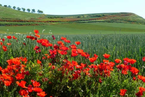
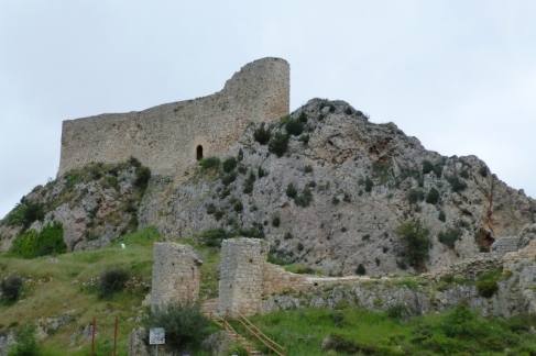
The first day on our own route finding was more of the gorgeous farmland,which i think I’ve already described: the fields of wheat, the wildflowers and the distant mountains, all under a clear blue sky. And with only two short sharp hills. The next day’s riding, under unexpected grey skies, had an unusual squiggly line on Bing Maps. ‘We’ll bypass that village up there (Poza de la Sal). There must be a lookout point past it that the map is taking us too,’ said Chris. But we didn’t bypass it; the road took us up and up to the town, which seemed to be built into a cliff. After a coffee in the town square and a glimpse at the historical wonders, we continued to climb up and up. The ruins of a 12th century castle provided an opportunity to have a lunch break to eat our bread and cheese before continuing on and up. It was quite apparent that the squiggle on the map wasn’t taking us around a gorge – Chris’s second optimistic interpretation – which might have been winding and flattish, but up and over a small craggy mountain. At no point were we lost, just uninformed about the contours. This information has been the benefit of Harry Dowdell’s route descriptions so far.
Anyway, if you keep pedalling you do eventually get there and the castle had been very impressive; it had been possible to climb up steep stone steps and in through a door and finally up more steps onto the ramparts. The view from this high point was spectacular. You looked down on the rooftops of Poza de la Sal and beyond to the patchwork fields of the plains. The view was inclined to fade into the mist, but still impressive.
When we finally struggled up to the top of the ridge, with a few bright patches being offered by the yellow flowers of the gorse, we were in the mist with the wind turbines – the second time we have seen whole ‘farms’ of these. After this it was across a high flat plain, on a narrow road, before eventually descending to Montorio where we had booked our hotel ahead fearing that, if there had been no accommodation available, we would have needed to ride another 30 kilometres to Burgos, a major regional town. It was a long day – 57 kilometres and 6 hours of riding. The interesting, and obvious thing about riding, as opposed to walking, is that you cover the downhill kilometres very quickly – 6 kilometres might only take 6 minutes on a steep descent – but the uphill can be very slow. The squiggle on the map was about 6 kilometres and, in riding time, took about an hour and a half!
And today there were no small, quiet roads to follow, just a main highway coming through from Madrid to Bilbao. Lots of trucks and some very big ones too. The distance was 46 kilometres but we covered it in four ours because it was fairly gentle up and down and there was less to distract us. So we’ve ridden for eleven days; some stormy weather is forecast for Monday and Tuesday we’ve booked a nice place in the mountains and will actually rest up.

